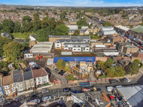
Bruce Grove Industrial Estate, Moorefield Road, N17 6RA
£15.39 per sq ft
Business rates & charges may apply

- SIZE AVAILABLE
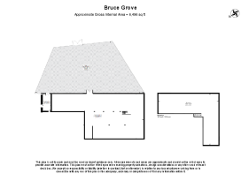
6,496 sq ft
603 sq m
- SECTOR
Warehouse to lease
Lease details
- Lease available date:
- Now
- Lease type:
- Long term
Key features
- Detached warehouse
- Self contained site
- 4,500 ft2 yard
- 4.7m - 6m ceiling heights
- Adjacent to Bruce Grove Station (Overground)
Description
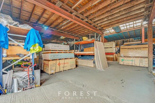
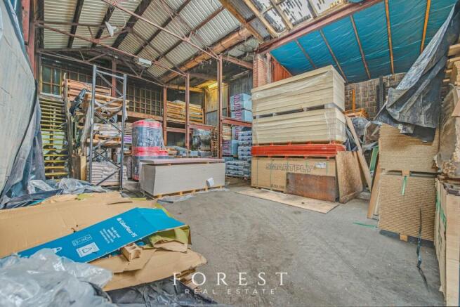
A large detached 1970's warehouse benefitting from a gated yard.
The warehouse is mainly open plan with a mezzanine floor and is made up of a steel frame with corrugated sheeting.
Eaves heights range from 4.7 - 6m.
Location
The property is located on the north side of Moorefield Road, close to its junction with Bruce Grove (A10), in a popular and busy mixed residential and commercial location in Tottenham.
The property is opposite Bruce Grove rail station, and next to a Royal Mail sorting office. Shops and local amenities are available on Bruce Grove (A10), and High Road (A1010), including an Aldi supermarket.
The A10 provides access to the North Circular Road (A406) and Central London.
Terms
New lease direct from the Landlord for a term by arrangement.
Brochures
Bruce Grove Industrial Estate, Moorefield Road, N17 6RA

NEAREST STATIONS
Distances are straight line measurements from the centre of the postcode- Bruce Grove Station0.0 miles
- Tottenham Hale Station0.6 miles
- White Hart Lane Station0.8 miles
Notes
Disclaimer - Property reference 118706-2. The information displayed about this property comprises a property advertisement. Rightmove.co.uk makes no warranty as to the accuracy or completeness of the advertisement or any linked or associated information, and Rightmove has no control over the content. This property advertisement does not constitute property particulars. The information is provided and maintained by Forest Real Estate, London. Please contact the selling agent or developer directly to obtain any information which may be available under the terms of The Energy Performance of Buildings (Certificates and Inspections) (England and Wales) Regulations 2007 or the Home Report if in relation to a residential property in Scotland.
Map data ©OpenStreetMap contributors.