
Meads Lane, Wheathampstead
- PROPERTY TYPE
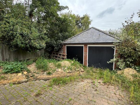
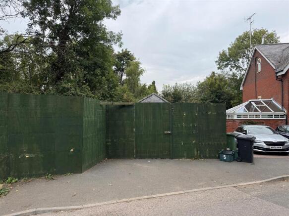
Plot
- SIZE
Ask agent
Key features
- Planning consent to build a single detached house on three levels
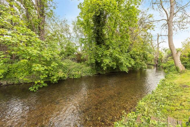
- Desirable 'riverside' setting and close to the Meads recreational park
- Wheathampstead features a good selection of shops, bars and restaurants, together with STAHS Prep school
- KWS Secondary School 2.1 miles, Harpenden Station 3.7 miles, St Albans City Centre 4.8 miles
Description
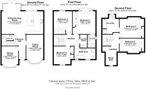
Ground Floor -
Entrance Hall -
Cloakroom/Wc -
Living Room - 4.93m x 2.95m (16'2 x 9'8) -
Dining Room - 3.58m x 2.87m (11'9 x 9'5) -
Kitchen/Dining/Family Room - 7.16m x 5.13m max (23'6 x 16'10 max) -
First Floor -
Landing -
Principal Bedroom - 3.96m x 3.99m (13' x 13'1) -
En Suite Shower Room -
Bedroom Three - 3.96m x 3.15m (13' x 10'4) -
Bedroom Four - 3.12m x 2.87m (10'3 x 9'5) -
Family Bathroom -
Laundry Room -
Second Floor -
Landing Incorporating Study Area -
Bedroom Two - 4.75m x 3.33m (15'7 x 10'11) -
Bedroom Five - 3.76m x 2.54m max (12'4 x 8'4 max) -
Externally -
Rear Garden -
Off Street Parking -
Brochures
Meads Lane, WheathampsteadBrochureMeads Lane, Wheathampstead

NEAREST STATIONS
Distances are straight line measurements from the centre of the postcode- Harpenden Station2.6 miles
- Welwyn Garden City Station3.8 miles
- Welwyn North Station4.3 miles

Notes
Disclaimer - Property reference 34262439. The information displayed about this property comprises a property advertisement. Rightmove.co.uk makes no warranty as to the accuracy or completeness of the advertisement or any linked or associated information, and Rightmove has no control over the content. This property advertisement does not constitute property particulars. The information is provided and maintained by Whittaker & Co, Harpenden. Please contact the selling agent or developer directly to obtain any information which may be available under the terms of The Energy Performance of Buildings (Certificates and Inspections) (England and Wales) Regulations 2007 or the Home Report if in relation to a residential property in Scotland.