Hollins Road, Todmorden, West Yorkshire, OL14
- PROPERTY TYPE
Land
- SIZE
17,222 sq ft
1,600 sq m
Key features
- Proposal: Demolition/redevelopment of the former warehouse to create 11 two-bedroom dwellings with associated on-site parking
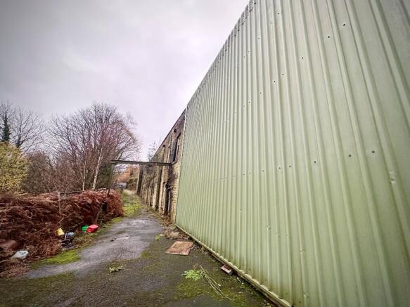
- Attractive stone-built 1860s cotton mill setting
- Site Area: Approx. 1,582 m² (0.16 ha)
- Planning Reference: 08/00289/FUL (renewed under 11/01011/REN)
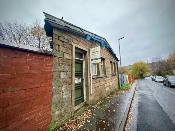
- Frontage to Hollins Road with direct vehicular access
- Potential to reuse natural stone from the existing structure to maintain local character
- Good road links via A6033 Rochdale Road and M62 access via Littleborough
- Competitively priced with a strong ROI potential
Description
For Sale - Offers Over £399,950
Freehold | Canalside Development Opportunity | Approx. 1,582 m²
Overview
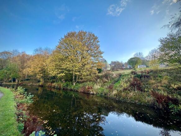
An exceptional opportunity to acquire the former Woodbottom Mill, a historic 19th-century cotton mill occupying a prime canalside position in the sought-after village of Walsden, just 1.25 miles from Todmorden town centre and moments from Walsden railway station.
Set against the dramatic backdrop of the Calder Valley, the site offers significant redevelopment potential - blending rich industrial heritage with modern residential possibilities.
Planning Summary
* Planning Reference: 08/00289/FUL (renewed under 11/01011/REN)
* Council: Calderdale MBC
* Proposal: Demolition/redevelopment of the former warehouse to create 11 two-bedroom dwellings with associated on-site parking
* Status: Consent lapsed (but establishes clear residential use and density precedent)
* Site Area: Approx. 1,582 m² (0.16 ha)
Supporting documents from the original consent include design & access statement, ecological, drainage, and land-stability reports - all of which can inform a new full planning submission.
Site Features & Location
* Attractive stone-built 1860s cotton mill setting
* Frontage to Hollins Road with direct vehicular access
* Rochdale Canal boundary with potential for landscaped amenity space or private gardens
* Within walking distance of Walsden Station (Manchester - Leeds line) and Todmorden amenities
* Good road links via A6033 Rochdale Road and M62 access via Littleborough
Development Potential
* Ideal for boutique housing development or mixed-use live/work scheme
* Potential to reuse natural stone from the existing structure to maintain local character
* Opportunity to deliver 11 stylish two-bed homes sympathetic to the valley's industrial heritage
* Precedent supports residential use, parking provision, and design continuity
Enquiries | For full planning pack (including officer report, layout plans and historic consents) please visit Calderdale Council website quoting 08/00289/FUL (renewed under 11/01011/REN). To make a viewing or for more information, contact:
Calder Valley Homes
? Todmorden
?
?
Hollins Road, Todmorden, West Yorkshire, OL14

NEAREST STATIONS
Distances are straight line measurements from the centre of the postcode- Walsden Station0.3 miles
- Todmorden Station1.0 miles
- Littleborough Station4.0 miles
Notes
Disclaimer - Property reference KIM_M1ll. The information displayed about this property comprises a property advertisement. Rightmove.co.uk makes no warranty as to the accuracy or completeness of the advertisement or any linked or associated information, and Rightmove has no control over the content. This property advertisement does not constitute property particulars. The information is provided and maintained by CALDER VALLEY HOMES, Todmorden. Please contact the selling agent or developer directly to obtain any information which may be available under the terms of The Energy Performance of Buildings (Certificates and Inspections) (England and Wales) Regulations 2007 or the Home Report if in relation to a residential property in Scotland.