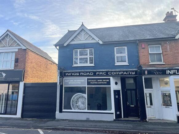

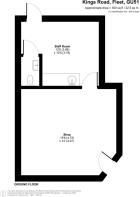
Kings Road, Fleet, Hampshire, GU51
- PROPERTY TYPE
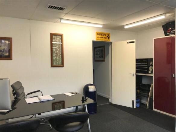
Shop
- SIZE
Ask agent
Key features
- Vacant Possession
- 199 Year Lease
- Retail/Financialn & Professional Services
- EPC Rating C
Description
Suitable for alternative uses, subject to any necessary planning consent.
Retail/Financial and Professional Services.
Fleet is situated in the northeast corner of Hampshire, close to the Surrey and Berkshire borders. The town offers excellent transport links to London and the south coast via its mainline rail service from Waterloo and junction 4a of the M3 motorway. The Basingstoke Canal runs through the town, with the section between the Wey Navigation and the Greywell Tunnel maintained as a leisure facility. Fleet town centre offers an excellent range of multiple and independent retailers. Fleet has several business parks and in recent years has expanded with new residential areas being built at Edenbrook and Elvetham Heath. The town offers an excellent choice of respected schools from both the state and independent sectors.
Central London 40 miles
Basingstoke 18 miles
Guildford 15 miles
Farnham 6 miles
Heathrow Airport 27 miles
Gatwick Airport 50 miles
Kings Road, Fleet, Hampshire, GU51

NEAREST STATIONS
Distances are straight line measurements from the centre of the postcode- Fleet Station0.5 miles
- Winchfield Station3.1 miles
- Farnborough Station3.6 miles
About Vickery, West End, Woking
1 The Parade, Gosden Road, West End, Woking, GU24 9LH


Notes
Disclaimer - Property reference CRL250032. The information displayed about this property comprises a property advertisement. Rightmove.co.uk makes no warranty as to the accuracy or completeness of the advertisement or any linked or associated information, and Rightmove has no control over the content. This property advertisement does not constitute property particulars. The information is provided and maintained by Vickery, West End, Woking. Please contact the selling agent or developer directly to obtain any information which may be available under the terms of The Energy Performance of Buildings (Certificates and Inspections) (England and Wales) Regulations 2007 or the Home Report if in relation to a residential property in Scotland.
Map data ©OpenStreetMap contributors.