Land for sale
Land At Sturt Farm, Forfar, Angus, DD8
- PROPERTY TYPE
Land
- SIZE
Ask agent
Key features
- Available as a whole.
Description
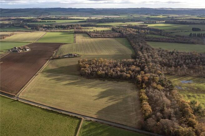
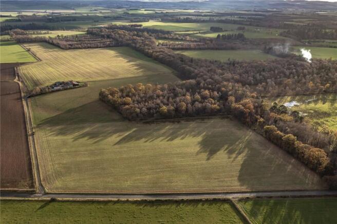
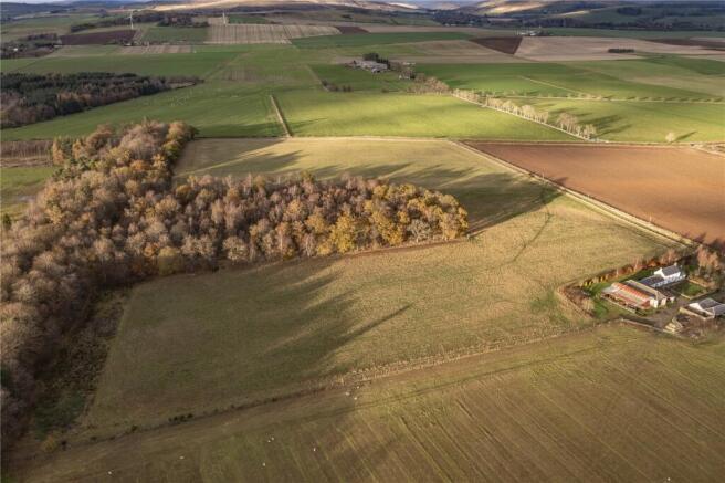
Productive arable land located in Angus, extending to approximately 29.66 ha (73.31acres)
As a whole, the land extends to about 29.66 ha (73.31acres), which ranges from 100 metres to 110 metres above sea level. The land is classified principally as Class 3(1) by the James Hutton Institute, which is land capable of growing a wide range of crops.
The land has grown a variety of crops over recent years including spring barley, temporary grass, potatoes and peas as noted in the cropping schedule below.
Fields
1) NO/44446/58183 = (2021 - Peas), (2022 - Potatoes), (2023 - Spring Barley), (2024 - Spring Barley), (2025 - Spring Barley)
2) NO/44537/57966 = (2021 - Temporary Grass), (2022 - Temporary Grass), (2023 - Temporary Grass), (2024 - Temporary Grass), (2025 - Temporary Grass)
3) NO/44716/57600 = (2021 - Spring Barley), (2022 - Spring Barley), (2023 - Peas) (2024 - Potatoes), (2025 - Spring Barley/Stubble Turnips)
The land will be left fallow for the incoming occupier.
The Land at Sturt Farm lies in a productive and well-established agricultural area of Angus, just north of Forfar. Surrounded by fertile farmland and gently rolling countryside, the property is ideally positioned for a range of rural enterprises. The area is known for its strong arable and livestock farming tradition, with a patchwork of fields, shelterbelts, and access to local agricultural infrastructure.
The land benefits from good transport links, with the A90 nearby providing efficient access to Forfar (approximately 7 miles), as well as to the wider Angus region and key agricultural markets in Dundee and Aberdeen. Forfar itself offers a range of agricultural suppliers and rural services, supporting both commercial and small-scale farming operations.
This location presents an excellent opportunity for those seeking to expand existing holdings, establish a rural business, or invest in land with long-term agricultural potential.
Mains water to Fields 1 & 2
From Forfar, travel north on the A90 for approximately 3.8 miles, then turn left at the signposted junction for Bogindollo. Follow this road for around 1.5 miles until you reach a T-junction with the B957, where you should turn right. Continue for a further 1.2 miles and take the left turn signposted for Memus. Shortly after, turn left again and proceed for 0.7 miles. The land will be located on the left-hand side and is accessed via a private gravel track.
For viewers using the ‘what3words’ app, ///driftwood.broker.stuffy
Brochures
ParticularsLand At Sturt Farm, Forfar, Angus, DD8

NEAREST STATIONS
Distances are straight line measurements from the centre of the postcode- Arbroath Station15.9 miles


Notes
Disclaimer - Property reference FRF250014. The information displayed about this property comprises a property advertisement. Rightmove.co.uk makes no warranty as to the accuracy or completeness of the advertisement or any linked or associated information, and Rightmove has no control over the content. This property advertisement does not constitute property particulars. The information is provided and maintained by Bell Ingram, Perth. Please contact the selling agent or developer directly to obtain any information which may be available under the terms of The Energy Performance of Buildings (Certificates and Inspections) (England and Wales) Regulations 2007 or the Home Report if in relation to a residential property in Scotland.
Map data ©OpenStreetMap contributors.