Just Off Badgworth Lane, Axbridge, Somerset, BS26
£0.15 per sq ft
Business rates & charges may apply
- SIZE AVAILABLE
865,537 sq ft
80,411 sq m
- SECTOR
Land for sale
Description
DESCRIPTION
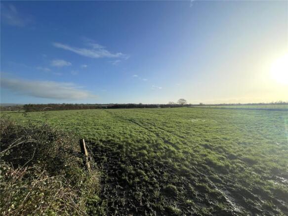
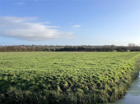
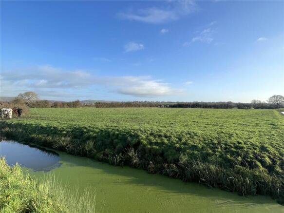
19.87 acres of level productive permanent pastureland, split into 3 parcels. Situated off a hard track road known as the Doles. The land is surrounded by mature hedgerow boundaries and natural water courses, which includes a drainage board maintained rhyne running the southern boundary. The land is classified as Grade 4 under the DEFRA land classification map. The land benefits from natural watering only.
SITUATION
Access to the land is via The Doles, which provides Gated access to the west on to a tarmac lane, which leads to Badgworth Lane to the north. The land is approximately 2 miles Southwest of Axbridge, and 3 miles away from Wedmore. With close connection to the A38 of 1.5 miles. What3Words - Northern Access: snowballs.hacking.guard
VIEWING
Strictly by appointment with the Agents: David James, Tel: .
LOCAL AUTHORITY
Somerset Council
Brochures
Just Off Badgworth Lane, Axbridge, Somerset, BS26

NEAREST STATIONS
Distances are straight line measurements from the centre of the postcode- Highbridge & Burnham Station5.0 miles
Notes
Disclaimer - Property reference WRU260001. The information displayed about this property comprises a property advertisement. Rightmove.co.uk makes no warranty as to the accuracy or completeness of the advertisement or any linked or associated information, and Rightmove has no control over the content. This property advertisement does not constitute property particulars. The information is provided and maintained by David James, Wrington. Please contact the selling agent or developer directly to obtain any information which may be available under the terms of The Energy Performance of Buildings (Certificates and Inspections) (England and Wales) Regulations 2007 or the Home Report if in relation to a residential property in Scotland.