Land at Priory Meadow, Runcorn, WA7 2BN
- SIZE AVAILABLE
589,802-810,216 sq ft
54,794-75,272 sq m
- SECTOR
Residential development for sale
Key features
- Residential Development Site
- Allocated in the Local Plan for 158 dwellings
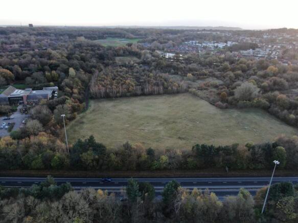
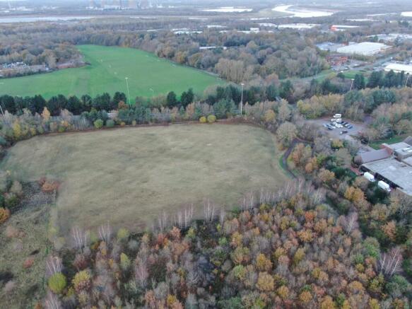
Description
The site is allocated for a notional capacity of 158 dwellings under Policy R74 Residential Development in the 2022 Adopted Delivery and Allocations Local Plan (DALP).
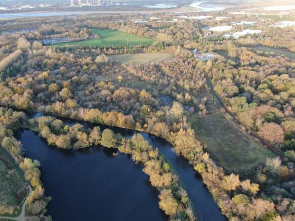
Priory Meadow is located to the north-east of Runcorn, approximately 2.5 miles east of Runcorn Town Centre and approximately 2 miles to the north west of Daresbury Village. Runcorn has excellent transport links having access to the M56 Motorway at Junction 11 and 12, both approx. 3 miles distant. Access to the Mersey Gateway Bridge is approx. 2 miles north west of Priory Meadow.
The immediate area is predominantly residential with the site located immediately to the north east of the Castlefield’s area. The site itself is bounded by the Daresbury Expressway to the north, Norton Priory Museum and Gardens to the east, the Bridgewater Canal to the south and the former Runcorn New Town Busway to the west.
Brochures
Land at Priory Meadow, Runcorn, WA7 2BN

NEAREST STATIONS
Distances are straight line measurements from the centre of the postcode- Runcorn East Station1.2 miles
- Runcorn Station2.3 miles
- Frodsham Station3.5 miles
Notes
Disclaimer - Property reference 351295-1. The information displayed about this property comprises a property advertisement. Rightmove.co.uk makes no warranty as to the accuracy or completeness of the advertisement or any linked or associated information, and Rightmove has no control over the content. This property advertisement does not constitute property particulars. The information is provided and maintained by Sanderson Weatherall, Manchester. Please contact the selling agent or developer directly to obtain any information which may be available under the terms of The Energy Performance of Buildings (Certificates and Inspections) (England and Wales) Regulations 2007 or the Home Report if in relation to a residential property in Scotland.