Land at East Barsham, Fakenham, Norfolk
£0.20 per sq ft
Business rates & charges may apply
- SIZE AVAILABLE
6,027,833 sq ft
560,004 sq m
- SECTOR
Farm land for sale
Key features
- 138.38 acres of grade 2 and 3 arable land
- Traditional brick-built farm building with potential for alternative use
- Picturesque location near the Norfolk coast
- Good accessibility
Description
The land is available for sale by Private Treaty as a whole.
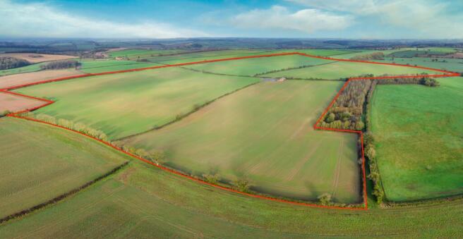
A single block of land with about 138.38 acres (56 hectares) of productive farmland, classified as Grade 2 and 3 by DEFRA and described as being of the Burlingham soils series, which are deep coarse and fine loamy with slowly permeable subsoils and slight seasonal waterlogging, well suited to winter cereals, sugar beet and potatoes. The land is subject to a Sustainable Farming Incentive expiring on 31st May 2027. Further details available from the Vendor's agent
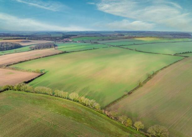
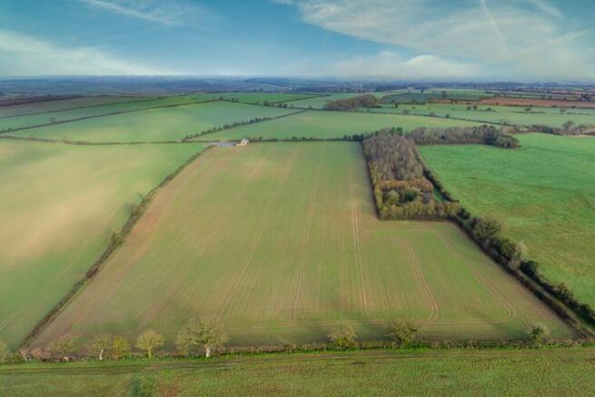
The land is laid out into four easily worked fields, well suited to modern arable machinery. It has been farmed for many years within a rotation of winter wheat, oilseed and sugar beet. Soil testing was recently carried out, the results of which can be made available on request.
A traditional brick built farm building (7.30m x 20.50m) is situated at the centre of the holding together with an area of concrete hardstanding, benefiting from attractive southerly views and direct access from the public highway. The building offers potential for alternative uses, subject to obtaining the necessary planning consents.
LOCATION
The property is located between the villages of East Barsham and Great Snoring, Norfolk, within an attractive rural setting in close proximity to the picturesque North Norfolk coast.
The land lies in a rural location, about 3 miles north of Fakenham, 9.5 miles south of Burnham Market and approximately 28 miles north of Norwich. Access to the property is available from Water Lane, which bisects the holding.
The nearest postcode is NR21 0LF.
What3words: ///gracing.dragons.skimmers
TENURE & POSSESSION
The property is offered for sale freehold with vacant possession on completion.
Should the Purchaser require, the Vendor would be prepared to consider continuing to farm all or part of the holding under a Farm Business Tenancy or Contract Farming Agreement, subject to terms to be agreed.
SPORTING, TIMBER & MINERAL RIGHTS
All sporting, timber and mineral rights are included within the sale in so far as they are owned.
EASEMENTS, WAYLEAVES & RIGHTS OF WAY
The property is sold subject to and with the benefit of all rights including rights of way, whether public or private, light, support, drainage, water and electricity supplies and any other rights and obligations, easements and quasi-easements, restrictive covenants, and all existing and proposed wayleaves for masts, pylons, stays, cables, drains, water and gas and other pipes, whether referred to in these particulars or not.
INGOING VALUATION
The Purchaser will, in addition to the purchase price, be required to take over and pay for all growing crops, cultivations, fertilisers, sprays, and acts of husbandry at valuation to be agreed between the parties. The valuation will be based on the cost of establishing the crops, including cultivations, seed, fertilisers, sprays, and other inputs, plus a reasonable profit or management allowance, all assessed in line with current agricultural industry standards and contractor rates.
Payment will be due immediately upon agreement of the valuation with interest at 4% above Barclays Bank base rate from exchange of contracts until payment. Should the valuation not be agreed within four weeks of exchange of contracts, the matter will be referred to a single arbitrator appointed by mutual agreement or, in default, by the President of the Royal Institution of Chartered Surveyors.
BOUNDARIES
All boundaries outlined on the attached plans are for identification purposes only. Potential buyers are responsible for confirming the boundaries.
Any mistakes, omissions, or inaccuracies will not allow the buyer to cancel the contract or claim compensation.
REGISTERED TITLE
The property is registered under Title Numbers NK386179 & NK250050.
LOCAL AUTHORITY
North Norfolk District Council
Address: Council Offices, Holt Road, Cromer, Norfolk, NR27 9EN
VIEWINGS
Strictly by appointment with the selling agents. Interested parties are requested to contact the agents to arrange a viewing.
ANTI-MONEY LAUNDERING
In accordance with the Money Laundering Regulations 2017, once an offer is accepted, the purchaser(s) must provide any requested information to complete the necessary due diligence as a legal requirement.
VAT
Should any sale of the property or any rights attached to it become chargeable for the purpose of VAT, such tax will be payable by the purchaser in addition to the purchase price. All interested parties are advised to seek independent professional advice regarding their VAT position.
HEALTH & SAFETY
Given the potential hazards of a working farm, we ask that you exercise caution when viewing the property. Neither the seller nor the selling agents are responsible for the safety of those viewing the property, and accordingly, those viewing the property do so at their own risk.
GUIDE PRICE
Offers in the region of £1,200,000.
PHOTOS
Taken on the 7th February 2026.
Brochures
Land at East Barsham, Fakenham, Norfolk

NEAREST STATIONS
Distances are straight line measurements from the centre of the postcode- Sheringham Station15.2 miles
About Ceres Property LLP, Saffron Walden
Ceres Property, Council Offices, London Road, Saffron Walden, CB11 4ERNotes
Disclaimer - Property reference LandatEastBarsham. The information displayed about this property comprises a property advertisement. Rightmove.co.uk makes no warranty as to the accuracy or completeness of the advertisement or any linked or associated information, and Rightmove has no control over the content. This property advertisement does not constitute property particulars. The information is provided and maintained by Ceres Property LLP, Saffron Walden. Please contact the selling agent or developer directly to obtain any information which may be available under the terms of The Energy Performance of Buildings (Certificates and Inspections) (England and Wales) Regulations 2007 or the Home Report if in relation to a residential property in Scotland.