
Rotherfield Greys, Henley-on-Thames, Oxfordshire, RG9
- PROPERTY TYPE
Land
- SIZE
945,252 sq ft
87,817 sq m
Key features
- Ring fenced block of permanent pasture
- Rural location
- Access to mains water
- Direct road access
- Within Chilterns National Landscape (AONB)
- In all about 21.70 acres
Description
Description
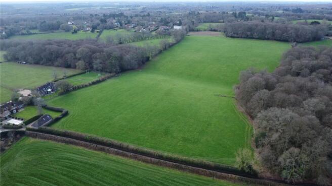
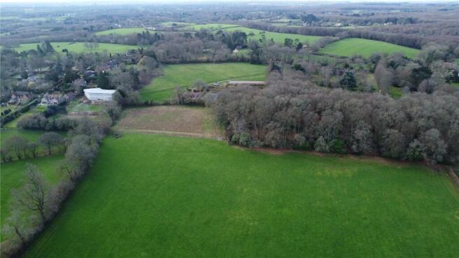
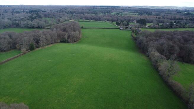
Extending to approximately 21.70 acres (8.78 hectares), the permanent pasture gently slopes into a valley which runs through the centre of the main parcel, bounded by woodland to the east and west of the valley.
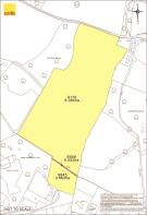
The southern and north eastern boundary of the parcel abuts residential dwellings. The pasture benefits from robust livestock fencing around all perimeters and a water supply along the northern boundary, marked in blue on the Plan.
At present there is a water supply connected to the property and understand there may be other services available in the locality.
Location
The Land is located between the village of Shepherds Green and Rocky Lane approximately 4 miles west of Henley-on-Thames.
Acreage: 21.7 Acres
Directions
The Property benefits from direct road access from Rocky Lane to the north, marked in yellow on the Plan.
Nearest Postcode - RG9 4RD
What3Words: ///starred.sensitive.milkman. Access off Rocky Lane - What3Words: ///centrally.saved.flasks
Additional Info
Viewings strictly by appointment with Savills. Prior to making an appointment to view, we strongly recommend that you discuss any particular points which are likely to affect your interest in the property with a member of staff who has seen the property, in order that you do not make a wasted journey.
The land is located within the Chilterns National Landscape (previously Area of Outstanding Natural Beauty (AONB))
There is a public footpath 249|22/20 which severs the two parcels at the southern end of the Property, marked in purple on the Plan
Brochures
Web DetailsRotherfield Greys, Henley-on-Thames, Oxfordshire, RG9

NEAREST STATIONS
Distances are straight line measurements from the centre of the postcode- Henley-on-Thames Station3.5 miles
- Shiplake Station4.8 miles
- Wargrave Station5.5 miles
About Savills Rural Agency, Covering Central England
Wytham Court, 11 West Way, Botley, Oxford, OX2 0QLNotes
Disclaimer - Property reference OXR260012. The information displayed about this property comprises a property advertisement. Rightmove.co.uk makes no warranty as to the accuracy or completeness of the advertisement or any linked or associated information, and Rightmove has no control over the content. This property advertisement does not constitute property particulars. The information is provided and maintained by Savills Rural Agency, Covering Central England. Please contact the selling agent or developer directly to obtain any information which may be available under the terms of The Energy Performance of Buildings (Certificates and Inspections) (England and Wales) Regulations 2007 or the Home Report if in relation to a residential property in Scotland.