
High Street, Wallingford, OX10
- PROPERTY TYPE
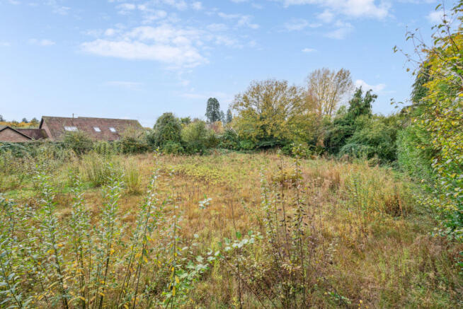
Land
- SIZE
Ask agent
Description
Brightwell-cum-Sotwell, is a thriving village with a public house, primary school, village store/Post Office and three churches. More extensive amenities are found in the nearby historic Thameside town of Wallingford with shops, restaurants, pubs, supermarkets, a monthly Farmer’s market, a cinema and local theatre
Transport:
Transport links are good, with access to the M4 (J12) at Theale and the M40 (J6) and Lewknor. Didcot mainline station is within a reasonable driving distance with a regular service to London, Paddington. There is an excellent choice of state and independent schools in the area including a state primary school in the village.
Wallingford: 2.4 miles
Didcot: 4.6 miles
Didcot Parkway: 4.4 miles
Oxford: 13 miles
Henley on Thames: 14.3 miles
Planning:
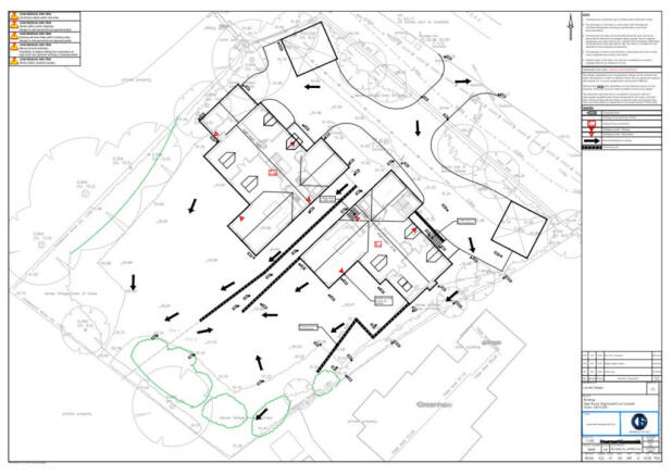
Planning permission was granted for the demolition of the existing property and erection of two detached dwellings by South Oxfordshire District Council on 7th November 2018 (P18/ S0050/FUL).
The planning consent was implemented and the CIL charge paid.
The existing property has been demolished. On the 4th September 2020 planning permission was granted to allow for internal and external amendments to the two approved dwellings and to allow amendments to the access and parking arrangements (P20/S1367/FUL).
Planning conditions 7 & 12 in respect P20/S1367/FUL have recently been discharged:
P25/S2425/DIS - P25/S3701/DIS
The applications can be viewed via the South Oxfordshire District Council's planning portal.
Resale Values:
Please contact James Merrifield of Thomas Merrifield for advice on resale values.
Viewings and further enquiries
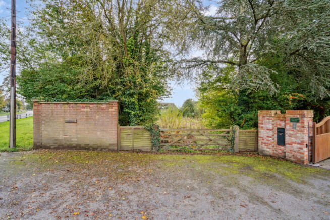
The site can be viewed from the driveway but if you would like to arrange a closer inspection, please contact James Merrifield on
Local Authority:
South Oxfordshire District Council.
High Street, Wallingford, OX10

NEAREST STATIONS
Distances are straight line measurements from the centre of the postcode- Cholsey Station2.9 miles
- Didcot Parkway Station4.1 miles
- Appleford Station4.5 miles


Notes
Disclaimer - Property reference RX480578. The information displayed about this property comprises a property advertisement. Rightmove.co.uk makes no warranty as to the accuracy or completeness of the advertisement or any linked or associated information, and Rightmove has no control over the content. This property advertisement does not constitute property particulars. The information is provided and maintained by Thomas Merrifield, Wallingford. Please contact the selling agent or developer directly to obtain any information which may be available under the terms of The Energy Performance of Buildings (Certificates and Inspections) (England and Wales) Regulations 2007 or the Home Report if in relation to a residential property in Scotland.