
Development Land @ Plas Llanerch, Hiraddug Road, Dyserth LL18 6HS
- PROPERTY TYPE
Land
- SIZE
Ask agent
Key features
- DEVELOPMENT LAND
- PLANNING FOR THREE DWELLINGS
- SERVICES ON SITE
- POPULAR VILLAGE LOCATION
- ACCESSIBLE TO THE A55
- 0.15 Ha
- 0.371 acres
- WALKING DISTANCE TO AMENITIES
- FREEHOLD
- DENBIGHSHIRE COUNTY COUNCIL
Description
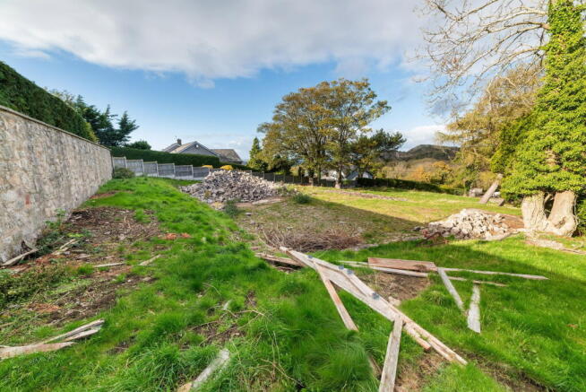
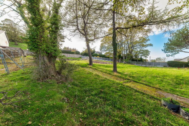
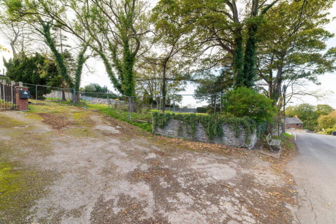
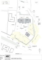
DEVELOPMENT LAND FOR THE ERRECTION OF THREE DWELLINGS - The site totals an area of 0.15 Ha 0.371 acres and offers excellent frontage onto the Hiraddug Road. It stands on the edge of this popular village which boasts a range of independent shops, Post Office and primary school with several popular Inns. The resort town of Prestatyn is within three miles and access to the A55 expressway is a similar distance.
DIRECTIONS From the Prestatyn office proceed along Meliden Road bearing left at Dyserth crossroads. Proceed up past Dyserth Waterfall and turn left at the lights on to the High Street and after the shops turn right onto Hiraddug Road and the property can be seen on the right after 500 yards.
Brochures
Brochure 1Development Land @ Plas Llanerch, Hiraddug Road, Dyserth LL18 6HS

NEAREST STATIONS
Distances are straight line measurements from the centre of the postcode- Prestatyn Station2.5 miles
- Rhyl Station3.6 miles

About Peter Large Estate Agents, Prestatyn
19 Meliden Road, Prestatyn, LL19 9SD


Notes
Disclaimer - Property reference S1670677. The information displayed about this property comprises a property advertisement. Rightmove.co.uk makes no warranty as to the accuracy or completeness of the advertisement or any linked or associated information, and Rightmove has no control over the content. This property advertisement does not constitute property particulars. The information is provided and maintained by Peter Large Estate Agents, Prestatyn. Please contact the selling agent or developer directly to obtain any information which may be available under the terms of The Energy Performance of Buildings (Certificates and Inspections) (England and Wales) Regulations 2007 or the Home Report if in relation to a residential property in Scotland.