Unit 76 Barracks Road, Sandy Lane Industrial Estate, Stourport-On-Severn
£5.31 per sq ft
Business rates & charges may apply
- SIZE AVAILABLE
4,707 sq ft
437 sq m
- SECTOR
Light industrial facility to lease
Lease details
- Lease available date:
- Ask agent
Key features
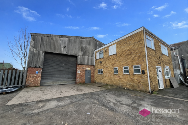
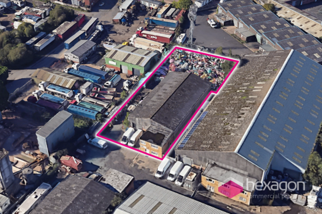
- SECURE YARD AREA OF 0.27 ACRES
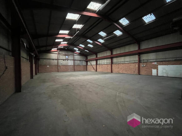
- HIGH BAY WAREHOUSE
- LOCATION ON ESTABLISHED BUSINESS PARK
Description
Warehouse - 4,707 Sq Ft Mezzanine - 721 Sq Ft Ground Floor Offices - 327 Sq Ft First Floor Offices - 506 Sq Ft Total - 6,340 Sq Ft
Sandy Lane Industrial Estate is an established business location to the south of Stourport-on-Severn, with access directly off the A4205 Worcester Road, which connects to the A449, leading to the M5 motorway. The position is approximately 1.7 miles from Stourport-on-Severn, 10 miles from Droitwich and 11 miles from junction 6 of the M5 of Worcester. Connectivity to the motorway system is via the M42 and M5 motorways. There are a variety of occupiers on the industrial estate, with both national and local businesses represented.
Leasehold
TBC
The premises are to be let by way of new lease on terms to be agreed.
Brochures
Unit 76 Barracks Road, Sandy Lane Industrial Estate, Stourport-On-Severn

NEAREST STATIONS
Distances are straight line measurements from the centre of the postcode- Hartlebury Station2.0 miles
- Kidderminster Station4.0 miles
- Droitwich Spa Station6.2 miles
Notes
Disclaimer - Property reference 56147. The information displayed about this property comprises a property advertisement. Rightmove.co.uk makes no warranty as to the accuracy or completeness of the advertisement or any linked or associated information, and Rightmove has no control over the content. This property advertisement does not constitute property particulars. The information is provided and maintained by Hexagon Commercial Property, Stourbridge. Please contact the selling agent or developer directly to obtain any information which may be available under the terms of The Energy Performance of Buildings (Certificates and Inspections) (England and Wales) Regulations 2007 or the Home Report if in relation to a residential property in Scotland.