Land off Cheddon Road,, Taunton, Somerset
Size
Ask agent
Tenure
Freehold
EPC
Parking
Ask agent
- Primary use
- Land
No floor / site plan
Key features
- Prime greenfield development site
- Edge of town location
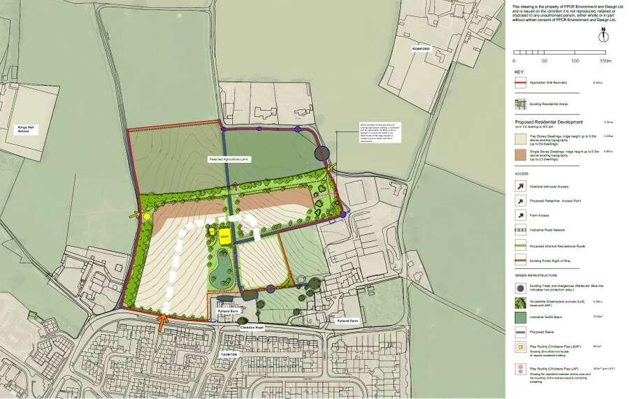
- Outline planning permission for up to 112 dwellings
- Approx 3.5 miles to Junction 25 of M5 Motorway
- Freehold interest
Description
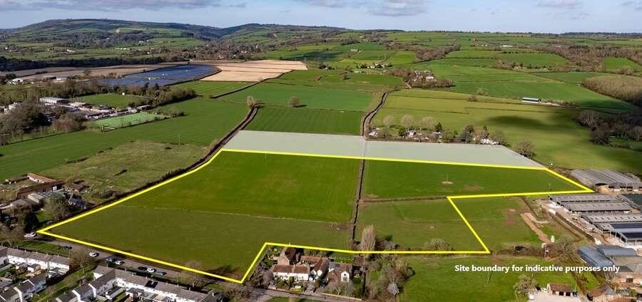
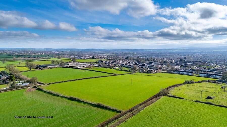
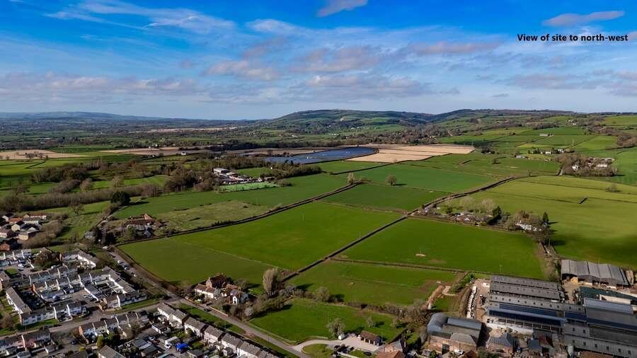
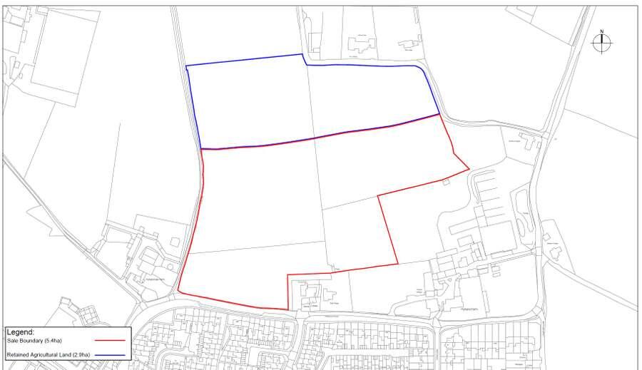
The site is situated on the northern edge of the built-up boundary of Taunton. The land falls within Flood Zone 1 and is currently in agricultural use. Cheddon Road abuts the southern boundary of the site and Cats Lane, which is a public footpath that joins Cheddon Road, runs along the western boundary. Pyrland Farm and agricultural land lie to the immediate east of the site. The land adjoining the northern boundary (which falls within the planning application site) will be retained by the seller as agricultural land. The subject land is gently sloping with hedgerow field boundaries.
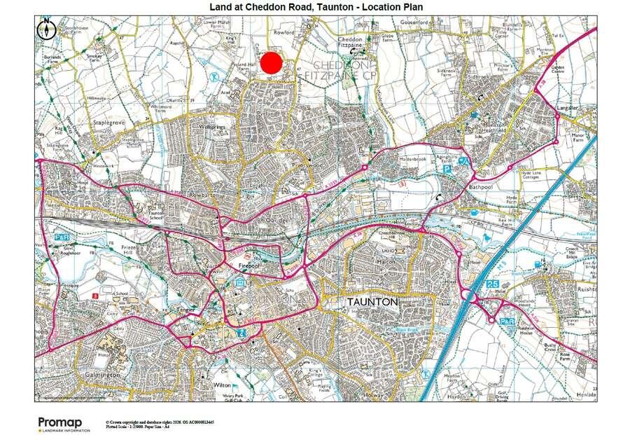
The proposed entrance to the development is approximately half a mile to the popular Cheddon Fitzpaine Church School to the north-east of the site (Ofsted Report: Good (March 2024)) and within a third of a mile of King’s College Prep School to the west. Wellsprings Leisure Centre is in close proximity to the south-west.
Taunton is the county town of Somerset and serves as the region’s primary hub for governance, public services and civic administration. With a population of over 63,000 (2021 census) and serving a much wider rural and regional catchment, the town functions as Somerset’s largest and most economically active settlement.
Taunton benefits from excellent transport links, with a mainline railway station providing direct services to Bristol Temple Meads, Exeter St Davids and London Paddington. The site is situated approximately 3.5 miles from Junction 25 of the M5 motorway, which provides access to Bristol and the M4 to the north-east and Exeter and the south peninsula to the south-west.
Bristol Airport is located approximately 37 miles to the north-east and provides scheduled and chartered flights to a wide range of national and international destinations.
As well as excellent road and rail connectivity, Taunton is set within an attractive rural hinterland being within the Vale of Taunton Deane and surrounded by the Quantock, Blackdown, and Brendon Hills.
- Service charge
- Ask agent
- Business rates
- Ask agent
- Use class
- Ask agent
- Listed building
- Ask agent
An Energy Performance certificate helps you understand the current energy efficiency of a property.
Read more about EPC requirementsAsk agent
- BREEAM rating
Unclassified
- Environmental description
- Ask agent
Brochure
About Savills National , Exeter
Your search history
You have no recent searches
Disclaimer - Property reference F97EB08C-AD18-4D3A-9463-DD21E6D13C37. The information displayed about this property comprises a property advertisement. Rightmove.co.uk makes no warranty as to the accuracy or completeness of the advertisement or any linked or associated information, and Rightmove has no control over the content. This property advertisement does not constitute property particulars. The information is provided and maintained by Savills National , Exeter. Please contact the selling agent or developer directly to obtain any information which may be available under the terms of The Energy Performance of Buildings (Certificates and Inspections) (England and Wales) Regulations 2007 or the Home Report if in relation to a residential property in Scotland.