
Covers Quarry, Westerham, Kent
Size
98
Lease length
Ask agent
EPC
Parking
Ask agent
- Price per
- POA
- Primary use
- Other
No floor / site plan
Key features
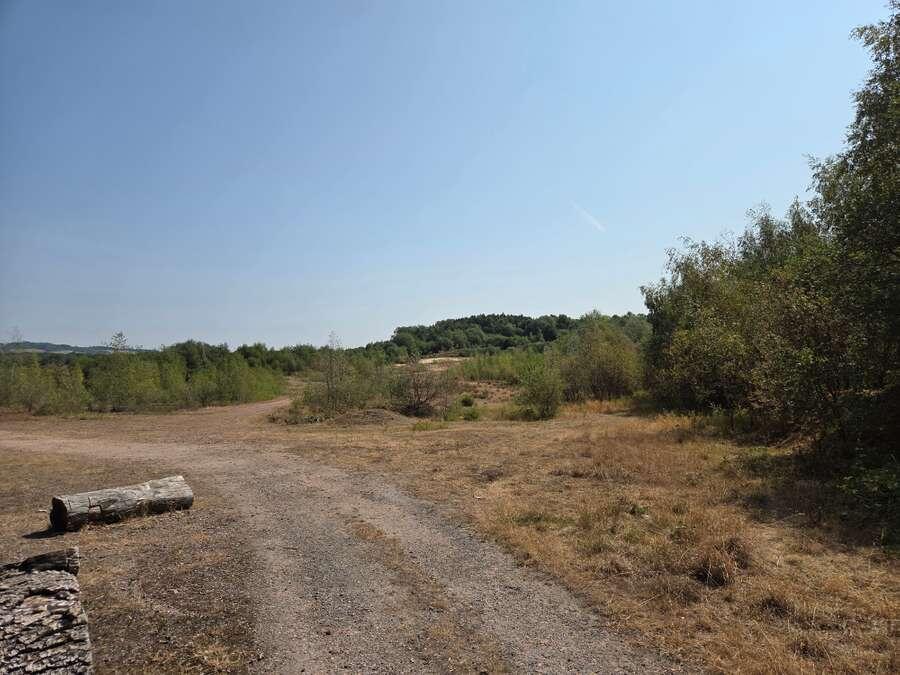
- A former sand quarry with outstanding restoration requirements.
- Site area extends to approximately 98 acres.
- Planning permission granted to fill the void with 800,000m3 of inert waste.
- Restoration of the site is back to agriculture, with some wetlands.
- Restoration to be completed within 6 years of commencement of tipping.
- Excellent access to the M25.
Description
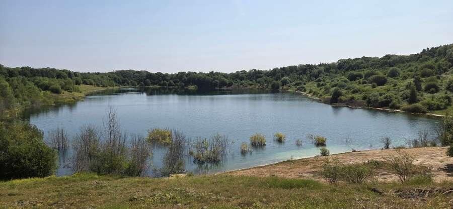
The property has effectively been mothballed since this time, and the northern void has been allowed to be filled with water.
The objective of the extant planning consent is to stabilise and fully restore the area of past mineral workings.
There is no more mineral to be extracted and therefore through the tipping of 800,000m3 of inert construction waste, the intention is to improve instability, which is progressively creeping towards the M25, provide a permanent sustainable drainage scheme and create a landscaped landform that will benefit the wider landscape and biodiversity.
The planning permission includes the installation of a temporary access to the Beggars Lane/London Road roundabout. However, the preference is that the planning permission be varied to rely on the historic access to the south.
The planning permission has a 6 year life and following restoration of the site, there will be a requirement to enter into an aftercare agreement with the County Council.
The property is located to the west of the village of Westerham in Kent, near the towns of Biggin Hill and Oxted. The M25 runs along the property’s northern boundary, with Westerham Road (A25) providing access west to Junction 6 of the M25 and east to Junction 5. Residential properties associated with Westerham are situated to the east, whilst the surrounding land area is mostly in agricultural use. Within 1 mile to the west there is a semi-rural industrial estate and BMI Redland's Moorhouse Sand Pit.
- Let type
- Ask agent
- Let contract length
- Ask agent
- Status
- Available
- Date available
- 08 October 2026
- Service charge
- Ask agent
- Business rates
- Ask agent
- Use class
- Ask agent
An Energy Performance certificate helps you understand the current energy efficiency of a property.
Read more about EPC requirementsAsk agent
- BREEAM rating
Unclassified
- Environmental description
- Ask agent
Brochure
Covers Quarry, Westerham, Kent
Your search history
You have no recent searches
Disclaimer - Property reference 2623BEA8-8AFF-492B-B96E-18B9F21FB863. The information displayed about this property comprises a property advertisement. Rightmove.co.uk makes no warranty as to the accuracy or completeness of the advertisement or any linked or associated information, and Rightmove has no control over the content. This property advertisement does not constitute property particulars. The information is provided and maintained by Savills National , Petworth. Please contact the selling agent or developer directly to obtain any information which may be available under the terms of The Energy Performance of Buildings (Certificates and Inspections) (England and Wales) Regulations 2007 or the Home Report if in relation to a residential property in Scotland.