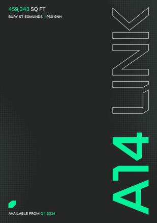
A14 Link, Suffolk Park, Bury St Edmunds, Bury St Edmunds, IP3 9NH

- SIZE AVAILABLE
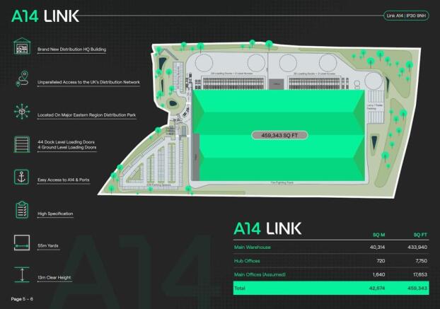
459,343 sq ft
42,674 sq m
- SECTOR
Distribution warehouse to lease
- USE CLASSUse class orders: B1 Business, B2 General Industrial and B8 Storage and Distribution
B1, B2, B8
Lease details
- Lease available date:
- Now
- Lease type:
- Long term
Description
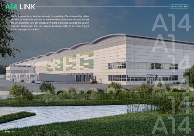
Suffolk Park is located just outside the market town of Bury St Edmunds. Bury St Edmunds at the heart of East Anglia, approximately 28 miles east of Cambridge, 28 miles north-west of Ipswich and 80 miles north-east of London.
Bury St Edmunds is located on the A14 dual carriageway, which provides access to both the south-east to Felixstowe, the UK’s largest container port, and west to key road infrastructure such as the M11, A11, A1(M), M1 and M6. This network provides access to many of the UK’s major cities including London and the South East, Cambridge, Birmingham, Manchester, Liverpool and Leeds.
To view the premises and for any additional information please contact the agents below.
- BREEAM Excellent
- 13 m clear internal height to the underside of the haunch
- 4 level access loading doors
- 44 dock level loading doors
- 274 car parking bays
- Grade A offices
- 55m yard depth
Road: The subject site is adjacent to A14, which provides excellent access to the key road infrastructure in relatively short drive times.
The M11 is accessed via the A11, 33 miles to the west. This provides excellent access to the M25 and the wider London market in under two hours. To access the northern markets, the A1(M) is just 50 miles away via the A14. Just 25 miles further west, via the A14, the M1 is accessed in under two hours.
Rail: The subject site has excellent connectivity to rail links. Bury St Edmunds and Thurston stations are located just 2.9 miles and 6.4 miles respectively. Both stations are located on the Greater Anglia Railway line. London can be directly reached within 2 hours and 20 minutes from both stations. The same line provides direct and frequent services to the wider east Anglia region.
Air: The subject site benefits from a close proximity to Stansted Airport which can be gained in 50 miles. Additionally Heathrow Airport can be gained in 110 miles and East Midlands Airport in 125 miles. Access to Heathrow is a huge benefit from an industrial logistics supply change standpoint as it handles around 70% of the UK’s air freight trade and around 32% (£104bn) of all UK goods by value making it the 3rd busiest airport in Europe for freight.
Sea: The Port of Felixstowe is within 41 miles of the property. This is very advantageous from a supply chain perspective as it is not only the busiest container port in the United Kingdom, dealing with 48% of Britain’s containerised trade but is also further building its influence post-Brexit. Furthermore, the Port of Tilbury, which is London’s main trading port can be reached in 85 miles.
Brochures
A14 Link, Suffolk Park, Bury St Edmunds, Bury St Edmunds, IP3 9NH

NEAREST STATIONS
Distances are straight line measurements from the centre of the postcode- Derby Road Station22.1 miles
- Ipswich Station20.8 miles
- Westerfield Station20.4 miles
Notes
Disclaimer - Property reference 73610-2. The information displayed about this property comprises a property advertisement. Rightmove.co.uk makes no warranty as to the accuracy or completeness of the advertisement or any linked or associated information, and Rightmove has no control over the content. This property advertisement does not constitute property particulars. The information is provided and maintained by M1 Agency LLP, London. Please contact the selling agent or developer directly to obtain any information which may be available under the terms of The Energy Performance of Buildings (Certificates and Inspections) (England and Wales) Regulations 2007 or the Home Report if in relation to a residential property in Scotland.
Map data ©OpenStreetMap contributors.