High Halden, Nr Tenterden
- PROPERTY TYPE
Land
- BEDROOMS
9
- BATHROOMS
3
- SIZE
Ask agent
Description
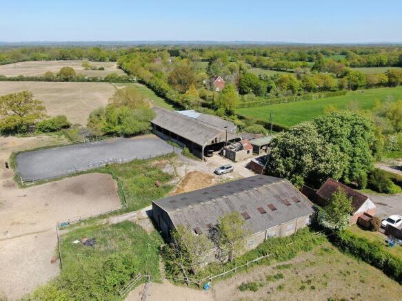
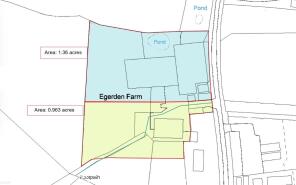
The entire site with consent for five dwellings.Lot 2 – £600,000
A plot with full planning permission for the construction of two detached dwellings.Lot 3 – £450,000
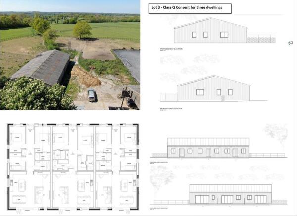
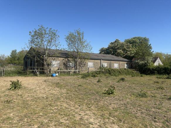
A barn with Class Q consent for conversion into three dwellings.
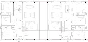
Lot 3 Guide Price: £450,000 A barn with Class Q permitted development consent for conversion into three single-storey dwellings, totalling approximately 3,130 sq. ft.The proposed accommodation comprises two three-bedroom properties and one two-bedroom dwelling. Each is designed with open-plan kitchen and living spaces, ensuite facilities, and bi-fold doors opening onto private garden areas with parking. Further Information SERVICES: Water and electricity supply available LOCAL AUTHORITY: Ashford Borough Council TENURE: Freehold. VIEWINGS: Strictly by appointment only.
Brochures
Property BrochureFull DetailsHigh Halden, Nr Tenterden

NEAREST STATIONS
Distances are straight line measurements from the centre of the postcode- Pluckley Station3.4 miles
- Ham Street Station5.6 miles
About Churchill Country and Equestrian Estate Agents, Billingshurst
The Old Stables, Strood Green, Billingshurst Road Wisborough Green RH14 0DY
Notes
Disclaimer - Property reference 12856520. The information displayed about this property comprises a property advertisement. Rightmove.co.uk makes no warranty as to the accuracy or completeness of the advertisement or any linked or associated information, and Rightmove has no control over the content. This property advertisement does not constitute property particulars. The information is provided and maintained by Churchill Country and Equestrian Estate Agents, Billingshurst. Please contact the selling agent or developer directly to obtain any information which may be available under the terms of The Energy Performance of Buildings (Certificates and Inspections) (England and Wales) Regulations 2007 or the Home Report if in relation to a residential property in Scotland.