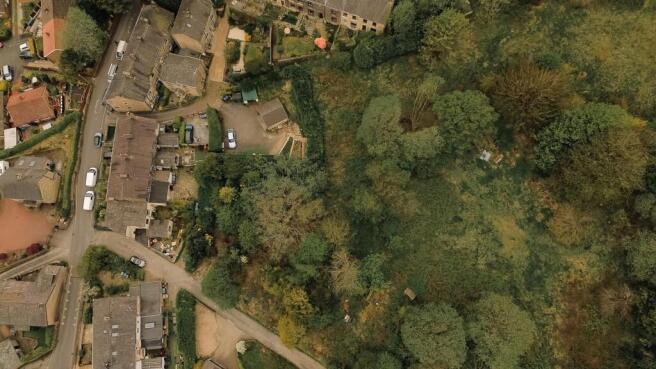
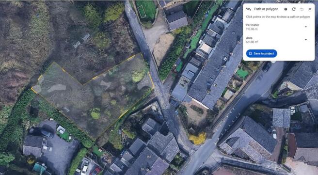
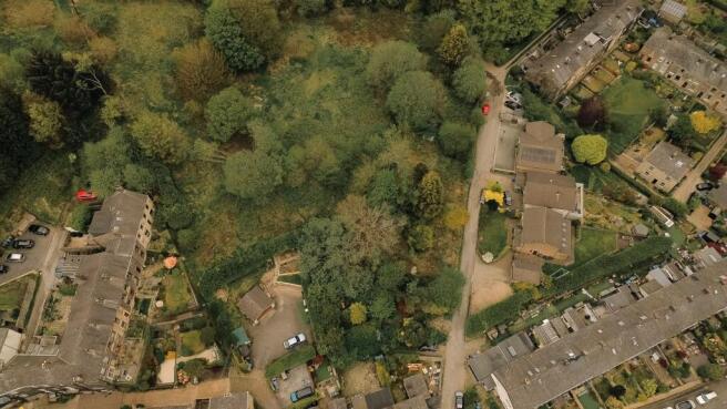
Land to the Rear of Tanners Street, Ramsbottom
- PROPERTY TYPE
Land
- SIZE
Ask agent
Description
This plot of land sits quietly to the rear of Tanners Street in Ramsbottom, surrounded by established residential streets yet benefiting from a green-belt setting that gives it a sense of privacy and long-term potential. The site is being sold in its current condition, with no existing planning consent, making it an appealing opportunity for buyers who want a blank canvas to explore subject to the appropriate approvals.
The land is freehold, and its location places it within easy reach of Ramsbottom’s amenities while still feeling tucked away. Although no development has been approved, the setting and position suggest future possibilities for those willing to undertake the planning process and investigate what may be achievable within green-belt constraints.
Overall, this is a rare chance to secure a plot in a sought-after area—ideal for buyers, investors, or local residents looking for land with long-term potential in a desirable Ramsbottom location.
Brochures
Land to the Rear of Tanners Street, RamsbottomBrochureLand to the Rear of Tanners Street, Ramsbottom

NEAREST STATIONS
Distances are straight line measurements from the centre of the postcode- Entwistle Station3.8 miles
- Bury Interchange Tram Stop4.0 miles
- Bury Station4.1 miles
Notes
Disclaimer - Property reference 34642188. The information displayed about this property comprises a property advertisement. Rightmove.co.uk makes no warranty as to the accuracy or completeness of the advertisement or any linked or associated information, and Rightmove has no control over the content. This property advertisement does not constitute property particulars. The information is provided and maintained by Keenans Estate Agents, Bury. Please contact the selling agent or developer directly to obtain any information which may be available under the terms of The Energy Performance of Buildings (Certificates and Inspections) (England and Wales) Regulations 2007 or the Home Report if in relation to a residential property in Scotland.