
Churchfields, Hertford, Hertfordshire
- PROPERTY TYPE
Plot
- SIZE
Ask agent
Description
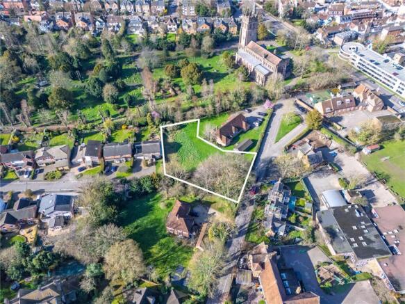
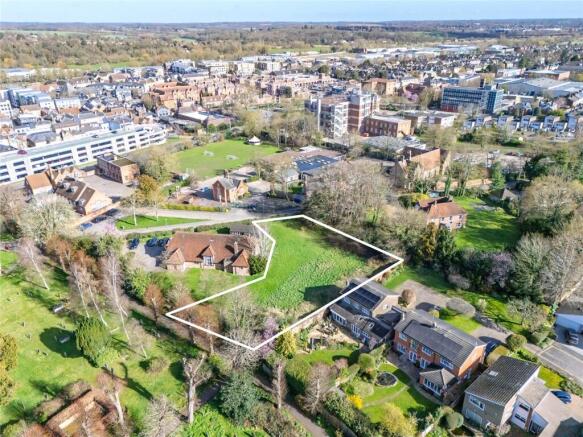
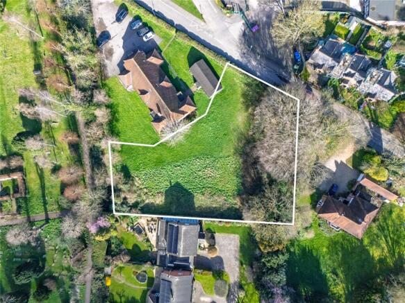
The land is located to the south of Churchfields and extends to 0.49 acres (0.20 hectares). The site is currently an unused area of grass. The site is centrally located in Hertford and in proximity to both Hertford East and Hertford North train station.
The site lies within East Hertfordshire District Council. The EHDC District Plan was adopted in October 2018 for the period to 2033. EHDC cannot currently demonstrate a 5YHLS (3.4 to 3.7 years according to the latest Annual Monitoring Report) and, therefore, the presumption in favour of sustainable development is engaged. The site is well-located within the existing settlement of Hertford and considered to have potential for bringing forward a small-scale residential development.
The site is for sale by Informal Tender and proposals are sought for the promotion of the entire site under either a conditional contract or option agreement.
Bids are to be received by Bidwells no later than 12 noon, Friday 5 June 2026
Brochures
ParticularsChurchfields, Hertford, Hertfordshire

NEAREST STATIONS
Distances are straight line measurements from the centre of the postcode- Hertford East Station0.3 miles
- Hertford North Station0.8 miles
- Ware Station2.1 miles


Notes
Disclaimer - Property reference RUR260052. The information displayed about this property comprises a property advertisement. Rightmove.co.uk makes no warranty as to the accuracy or completeness of the advertisement or any linked or associated information, and Rightmove has no control over the content. This property advertisement does not constitute property particulars. The information is provided and maintained by Bidwells, Rural. Please contact the selling agent or developer directly to obtain any information which may be available under the terms of The Energy Performance of Buildings (Certificates and Inspections) (England and Wales) Regulations 2007 or the Home Report if in relation to a residential property in Scotland.
Map data ©OpenStreetMap contributors.