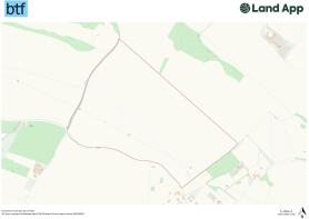
Land & Building at Charity Farm, Pilgrims Way, Hollingbourne, Kent
- PROPERTY TYPE
Farm Land
- SIZE
2,888,899 sq ft
268,388 sq m
Key features
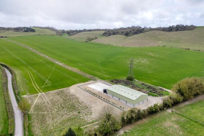
- Ring fenced field parcel with building and yard
- Vehicular access from the Pilgrims Way
- Gently undulating to the south west in an easily accessible location
- Viticulture opportunities with chalky soil types and between 100m to 140m above sea level
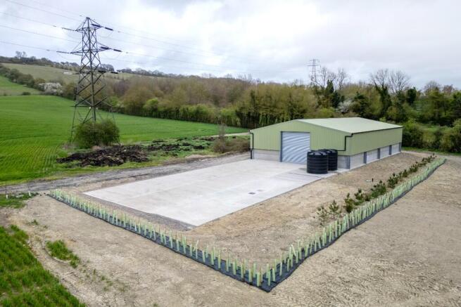
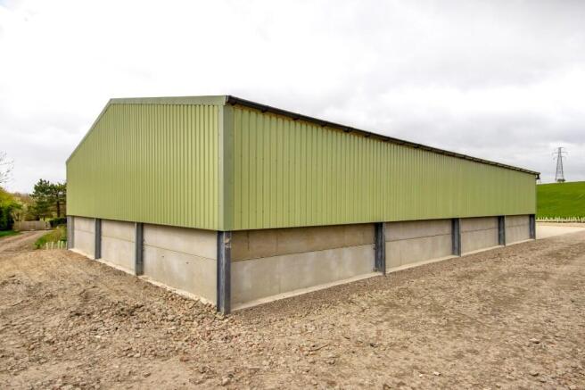
- New agricultural building (3,875ft²) and concrete yard done to high specification
- In all approximately 66.32 acres
Description
The Land at Charity Farm is classified as Grade III on the Agricultural Land Classification Plan for England and Wales and extends in total to 66.32 acres. The land is considered to be freely draining with chalky lime rich loamy soils and ranges from 100m above sea level at the lowest point, to 150m above sea level at the highest in the north western corner.
Wind breaks were planted in 2023 with the view of planting vines on the land. In addition to this, the Vendor has had positive soil reports undertaken along with temperature monitoring and a vine planting plan which is all available from the selling agents on request.
The land is currently planted with Winter Wheat and the Vendor will be reserving holdover until completion of harvest in 2026.
Over the last 6 months, the Vendor has erected a brand new high specification agricultural/viticulture building that already includes a septic tank, mains water, rainwater containers and a sprayer catch pit, all of which is compliant with the current regulations.
The building extends to approximately 3,875ft² with the concrete yard to the west of very similar size.
Access is directly to the south onto a hard core access track from a gated entrance off the Pilgrims Way.
Please see the Property Particulars for further information on maps & plans, current farming, services, nature based solutions, rights of way, tenure etc.
Brochures
Property ParticularsLand & Building at Charity Farm, Pilgrims Way, Hollingbourne, Kent

NEAREST STATIONS
Distances are straight line measurements from the centre of the postcode- Hollingbourne Station1.2 miles
- Bearsted Station1.9 miles
- Harrietsham Station3.4 miles
Notes
Disclaimer - Property reference LandBuildingCharityFarm. The information displayed about this property comprises a property advertisement. Rightmove.co.uk makes no warranty as to the accuracy or completeness of the advertisement or any linked or associated information, and Rightmove has no control over the content. This property advertisement does not constitute property particulars. The information is provided and maintained by BTF Partnership, Heathfield. Please contact the selling agent or developer directly to obtain any information which may be available under the terms of The Energy Performance of Buildings (Certificates and Inspections) (England and Wales) Regulations 2007 or the Home Report if in relation to a residential property in Scotland.