Arable Land For Sale by Informal Tender
- SIZE
Ask agent
- SECTOR
Farm land for sale
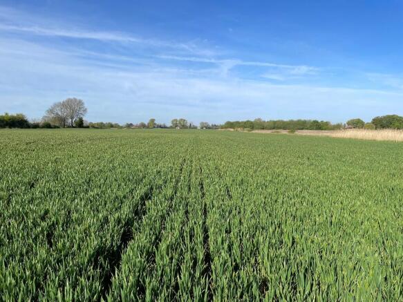
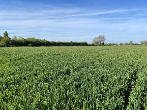
Description
LAND CLASSIFICATION:
The land is classified as Grade II on the ´Provisional´ Land Classification Map of England & Wales.
SOIL SERIES:
The soils are principally of the Wallasea 2 series which are described as deep stoneless clayey soils, calcareous in places.
TENURE:
The land is offered for sale freehold.
POSSESSION:
Vacant possession can be available at completion, assuming that the purchaser takes over the growing crop of wheat. If not required, vacant possession will be available when completion takes place after the wheat has been combined.
SERVICES:
There are no services connected to the land. If services are required, interested parties must make their own specific enquiries with the relevant service providers as to availability, practicality of connection and related cost.
ASSESSMENT AND OUTGOINGS:
The land is subject to the payment of annual Drainage Rates to the North Level District Internal Drainage Board. We are advised that the current rates for the 2026/2027 Drainage Rate Liability is £116.43. The Drainage Rates will be apportioned up to the time of completion with the balance to 31.03.27 payable to the Vendor in addition to the purchase price.
WAYLEAVES, RIGHTS OF WAY AND EASEMENTS:
The land is offered for sale subject to, and with the benefit of, all existing rights including rights of way, whether public or private, light, support, drainage, water, electricity, or other rights, easements, quasi-easements and all wayleaves, whether referred to specifically in these particulars or not.
SPORTING AND MINERAL RIGHTS:
As far they are owned, the Sporting and Mineral Rights are included in the sale.
UPLIFT CLAUSE/CLAWBACK PROVISION:
Should Planning Consent be granted for alternative use other than agricultural, horticulture or private equestrian use, then an uplift payment will be due to the Vendor or his Successors in Title for a period of 15 years at the rate of 35% of the uplift in value at the then trigger point which will be defined as the implementation of Planning Consent, the commencements of works on site or the sale of the land with the benefit of such consent, or the development of the land for alternative uses other than those permitted, even though such consent may not necessarily have required Planning Consent or indeed had been proceeded with without consent.
ENVIRONMENTAL SCHEMES:
None of the land is entered into any Environmental Scheme at the present time.
DELINKED PAYMENTS:
The Delinked Payments for the 2026 and 2027 years will be retained by the Vendor.
DRAINS AND DITCHES:
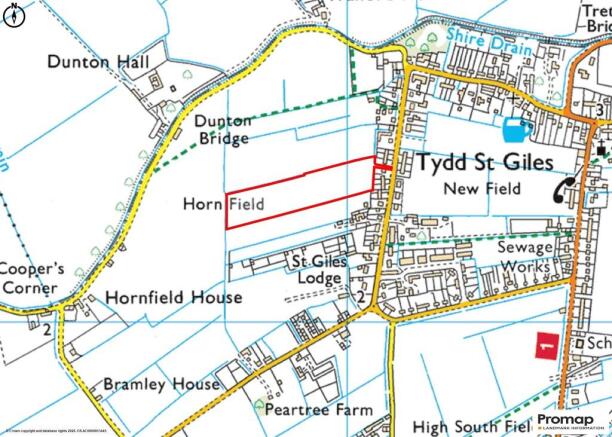
We are advised by the North Level Internal Drainage Board that the drain (Hornfield Drain) which borders the west boundary of the field, is within the control of the IDB. The other boundary dykes are private dykes.
UNDER DRAINAGE:
The Vendor is not aware that the field has ever been under drained.
PLANS, AREAS, AND SCHEDULE:
The plans and areas have been prepared as accurately as reasonably possible and are based on the Ordnance Survey and Rural Land Registry. The plans included in these Particulars are published for convenience and / or identification purposes only and although believed to be correct, the accuracy cannot be guaranteed. The purchaser(s) will be deemed to have satisfied themselves as to the description and extent of the property and the ownership of the boundaries.
HEALTH AND SAFETY:
All those entering on to the land should take great care both for themselves, their property and any part of the farm or crops. It should be remembered that this is a working farm area and neither the Vendor nor his Agents are responsible for any injury or accident that occurs on the farm.
CONTRACTS AND QUOTAS:
There are no contracts nor quotas available with the sale of the land.
TENANTRIGHT/DILAPIDATIONS:
There will be no charge for the current crop of wheat if the purchaser takes this over at completion or if this does not take place until after harvest, the crop will remain with the Vendor. There will be no counterclaim allowed for dilapidations (if any).
FORM OF TENDER:
The Informal Tender Form is attached to these Particulars or is available upon request by contacting the Agricultural Department of R Longstaff & Co LLP, Tel: (Option 4).
Brochures
Arable Land For Sale by Informal Tender

NEAREST STATIONS
Distances are straight line measurements from the centre of the postcode- March Station11.3 miles
Notes
Disclaimer - Property reference 101505032893. The information displayed about this property comprises a property advertisement. Rightmove.co.uk makes no warranty as to the accuracy or completeness of the advertisement or any linked or associated information, and Rightmove has no control over the content. This property advertisement does not constitute property particulars. The information is provided and maintained by Longstaff Chartered Surveyors, Spalding. Please contact the selling agent or developer directly to obtain any information which may be available under the terms of The Energy Performance of Buildings (Certificates and Inspections) (England and Wales) Regulations 2007 or the Home Report if in relation to a residential property in Scotland.