Burnt House Lane, Lower Beeding
- PROPERTY TYPE
Land
- SIZE
194,278 sq ft
18,049 sq m
Key features
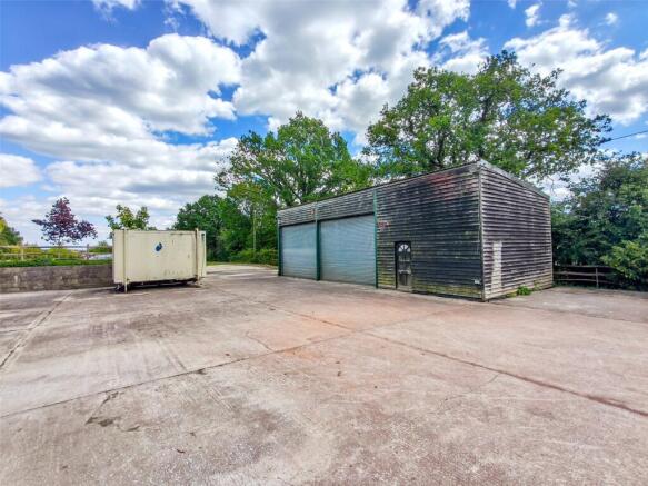
- Farm Building
- Planning for Gypsy/Traveller Pitch
- Polytunnel
- Hardstanding
- Secure Gate Entrance
- Large Pond
- Mains Electricity and Water
- Private Drainage
- Approximately 4.46 Acres
- (1.81 Hectares)
Description
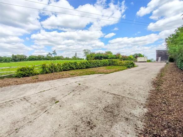
An agricultural building with extensive hardstanding, polytunnel, planning consent for the siting of a single gypsy/traveller pitch, and land extending in total to 4.46 acres (1.81 hectares). The land is accessed via multiple entrances from the hardstanding and benefits from water points.
DESCRIPTION
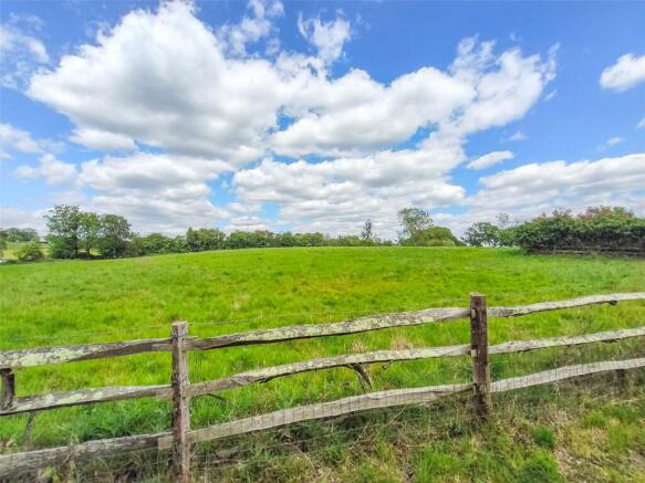
Situated in a quiet location, well set back from main roads, the property benefits from extensive areas of concrete hardstanding, a mix of chestnut post-and-rail and livestock fencing, mature tree-lined boundaries, and a pond. The barn extends to approximately 900 sq ft.
The land itself comprises open pasture, easily accessed via multiple entrances from the hardstanding, and is served by multiple water points.
There is also a Portacabin (a toilet block with mains water and cesspit connection).
The farm benefits from mains electricity, water, and private drainage. There is also a Portacabin (currently used as an events toilet unit).
PLANNING
The site is subject to planning application DC/24/0273 for the change of use of the land to allow the siting of a single gypsy pitch (retrospective). There is currently a polytunnel with previous permission for two more.
AMENITIES
Local: Located between Cowfold (2.5 miles) and Mannings Heath (2.3 miles), both of which offer a range of retail and leisure facilities. Leonardslee Gardens and the South Lodge area are also approximately 2 miles to the east.
Leisure: The surrounding countryside provides an extensive network of footpaths and bridleways, ideal for a variety of outdoor pursuits.
Brochures
ParticularsBurnt House Lane, Lower Beeding

NEAREST STATIONS
Distances are straight line measurements from the centre of the postcode- Horsham Station3.9 miles
- Littlehaven Station4.3 miles
- Christ's Hospital Station4.4 miles


Notes
Disclaimer - Property reference PUL190155. The information displayed about this property comprises a property advertisement. Rightmove.co.uk makes no warranty as to the accuracy or completeness of the advertisement or any linked or associated information, and Rightmove has no control over the content. This property advertisement does not constitute property particulars. The information is provided and maintained by Batcheller Monkhouse, Pulborough. Please contact the selling agent or developer directly to obtain any information which may be available under the terms of The Energy Performance of Buildings (Certificates and Inspections) (England and Wales) Regulations 2007 or the Home Report if in relation to a residential property in Scotland.