
Dalton Piercy, Hartlepool, County Durham, TS27
- PROPERTY TYPE
Farm
- SIZE
Ask agent
Key features
- Productive Grade 3 Agricultural land within a ringfence
- Extending in total to approximately 59.13 hectares (146.12 Acres)
Description
The Property
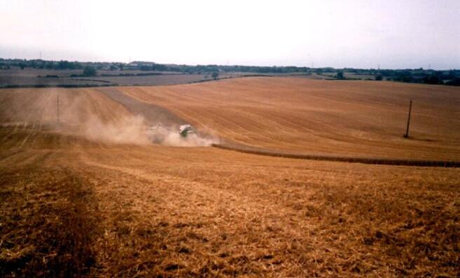
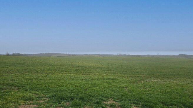
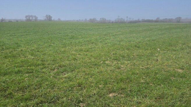
This property comprises approximately 146.12 acres of Grade 3 land, offering versatile and productive agricultural potential. As Grade 3 land, it is classified as moderate-quality agricultural land, suitable for arable, permanent pasture, grazing, or mixed farming uses. The expansive acreage provides flexibility for a range of rural, agricultural, or land-use opportunities, all within the tranquil setting of Dalton Piercy. The land also benefits from a mains water supply.
Tenure & Possession
The land will be sold freehold with vacant possession on completion of sales contracts.
Local Authority
Hartlepool unitary authority.
Council Tax Exempt.
Access and Parking
The property is accessed off the A19 onto an unnamed road to Dalton Piercy, access is available just over the beck via a private right of way.
A gravel road runs through the land and parking is available on the road.
Wayleaves
There are overhead powerlines over the land.
Development Clawback/Overage
The land is sold subject to a clawback/overage agreement. The trigger point will be the implementation of planning permission for any use other than agricultural or equestrian. The clawback term will be drawn up during the conveyancing process and will be for a period of 50 years and for 25% of the uplift in value.
What3words
Every three metre square of the world has been given a unique combination of three words.
///repay.free.punch
Viewings
Viewings are strictly by prior appointment with GFW.
Important Notice
Every care has been taken with the preparation of these particulars, but they are for general guidance only and complete accuracy cannot be guaranteed. If there is any point, which is of particular importance professional verification should be sought. All dimensions/boundaries are approximate. The mention of fixtures, fittings &/or appliances does not imply they are in full efficient working order. Photographs are provided for general information and you may not republish, retransmit, redistribute or otherwise make the material available to any party or make the same available on any website. These particulars do not constitute a contract or part of a contract.
The front page photograph is historic.
Location
Positioned on the edge of this peaceful village, the site offers a rare chance to secure unspoiled bare land in a highly desirable rural setting. Dalton Piercy is known for its tranquil countryside character, surrounded by open farmland and natural features such as Dalton Beck and scenic hedgerows, creating an attractive backdrop for future development or personal use.
Just one mile from the A19 and close to Hartlepool, the location combines rural quiet with excellent accessibility. The village itself is centred around a historic green with homes dispersed in a low-density layout, reinforcing its spacious, semi-rural appeal
Brochures
ParticularsDalton Piercy, Hartlepool, County Durham, TS27

NEAREST STATIONS
Distances are straight line measurements from the centre of the postcode- Hartlepool Station2.8 miles
- Seaton Carew Station3.1 miles
- Billingham Station4.6 miles

About George F.White, Barnard Castle
14c Redwell Court, Barnard Castle, County Durham DL12 8BN


Notes
Disclaimer - Property reference BAC260140. The information displayed about this property comprises a property advertisement. Rightmove.co.uk makes no warranty as to the accuracy or completeness of the advertisement or any linked or associated information, and Rightmove has no control over the content. This property advertisement does not constitute property particulars. The information is provided and maintained by George F.White, Barnard Castle. Please contact the selling agent or developer directly to obtain any information which may be available under the terms of The Energy Performance of Buildings (Certificates and Inspections) (England and Wales) Regulations 2007 or the Home Report if in relation to a residential property in Scotland.