Land at Darnhunch Farm, Muirkirk, Ayrshire
- PROPERTY TYPE
Farm Land
- SIZE
Ask agent
Description
The land also presents as an excellent investment opportunity with both carbon and natural capital potential.
Situation
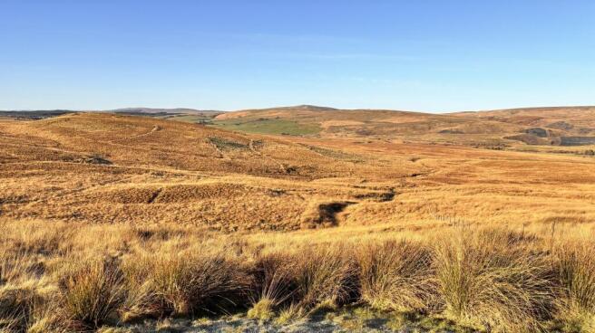
The land is located approximately 2.5 miles northeast of Muirkirk in East Ayrshire, with good access directly off the A70. The predominant land use in the surrounding area is a mixture of farming and forestry. Whilst the locality is distinctly rural in character with its scenic rolling landscape, the property benefits from close proximity to the A70, linking Ayr to the M74 and Glasgow. Agriculturally, the local area is well serviced by merchants and suppliers, with Stirling Agricultural Centre (58 miles) and Borderway Mart at Carlisle (75 miles) providing outlets for livestock.
Location
What3words ///wobbling.photos.unsightly
Postcode - KA18 3SD
Description
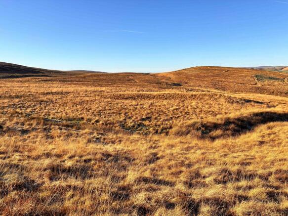
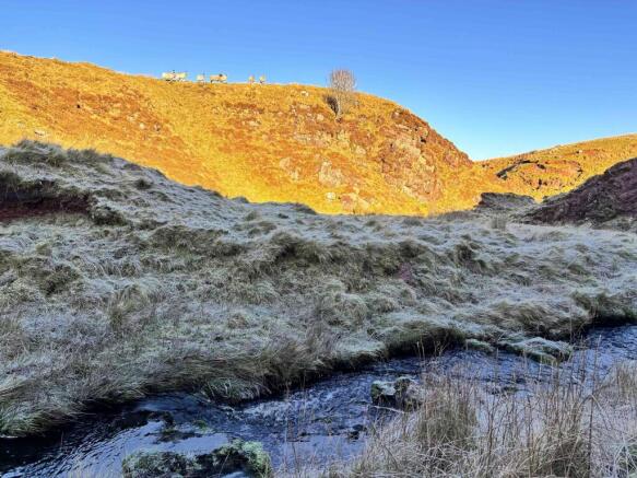
The land at Darnhunch extends to some 255.13 acres (103.25 hectares) or thereabouts of hill ground suitable for the grazing of sheep and cattle. The land has been classified as grade 5.2 and grade 5.3 by the James Hutton Institute and the soils are classed as Noncalcareous Gleys Soils within the Rowanhill Series. The land lies at 316m above sea level at its highest point. The majority of the fencing is in good condition however there are areas that require maintenance in order to make the boundaries stock proof. The boundaries will be the liability of the new owner. There are no piped troughs however there is a watercourse that provides livestock with a natural water source.
Carbon and Natural Capital Opportunities
The land at Darnhunch may have carbon and natural capital potential which could be explored through projects such as peatland restoration and biodiversity net gain.
Woodland
The land at Darnhunch is classed as F4 land capability for forestry (land with moderate flexibility for the growth and management of tree crops). An assessment of the potential for woodland creation could be carried out by a forestry specialist with a view to establishing woodland carbon credits.
Basic Payment Scheme
The land is all registered with Rural Payments for IACS purposes and is all classified as Region 2 giving a total eligible claim area of approximately 103.25 hectares. There are no BPS Entitlements included with the sale and the 2026 payment will be retained in full by the current vendor. Should entitlements be required by the purchaser, Edwin Thompson can assist with sourcing these under separate arrangement. For further information please contact Jack Frater on , or via email to j. .
There are no current Agri-Environment Climate Scheme or Woodland Creation contracts in place.
Less-Favoured Area Support Scheme (LFASS)
All of the land has been designated as being within Less-Favoured Area and therefore qualifies for LFASS Payments.
Nitrate Vulnerable Zone (NVZ)
The land is not included within an NVZ but does lie within a SSSI.
Environmentally Sensitive Grassland (ESG)
The land has been designated as ESG.
Minerals
All mineral rights are included.
Timber
All fallen and standing timber is included in the sale in so far as it is owned by the seller.
Sporting Rights
In so far as these rights form part of the property title, they are included within the sale.
For more information or to arrange a viewing please contact Lucy Murray in our Berwick Office on or by email l. .
Tenure: Freehold
Brochures
BrochureLand at Darnhunch Farm, Muirkirk, Ayrshire

NEAREST STATIONS
Distances are straight line measurements from the centre of the postcode- Kirkconnel Station9.9 miles
About Edwin Thompson, Berwick-Upon-Tweed
44-48 Hide Hill, Berwick-Upon-Tweed, TD15 1AB


Notes
Disclaimer - Property reference RS0272. The information displayed about this property comprises a property advertisement. Rightmove.co.uk makes no warranty as to the accuracy or completeness of the advertisement or any linked or associated information, and Rightmove has no control over the content. This property advertisement does not constitute property particulars. The information is provided and maintained by Edwin Thompson, Berwick-Upon-Tweed. Please contact the selling agent or developer directly to obtain any information which may be available under the terms of The Energy Performance of Buildings (Certificates and Inspections) (England and Wales) Regulations 2007 or the Home Report if in relation to a residential property in Scotland.