
Pill Road, Mark, Highbridge, Somerset, TA9
£0.73 per sq ft
Business rates & charges may apply
- SIZE AVAILABLE
95,396 sq ft
8,863 sq m
- SECTOR
Land for sale
Key features
- - 2.19 Acres of Agricultural land
- - Direct access from Pill Road
- - Rhyne watering
Description
Description
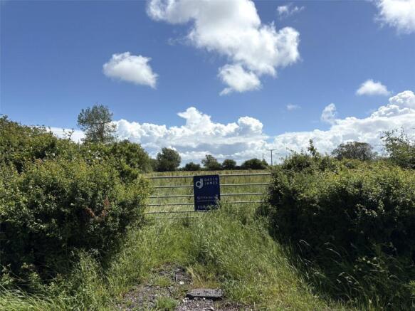
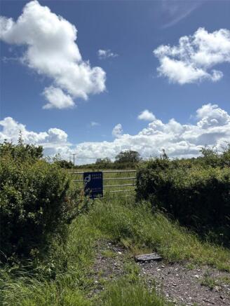
A chance to purchase a parcel of agricultural land situated in the parish of Mark, near Highbridge, Somerset. The land is a parcel of permanent pasture, extending to 2.19 acres (0.89 ha) as shown edged red on the plan. The land is bordered by mature hedgerows and ditches and benefits from direct access off the public highway known as Pill Road (Field No. ST370-0809).
Directions
From Junction 22 of the M5 motorway, head towards Edithmead roundabout, taking the third exit onto Bristol Road/A38. After approx. 0.4 miles, turn right onto Harp Road. In 0.9 miles, turn left onto Vole Road. In 0.4 miles turn right in order to continue along Vole Road. In 0.9 miles, bear left onto Pill Road. Continue along Pill Road for 0.5 miles, and the access gate to the land is situated on the right hand side demarcated with one of our ‘For Sale’ boards
Services
The land benefits from natural watering
Tenure & Possesion
The land is of Freehold Title with vacant possesion available upon completion of purchase.
Basic Payment scheme
No delinked payments are attached to the land or included in the sale.
Enviomental stewardship
The land is not subject to any sustainable farming incentive (SFI), ELS or HLS agreements.
Statutory Designations
The land sits within a SSSI impact risk zone where planning applications are assesssed for likely impacts on nearby SSSIs, SACs, SPAs & Ramsar Sites
Development Clawback
There is a development clawback clause attached to the sale of this land whereby the vendor or his successors in Title will be entitled to 30% of any uplift in value for a 25-year period for any development other than agricultural or equestrian.
Wayleaves & Easements
None known to exist.
Town and Country Planning
The land is sold subject to any Development Plan, Tree Preservation order, Town Planning Schedule, Resolution or Notice which may be or may which come into force, also subject to any statutory provision of byelaws without any obligation on the part of the Vendors to specify them and the purchaser shall be deemed to have full knowledge about the provisions of any such matters afecting the property.
Rights of Way
There are no known rights of way over the land.
Viewings
At any time during daylight hours with a set of the sales particulars and the usual courtesy shown to the occupier.
Brochures
Pill Road, Mark, Highbridge, Somerset, TA9

NEAREST STATIONS
Distances are straight line measurements from the centre of the postcode- Highbridge & Burnham Station3.6 miles
Notes
Disclaimer - Property reference WRU260012. The information displayed about this property comprises a property advertisement. Rightmove.co.uk makes no warranty as to the accuracy or completeness of the advertisement or any linked or associated information, and Rightmove has no control over the content. This property advertisement does not constitute property particulars. The information is provided and maintained by David James, Wrington. Please contact the selling agent or developer directly to obtain any information which may be available under the terms of The Energy Performance of Buildings (Certificates and Inspections) (England and Wales) Regulations 2007 or the Home Report if in relation to a residential property in Scotland.