
Bascote Heath, Southam, Warwickshire, CV47

- PROPERTY TYPE
Land
- SIZE
8,466,757 sq ft
786,588 sq m
Key features
- Deciduous woodland
- Predominantly oak with ash and an understorey of hazel coppice
- Site of Special Scientific Interest (SSSI)
- Direct public highway access
- In all about 194.37 acres (78.66 hectares)
Description
Description
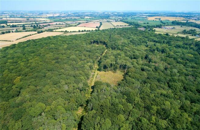
Long Itchington and Ufton Woods are a ring fenced block of about 194.37 acres (78.66 hectares) of predominantly deciduous woodland that will be of interest to amenity buyers and forestry investors alike.
The woodland combines a high conservation value with good quality timber with varied age class and species distribution.
Thought to be one of the largest areas of Ancient Woodland in Warwickshire, the whole of Long Itchington and Ufton Woods are classified as a Site of Special Scientific Interest (SSSI).
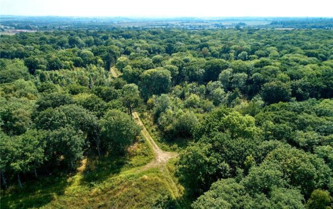
The woods principally contain broadleaf species with oak, the predominant species with ash and an understorey of hazel. There are the occasional ash, birch and aspen. The coupes of hazel coppice are interspersed with oak standards.
Opportunities exist for buyers to generate income through thinning areas of the woods over the next 5 to 10 years. Recent thinning and clear felling has produced good oak beam timber.
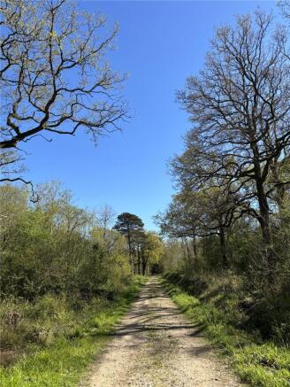
The woodland takes direct road access off the Ufton to Bascote Heath road at point X. A stoned roadway leads to the centre of the woods from which grass rides provide access to the rest of the woodland.
Elevations range from about 85 metres to 110 metres above sea level. Average rainfall in the area is in the region of 666mm per annum.
The woods lie on the route of the High Speed 2 (HS2) railway line which now passes beneath the site in a tunnel. All construction and monitoring work is now complete on either side of the woods.
The woods have been managed on a commercial basis and have the potential to generate significant income through timber sales and grant support.
Location
Long Itchington and Ufton Woods are situated to the west of Southam between the hamlet of Bascote Heath and the village of Ufton, in Warwickshire.
Acreage: 194.37 Acres
Directions
From Southam take the A425 west towards Royal Leamington Spa for approximately 1.7 miles. At the first crossroads you reach turn right signed for Bascote Heath and continue along this road for 0.4 miles and
the entrance is found on the left hand side
Post Code: CV47 2DN
What3Words
///elder.earplugs/event
Additional Info
Long Itchington and Ufton Woods are sold subject to a restriction limiting its use to forestry and the production of timber. Furthermore it prevents the woods from being sub-divided into multiple ownership.
The Woodland Management Plan is due for renewal although there is a live felling licence in place, along with a Woodland Improvement Grant.
It is understood that mains water is connected to the property but for other services, prospective purchasers should make their own enquiries of utilities providers.
The sporting rights are included in the sale and are in-hand.
Unaccompanied viewings of Long Itchington and Ufton Woods are permitted provided you have registered your interest with Savills Banbury and take a copy of the sale plan with you.
Brochures
Web DetailsBascote Heath, Southam, Warwickshire, CV47

NEAREST STATIONS
Distances are straight line measurements from the centre of the postcode- Leamington Spa Station4.9 miles
About Savills Rural Agency, Covering Central England
Wytham Court, 11 West Way, Botley, Oxford, OX2 0QLNotes
Disclaimer - Property reference OXR260013. The information displayed about this property comprises a property advertisement. Rightmove.co.uk makes no warranty as to the accuracy or completeness of the advertisement or any linked or associated information, and Rightmove has no control over the content. This property advertisement does not constitute property particulars. The information is provided and maintained by Savills Rural Agency, Covering Central England. Please contact the selling agent or developer directly to obtain any information which may be available under the terms of The Energy Performance of Buildings (Certificates and Inspections) (England and Wales) Regulations 2007 or the Home Report if in relation to a residential property in Scotland.