Langdon Hills, Basildon
Business rates & charges may apply

- SIZE
Ask agent
- SECTOR
Farm land for sale
Key features
- Elevated pasture & woodland
- Far-reaching views
- Grazing and woodland
- Southerly aspect
- Established woodland
- Vacant possession available
- No public access
- Potential for Alternative Uses (Subject to consents)
- Permitted Development Rights
- Available as a whole or in Lots
Description
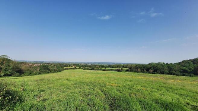
A rare opportunity to acquire an elevated block of pasture and woodland within the highly regarded Langdon Hills area, enjoying spectacular far-reaching views across the Essex countryside towards the Thames Estuary with no public rights of access.
Extending to approximately 64.21 acres (25.99 hectares) in total, the land occupies a striking position to the southwest of Billericay within an area renowned for its rolling landscape, woodland and open countryside.
The property combines productive grazing land with established woodland, creating a highly attractive holding with considerable amenity appeal and excellent accessibility to Basildon, Billericay, Brentwood and the A127.
The surrounding Langdon Hills area is recognised as one of the highest points in south Essex, offering panoramic viewpoints, extensive countryside walks and a desirable semi-rural setting.
The land is considered suitable for a range of agricultural, equestrian, leisure, conservation and amenity use, together with longer-term strategic potential for alternative uses, subject to obtaining the necessary planning permissions and statutory consents.
Lotting
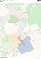
The property is available as a whole or in four separate lots:
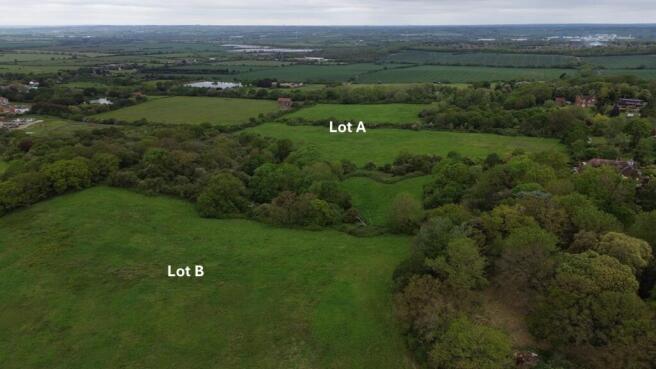
Lot A – Approximately 29.22 acres (11.82 hectares) - Guide Price £540,000
Edged and cross hatched red on the plan this lot comprises approximately 19.89 acres of open grassland together with 9.33 acres of established woodland. This attractive parcel benefits from direct highway access via Old Church Hill and offers an appealing combination of grazing, wildlife habitat and recreational potential.
Road access is from Old Church Hill at What3Words: ///crew.hotel.unique
Lot B – Approximately 12.54 acres (5.07 hectares) - Guide Price £250,000
Edged and cross hatched blue on the plan this is a useful block of grazing pasture with an attractive southerly aspect and access from South Hill / B1007. The elevated setting provides impressive open views and strong amenity appeal.
Road access is from South Hill / B1007 at What3Words: ///farms.dishes.stop
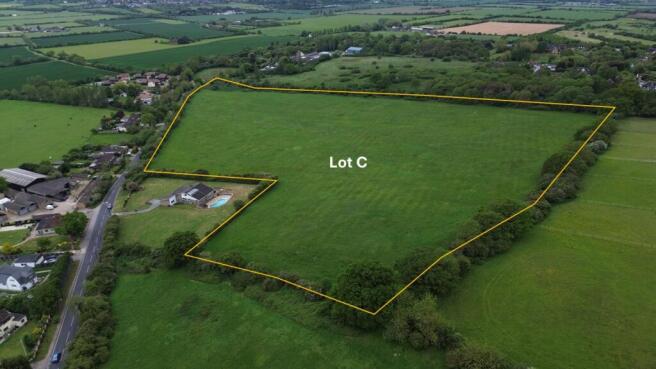
Lot C - Approximately 21.94 acres (8.88 hectares) - Guide Price £440,000
Edged and cross hatched orange on the plan this is a block of hay / grazing pasture with road frontage to south Hill / B1007 with elevated views and amenity appeal.
Road access is from South Hill / B1007 at What3Words: ///hogs.hurt.organs
Lot D - Approximately 0.51 acres (0.2 hectares) - Guide Price £135,000
Shaded green on the plan a modest block of amenity land with road frontage lying between exisitng dwellings. May hold development potential subject to consent.
Road frontage is on South Hill / B1007 at What3Words: ///moral.files.oppose
Tenure
The property will be sold with vacant possession upon completion.
Town and Country Planning
The local planning authority is Thurrock Council.
All the land is designated as lying within the Green Belt.
The land may benefit from Permitted Development rights, subject to the usual criteria and any necessary consents.
Prospective purchasers must make their own inquiries as to the likelihood of obtaining planning consent for any proposed use.
Restrictive, Covenants, Easements and Rights of Way
The land is sold subject to any easements, quasi easements, wayleaves, rights of way or obligations whether mentioned in these particulars or not.
No public rights of way cross the land.
Rights of access for all purposes at all times may need to be reserved, if required to ensure unsold parcels remain accessible.
Services
There are no services attached to the land. Rights for services may need to be reserved over adjoining lots.
Overage
All land will be sold subject to overage. The term of the overage will be 25 years. The Seller reserves 25% of any uplift in value resulting from any change of use or implementable planning. The overage will not trigger for horticulture, equestrian, forestry, or agriculture uses. It will trigger if any use that enables independent residential habitation. The overage may be triggered multiple times.
Viewing
Strictly by appointment. Viewing of the property is entirely at the risk of the enquirer. Neither Whirledge & Nott nor the vendor accept any responsibility for any damage, injury or accident during viewing.
Notice
Whirledge & Nott does not have any authority to give representations or warranties in relation to the property. These particulars do not form part of any offer or contract. All descriptions, photographs and plans are for guidance only and should not be relied upon as statements or representations of fact. All measurements are approximate. No assumption should be made that the property has the necessary planning, building regulations or other consents. Whirledge & Nott has not carried out a survey nor tested any appliances, services or facilities. Purchasers must satisfy themselves by inspection or otherwise.
Brochures
Langdon Hills, Basildon

NEAREST STATIONS
Distances are straight line measurements from the centre of the postcode- Laindon Station1.8 miles
- Stanford-le-Hope Station2.0 miles
- Basildon Station2.6 miles
About Whirledge and Nott, Commercial
The Black Barn, Lubards Farm, Hullbridge Road, Rayleigh, SS6 9QGNotes
Disclaimer - Property reference 5109. The information displayed about this property comprises a property advertisement. Rightmove.co.uk makes no warranty as to the accuracy or completeness of the advertisement or any linked or associated information, and Rightmove has no control over the content. This property advertisement does not constitute property particulars. The information is provided and maintained by Whirledge and Nott, Commercial. Please contact the selling agent or developer directly to obtain any information which may be available under the terms of The Energy Performance of Buildings (Certificates and Inspections) (England and Wales) Regulations 2007 or the Home Report if in relation to a residential property in Scotland.