
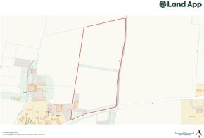
Barnsole, Staple, Canterbury, Kent
- PROPERTY TYPE
Plot
- SIZE
326,700 sq ft
30,351 sq m
Key features
- Former Winery Building measuring 260m²
- Prior Approval granted under Ref: 24/00813 – Dover District Council
- 5 acres of different varieties of planted vines
- Self build opportunity to create contemporary family home
- In all approximately 7.5 acres
Description
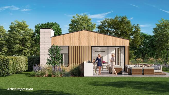
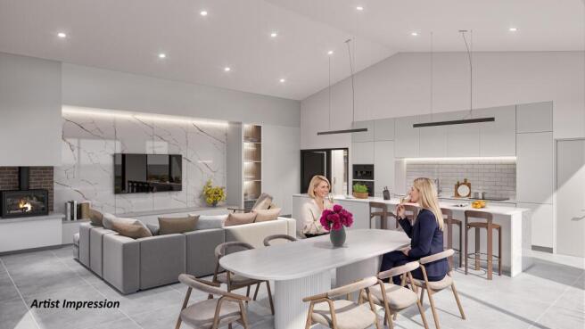
Prior Approval has been granted under Ref No: 24/00813 – Dover District Council for the change of use from a steel portal frame agricultural building to a 5 bedroom dwelling house, comprising open plan Living Room, Dining Room & Kitchen, Pantry, Utility Room, Office Space, Family Bathroom, 5 bedrooms, 2 of which are en-suite with the master bedroom benefitting from a Walk in Wardrobe / Dressing Room.
The Gross Internal Area of the property to be developed extends to approximately 3,000ft².
Outside, there is a small wrap around garden with views overlooking the existing vines.
Full planning has currently been submitted and approval is awaited by the local council.
Please see the Property Particulars for further information on services, access, planning, tenure etc.
Brochures
Property ParticularsBarnsole, Staple, Canterbury, Kent

NEAREST STATIONS
Distances are straight line measurements from the centre of the postcode- Adisham Station3.4 miles
- Sandwich Station3.3 miles
- Aylesham Station3.6 miles
Notes
Disclaimer - Property reference Barnsole. The information displayed about this property comprises a property advertisement. Rightmove.co.uk makes no warranty as to the accuracy or completeness of the advertisement or any linked or associated information, and Rightmove has no control over the content. This property advertisement does not constitute property particulars. The information is provided and maintained by BTF Partnership, Heathfield. Please contact the selling agent or developer directly to obtain any information which may be available under the terms of The Energy Performance of Buildings (Certificates and Inspections) (England and Wales) Regulations 2007 or the Home Report if in relation to a residential property in Scotland.