Land & Building at Pikehall, Matlock
- PROPERTY TYPE
Land
- SIZE
265,716 sq ft
24,686 sq m
Key features
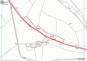
- 6.10 Acres or Thereabouts
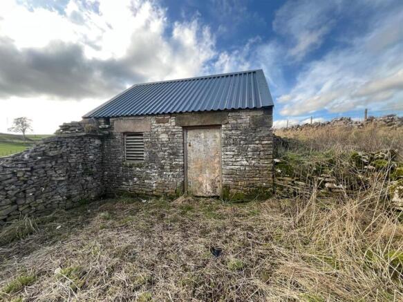
- Enclosed Stone & Profile Sheeted Storage Building
- Suitable for both Mowing and Grazing Purposes
- Good Road Frontage
- Of Interest to Equestrian or Smallholders
Description
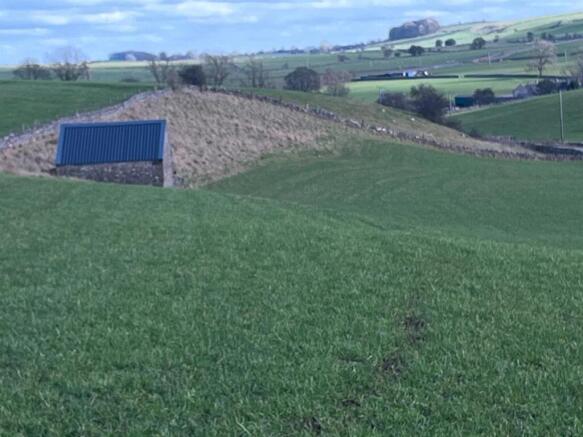
Comprises a sound block of grassland considered to be in good heart suitable for both mowing and grazing. The land is slightly undulating in nature and is considered to be capable of growing good crops of grass.
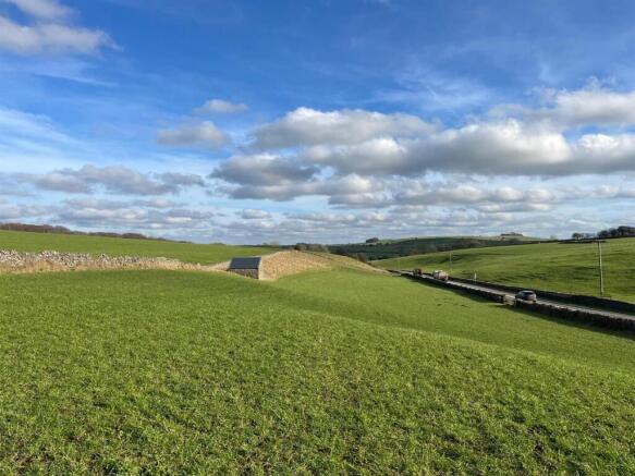
The land has good road frontage and access lying adjacent to the main road, A5012 at Pikehall. The land has the benefit of an enclosed stone and profile sheeted storage building extending to 4.71m x 4.18m internally approximately.
Situation - The land is located off the A5012 at Pikehall as will be seen on the attached plan and indicated by the agent’s ‘For Sale’ boards. The land has good road frontage to the A5012.
The land lies approximately 8.4 miles from Matlock and 8.8 miles from Bakewell.
What3words - ///ribcage.arena.graph
Please Download The Attached Brochure -
Brochures
Particulars - Land at Pikehall, Matlock - 6.10 acLand & Building at Pikehall, Matlock

NEAREST STATIONS
Distances are straight line measurements from the centre of the postcode- Matlock Station6.5 miles


Notes
Disclaimer - Property reference 34725311. The information displayed about this property comprises a property advertisement. Rightmove.co.uk makes no warranty as to the accuracy or completeness of the advertisement or any linked or associated information, and Rightmove has no control over the content. This property advertisement does not constitute property particulars. The information is provided and maintained by Graham Watkins, Leek. Please contact the selling agent or developer directly to obtain any information which may be available under the terms of The Energy Performance of Buildings (Certificates and Inspections) (England and Wales) Regulations 2007 or the Home Report if in relation to a residential property in Scotland.