
Honey Pot Lane, Colsterworth, Grantham
- PROPERTY TYPE
Farm Land
- SIZE
Ask agent
Description
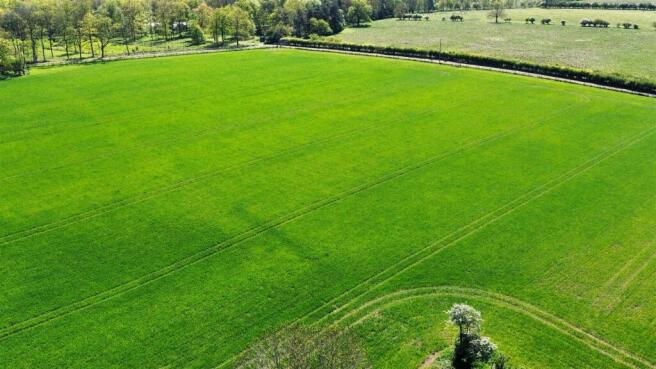
Description - Lot 3 - 20.78 acres of arable land with access onto Honey Pot Lane
Title Number LL91915.
Location - Wood View Farm is set in the beautiful undulating countryside located 10 miles north of Stamford and 8 miles south of Grantham, approximately one mile to the east of the A1. The main rail link to London Kings Cross is provided by nearby Grantham as well as good cross country services from Stamford. The surrounding towns offer a fine selection of primary and secondary schools including the renowned public schools of Oakham, Kings Grantham and Stamford. The area also has excellent shopping facilities and a wide range of sporting and leisure activities.
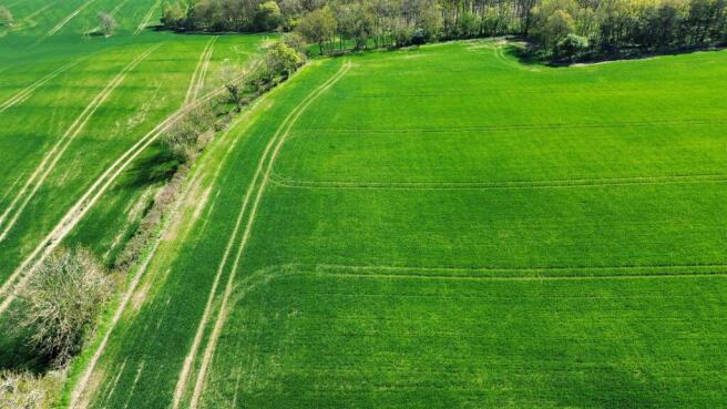
Lot 3 - A single parcel of arable land extending to 20.78 acres (8.42 ha) coloured blue on the attached plan. The field is predominently Grade 3 as categorised by the Land Classification of England and Wales. The soil type is from the Ragdale series being described as "Slowly permeable seasonally waterlogged clayey and fine loamy over clayey soils. Some slowly permeable calcareous clayey soils especially on slopes" by the Soil Suvey of England and Wales. The field has its own access onto Honey Pot Lane.
Back Cropping: 2026 - Winter Wheat, 2025 - Grass, 2024 - Grass, 2023 - Winter Wheat, 2022 - Winter Wheat
Method Of Sale - The property is for sale by Private Treaty with Vacant Possession.
Historic Designation - We understand that the property is not affected or restricted by any Ancient Monument Designation.
Wayleaves, Easements & Rights Of Way - The property is sold subject to and with the benefit of all exisitng wayleaves, easements and rights of way, whether public or private, and any other rights, obligations, easements and quasi easements, whether specifically mentioned or not.
Access - Access to the property is taken directly from Honey Pot Lane.
Boundaries - The successful purchaser shall be deemed to have full knowledge of all boundary responsibilities and neither the vendors nor their agents will be responsible for finding the ownership of said boundaries.
Services - The field is serviced by mains water.
Tenure & Possession - The property is offered for sale Freehold, with the benefit of Vacant Possession.
Local Authority - The property is located in the administrative boundaries of South Kesteven District Council.
Viewings - Viewings are strictly by appointment with Richardson Surveyors.
Health & Safety - Please be as vigilant as possible when making your inspection. Please observe any specific signage of the property.
Plans & Areas - The areas and plans attached to these particulars have been produced in good faith. They are for illustrative purposes only and their accuracy is not guaranteed.
Further Information - For further information please contact Jamie Richardson on his direct line on or or Charles Richardson on his direct line on or
Vat - Guide prices provided are exclusive of VAT. In the event that the sale of the property, or any part or right attached to it becomes a chargeable supply for the purposes of VAT, such tax will be payable in addition.
Brochures
Honey Pot Lane, Colsterworth, GranthamBrochureHoney Pot Lane, Colsterworth, Grantham

NEAREST STATIONS
Distances are straight line measurements from the centre of the postcode- Grantham Station8.5 miles
About Richardson Surveyors, Stamford
Sheepmarket House, Sheep Market, Stamford, PE9 2RB


Notes
Disclaimer - Property reference 34746566. The information displayed about this property comprises a property advertisement. Rightmove.co.uk makes no warranty as to the accuracy or completeness of the advertisement or any linked or associated information, and Rightmove has no control over the content. This property advertisement does not constitute property particulars. The information is provided and maintained by Richardson Surveyors, Stamford. Please contact the selling agent or developer directly to obtain any information which may be available under the terms of The Energy Performance of Buildings (Certificates and Inspections) (England and Wales) Regulations 2007 or the Home Report if in relation to a residential property in Scotland.