
Land on the West Side of The Causeway, Lawford
- PROPERTY TYPE
Land
- SIZE
Ask agent
Key features
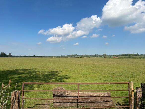
- Single parcel of land
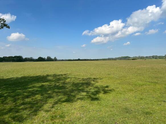
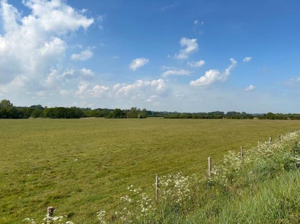
- 30.47 acres (subject to survey)
- Land
- Grade 3 grassland
- Well located
- Rural
Description
Tenure: Freehold
Location and Situation
The Property is located to the northwest of Manningtree. The land is accessed via the A137 which has close transport links to Ipswich, Colchester and the A12. The Land is located in the county of Essex with close proximity to Suffolk.
Nearest postcode - CO11 1QJ
What3words - ///various.iterative.grades
Description
The land comprises approximately 30.47 acres (12.33 hectares) of permanent pasture in a single field, bordering the River Stour.
The full extent of the Property is shown tinted pink on the attached plan for identification purposes only.
The land is classified as Grade 3 on DEFRA's Land Classification Map. According to the Soil Survey of England and Wales, the land belongs to the Ludford series.
Access
The Property benefits from access directly from the A137.
Method of Sale
The Property is offered for sale, as a whole, by Private Treaty.
Prospective purchasers should register their interest with the selling agent to whom offers should be submitted. Please contact Graham Ellis or Jake Beila at Stanfords.
Viewings
Should you wish to inspect the land, please register your interest with the agents and inform them of your attendance. Viewing may take place unaccompanied along the footpath EX|Lawford|54 during daylight hours with a set of particulars in hand.
Land Registry
The Property is registered with HM Land Registry under title number EX713873.
Tenure, Possession and Holdover
The Property is offered for sale subject to an existing Farm Business Tenancy with vacant possession due on 1st January 2027.
Sporting, Mineral and Timber
To be included in the sale, so far as they are owned.
Environmental Schemes
We are informed there is a Higher Level Stewardship Agreement on the land ending on 30th April 2027.
Local Authority
Tendring District Council, Town Hall, Station Road, Clacton-On-Sea, Essex, CO15 1SE.
Services
The Property does not benefit from any services, and prospective purchasers should make their own enquiries to the availability of services.
Planning
All planning enquiries should be directed to Tendring District Council.
Covenants, Rights of Way, Easements and Wayleaves
The land is offered for sale and will be conveyed with the benefit and subject to all covenants, rights of way (whether private or public), water, drainage, sewage, wayleaves and other easements, if any, subject to all outgoings or charges connected with or chargeable upon the land whether mentioned herein or not.
Footpath EX|Lawford|54 runs along the land's northern boundary.
The land has a water pipe easement crossing it, to Marsh Barn House under title number EX80401. Further information can be given upon request.
Boundaries, Plans, Areas, Schedule and Disputes
The plans attached to these particulars are based on Open Street Map and are for identification purposes only. The purchaser will be deemed to have full knowledge of the boundaries and any errors or mistakes shall not annul the sale or entitle any party to compensation in respect thereof.
Designations
The Property is located in a National Landscape (Area of Outstanding Natural Beauty).
A small slither of the northern part of the Property is located in a RAMSAR and SSSI (Site of Special Scientific Interest).
The Property is identified on the Environment Agency Flood Map as being Level 3 - High Probability of Flooding.
VAT
Any guide price quoted or discussed is exclusive of VAT. In the event that a sale of the Property or any part thereof, or any right attached to it under chargeable supply for the purposes of VAT, such tax will be payable in addition.
AML Compliance
In order to comply with current Anti-Money Laundering legislation, once an offer has been accepted (subject to contract), the prospective purchaser(s) will need to provide, as a minimum, proof of identity and residence, together with proof of source of funds for the purchase, before the transaction can proceed.
Brochures
BrochureLand on the West Side of The Causeway, Lawford

NEAREST STATIONS
Distances are straight line measurements from the centre of the postcode- Manningtree Station0.4 miles
- Mistley Station1.4 miles

About Stanfords, Colchester
The Livestock Market Wyncolls Road, Severalls Industrial Park, Colchester, CO4 9HUNotes
Disclaimer - Property reference CS0005. The information displayed about this property comprises a property advertisement. Rightmove.co.uk makes no warranty as to the accuracy or completeness of the advertisement or any linked or associated information, and Rightmove has no control over the content. This property advertisement does not constitute property particulars. The information is provided and maintained by Stanfords, Colchester. Please contact the selling agent or developer directly to obtain any information which may be available under the terms of The Energy Performance of Buildings (Certificates and Inspections) (England and Wales) Regulations 2007 or the Home Report if in relation to a residential property in Scotland.