Baston, Peterborough

- PROPERTY TYPE
Farm Land
- SIZE
Ask agent
Description
Tender deadline 12 noon on Wednesday 19th August 2026.
Location - The land is located to the south and east of the village of Baston, which is approx 4 miles to the south of Bourne. Three of the lots are directly accessible from the public highway, with the fourth lot being accessible via a track over lot 3.
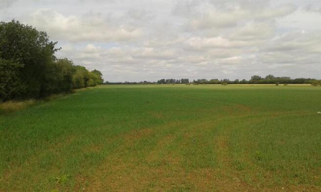
Description - The land comprises 5 separate fields, one of which includes a semi-derelict building and former RAF radar facility. A telecommunication mast is also located on the site for which no rent is payable, as it was commuted into a capital sum paid to the owners several years ago.
The land is classified Grade 2 on the former MAFF Agricultural Land Classification Map and is referred to as being of River Terrace and Lacustrine Gravel geology by the Soil Survey of England and Wales.
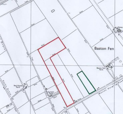
Lot 1 - 27.06 acres (10.95 hectares) of arable land edged red on the attached plan. Back cropping 2026: Spring Barley, 2025: Sugar beet, 2024: Winter Wheat, 2023: Potatoes, 2022: Spring Barley.
Lot 2 - 6.13 acres (2.48 hectares) of arable land edged green on the attached plan. Back cropping 2026: Spring Barley, 2025: Sugar beet, 2024: Winter Wheat, 2023: Potatoes, 2022: Spring Barley.
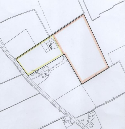
Lot 3 - 5.95 acres (2.41 hectares) of grass land edged yellow on the attached plan. The buildings and telecommunication mast are included in this lot.
Lot 4 - 13.00 acres (5.26 hectares) of arable land edged orange on the attached plan. Back cropping 2026: Winter Barley, 2025: Spring Barley, 2024: Sugar Beet, 2023: Winter Barley, 2022: Spring Barley.
Tenure - Freehold, with vacant possession upon completion.
Registered Titles - The 3 fields in Baston Fen are under Title LL264644 and the 2 fields south of Baston come under Title LL264088.
The On-Tower communication mast on lot 3 is subject to a 15 year lease from 2023 registered under Title LL422907 and Openreach have a Wayleave Agreement (WL344146) for an underground cable running from the main Bourne to Peterborough road (A15), down the current northern boundary access track to the telecommunication mast.
Agricultural/Environmental Subsidies - All of the land is registered with the Rural Payments Agency, but is not currently included in any scheme.
Plans - Plans of the land are attached and are for identification purposes only. A location plan is also attached.
Wayleaves, Easements & Rights Of Way - The land is sold subject to, and with the benefit of all rights, easements and wayleaves, whether specifically mentioned in these sale particulars, or not. There is a public footpath along the eastern boundary in lot 3.
In relation to the grass field to the south of Baston (Lot 3), the vendors reserve the right to continue to use the northern boundary access track to gain access to retained land to the north-east.
Sporting, Timber & Mineral Rights - These are included in the sale insofar as they are owned.
Tenantright - There will be no claims for Tenantright, nor any entertained for dilapidations.
Outgoings - Drainage rates are payable to the Welland Deepings Internal Drainage Board.
Method Of Sale - The land is for sale by tender in up to 4 lots. Those wishing to submit an offer should do so by completing the attached Tender Form and submitting it to the selling agents by the tender deadline.
Viewing - Viewing on foot may be carried out without an appointment by those in possession of a set of the sale particulars. Please be aware of any potential hazards.
Brochures
Land at Baston - Details & Tender Form.pdfBrochureBaston, Peterborough

NEAREST STATIONS
Distances are straight line measurements from the centre of the postcode- Stamford Station8.6 miles
About Richardson Surveyors, Stamford
Sheepmarket House, Sheep Market, Stamford, PE9 2RB


Notes
Disclaimer - Property reference 34812318. The information displayed about this property comprises a property advertisement. Rightmove.co.uk makes no warranty as to the accuracy or completeness of the advertisement or any linked or associated information, and Rightmove has no control over the content. This property advertisement does not constitute property particulars. The information is provided and maintained by Richardson Surveyors, Stamford. Please contact the selling agent or developer directly to obtain any information which may be available under the terms of The Energy Performance of Buildings (Certificates and Inspections) (England and Wales) Regulations 2007 or the Home Report if in relation to a residential property in Scotland.