Land at Willow View Farm, Topcliffe

- PROPERTY TYPE
Land
- SIZE
1,056,766 sq ft
98,177 sq m
Key features
- Best & Final offers invited no later than 12 noon on 25th September 2026
- Approximately 24.26 acres (9.82 ha) of Grade 2 & 3 pasture and arable land
- Good road frontage in an accessible location close to Topcliffe
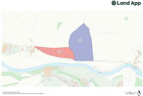
- Lot 1 - Approximately 7.33 acres (2.97 hectares) of pasture/meadow land with road frontage and water.
- Lot 2 - Approximately 16.93 acres (6.85 hectares) of good quality arable land with road frontage
- For sale as a whole or in two lots
Description
Approximately 24.26 acres (9.82 ha) of Grade 2 & 3 pasture and arable land with good road frontage in an accessible location close to Topcliffe.
FOR SALE AS A WHOLE OR IN TWO LOTS
Location - The land is situated to the north of Catton Lane approximately ¼ mile north west of Topcliffe Village and with good access to the A167, which in turn connects to the A61 and A1(M).
Topcliffe is approximately 5 miles south west of Thirsk and 27 miles north west of York and is an attractive village with a
mix of period and more modern properties on the banks of the River Swale. The village has a shop/post office, surgery,
primary school, two public houses (Angel and Swan) and church (St Columba’s) and benefits from excellent road links via the A168 and A167 to the A19 and A1(M). A more extensive range of facilities and amenities are available at
Thirsk.
Description - The land extends to approximately 24.26 acres (9.82 hectares) of pasture/meadow and arable land classified as
Grade 2 & 3 under the DEFRA Land Classification Scheme and is characterised as slowly permeable seasonally
wet slightly acid but base-rich loamy and clayey soils. Topographically, the land varies from being flat to gently
undulating and ranges from 25 metres to 20 metres above sea level. It has good road frontage and can be accessed
directly off Catton Lane.
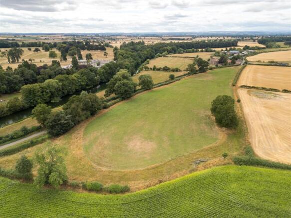
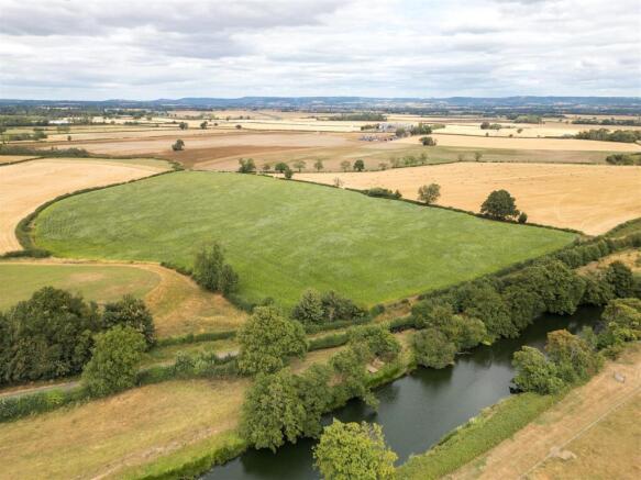
Lot 1 (Field Number 9050) comprises an attractive slightly undulating field extending to approximately 7.33 acres of Grade 3 meadow/pasture land with road frontage and a mains water supply. The land has been mown for hay/
silage and provides good quality grazing. The boundaries are enclosed by a combination of hedges and post and wire
fencing with a number of mature oak, ash and sycamore trees. The land has amenity/lifestyle appeal and offers
equestrian or leisure use potential subject to the necessary planning and statutory consents.
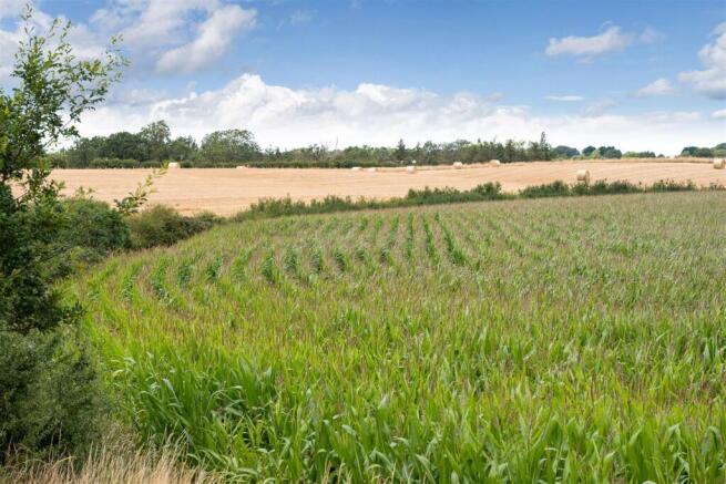
Lot 2 (Field Number 1258) is a Grade 2 arable field of circa 16.93 acres with good road frontage. The field is topographically level and enclosed by hedges and an open ditch (Old Sike) along part of the northern boundary. The
land is currently down to a maize crop but offers versatile cropping and has grown good crops of wheat and barley in
previous years with wheat yields in the order of 4 tonnes per acre.
The land does not fall within a Nitrate Vulnerable Zone (NVZ) but is within the Swale & Ure Drainage Board area
and subject to drainage rates.
General Information - Basic Payment Scheme (BPS) - The land is registered with the Rural Payments Agency although no Basic Payment Scheme (BPS) Entitlements are included within the sale. Any future de-linked payments will be retained by the sellers.
Grants and Schemes - The land is not currently entered into a either a countryside stewardship or Sustainable Farming Incentive (SFI) scheme or any other environmental agreements but offers the opportunity of entering such schemes as well as wider natural capital opportunities such as Biodiversity Net Gain (BNG).
Designations - The land falls outside the Nitrate Vulnerable Zone (NVZ) and we are not aware of any other designations.
Access - Both Lots 1 and 2 have direct access from Catton Lane, an adopted but unclassified road maintained by North
Yorkshire County Council, which connects to the A167.
Drainage Rates - The land lies within the Swale & Ure Internal Drainage Board area and is liable to drainage rates.
Wayleaves, Easements, Rights Of Way - The property is sold subject to and with the benefit of all rights of way whether public or private, rights of water,
light, support, drainage, electricity and other rights and obligations, easements, quasi-easements, restrictive
covenants and all existing and proposed wayleaves whether referred to or not.
A public footpath (Reference number 10.161/6/1) runs along part of the southern boundary of Lot 1 and the entire
southern boundary of Lot 2.
Services - Lot 1 has the benefit of a mains metered water supply with a sub-meter to Salmon Hall. The purchaser will be responsible for the meter on completion of the sale subject to existing supply arrangements to Salmon Hall.
Viewing - The land can be viewed during daylight hours subject to holding a set of the sales particulars and being registered
with the Selling Agents GSC Grays, 5 & 6 Bailey Court, Colburn Business Park, Richmond, DL9 4QL.
T:
E:
Brochures
96528 GSC Grays_Land at Willow Farm.pdfLand at Willow View Farm, Topcliffe

NEAREST STATIONS
Distances are straight line measurements from the centre of the postcode- Thirsk Station3.4 miles
About GSC Grays, Farm Agency
6, 5 Bailey Court, Colburn Business Park, Catterick Garrison, DL9 4QL

Notes
Disclaimer - Property reference 34878202. The information displayed about this property comprises a property advertisement. Rightmove.co.uk makes no warranty as to the accuracy or completeness of the advertisement or any linked or associated information, and Rightmove has no control over the content. This property advertisement does not constitute property particulars. The information is provided and maintained by GSC Grays, Farm Agency. Please contact the selling agent or developer directly to obtain any information which may be available under the terms of The Energy Performance of Buildings (Certificates and Inspections) (England and Wales) Regulations 2007 or the Home Report if in relation to a residential property in Scotland.