
Woolsery, Bideford

- PROPERTY TYPE
Land
- SIZE
2,156,220 sq ft
200,320 sq m
Key features
- Gently Sloping Farm Land
- 49.50 Acres (20.03 Hectares)
- Five Good Sized Fields
- South - East Facing
- For Sale by Private Treaty
- FREEHOLD
Description
Situation - The land is situated in an attractive rural area near to the upper River Torridge Valley, between the villages of Woolsery (Woolfardisworthy) and Bradworthy.
Woolsery lies 2.5 miles to the north and Bradworthy lies 3 miles to the south. There is access to the A39 at Buck's Cross (4.2 miles) and the town of Bideford is 13.5 miles to the north-east.
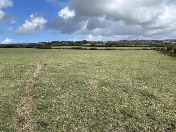
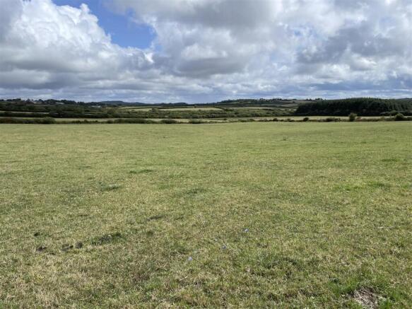
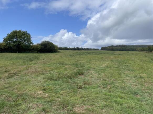
Description - The land comprises a gently sloping block of grass land which has been used for mowing and grazing. The total area is approximately 49.50 acres (20.03 hectares) and there are five good sized fields with views over the surrounding countryside.
The land lies at about 150 metres above sea level and the soils are described as a mixture of freely draining slightly acid loamy soils and slowly permeable seasonally wet acid loamy and clayey soils.
Access - Access to the land from the public highway is via a right of way which leads to the south-eastern corner of the land. The right of way is at all times and for all purposes with and without animals, vehicles and machinery.
Services - There is currently a private water supply to the land which will be discontinued after the completion date. We understand that there is a mains water pipe in the road near to the southern boundary.
Please note that the water troughs are not included in the sale.
Method Of Sale - The land is offered for sale by private treaty and is available as one lot.
Tenure - The land is owned freehold and is registered on the Land Registry. Vacant possession will be available from the completion date.
Land Management - The land is entered into a Sustainable Farming Incentive (SFI) agreement which ends on the 31st March 2027.
Completion Date - The seller would like the sale to complete during April 2027.
Designations - The land is not within a Nitrate Vulnerable Zone (NVZ) and is not within any Sites of Special scientific Interest (SSSI).
Local Authority - Torridge District Council.
Sporting & Mineral Rights - The sporting and mineral rights insofar as they are owned are included with the freehold.
Wayleaves & Rights Of Way - The property is sold subject to and with the benefit of any wayleave agreement and any public or private rights of way that may affect it.
There are no public rights of way passing through the land.
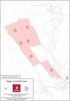
Boundary Plan - A plan which is not to scale, is included with these sale particulars for identification purposes only.
Viewing - Strictly by prior appointment with Stags. Please call or email: .
Directions - From the centre of Woolsery (Woolfardisworthy) proceed south on Lower Town towards Stibb Cross and after 0.45 miles, as the road bears around to the left, turn right signed towards Ashmansworthy. Continue for 1.1 miles and at Claw Cross turn right towards Hole.
Stay on this road for 0.6 miles and the entrance to the land will be on the right (it is the gateway and track on the left side of the entrance).
What3words - /// utensil.embraced.rave
Disclaimer - IMPORTANT: Stags gives notice that: 1. These particulars are a general guide to the description of the property and are not to be relied upon for any purpose. 2. These particulars do not constitute part of an offer or contract. 3. We have not carried out a structural survey and the services, appliances and fittings have not been tested or assessed. Purchasers must satisfy themselves. 4. All photographs, measurements, floorplans and distances referred to are given as a guide only. 5. It should not be assumed that the property has all necessary planning, building regulation or other consents. 6. Whilst we have tried to describe the property as accurately as possible, if there is anything you have particular concerns over or sensitivities to, or would like further information about, please ask prior to arranging a viewing.
Brochures
Woolsery, BidefordWoolsery, Bideford

NEAREST STATIONS
Distances are straight line measurements from the centre of the postcode- Chapleton Station16.5 miles



Notes
Disclaimer - Property reference 34901838. The information displayed about this property comprises a property advertisement. Rightmove.co.uk makes no warranty as to the accuracy or completeness of the advertisement or any linked or associated information, and Rightmove has no control over the content. This property advertisement does not constitute property particulars. The information is provided and maintained by Stags, Bideford. Please contact the selling agent or developer directly to obtain any information which may be available under the terms of The Energy Performance of Buildings (Certificates and Inspections) (England and Wales) Regulations 2007 or the Home Report if in relation to a residential property in Scotland.