
Land North of Frating Road

- PROPERTY TYPE
Plot
- SIZE
Ask agent
Key features
- 204.89 acres (or thereabouts) in total, available in 3 lots or as a whole
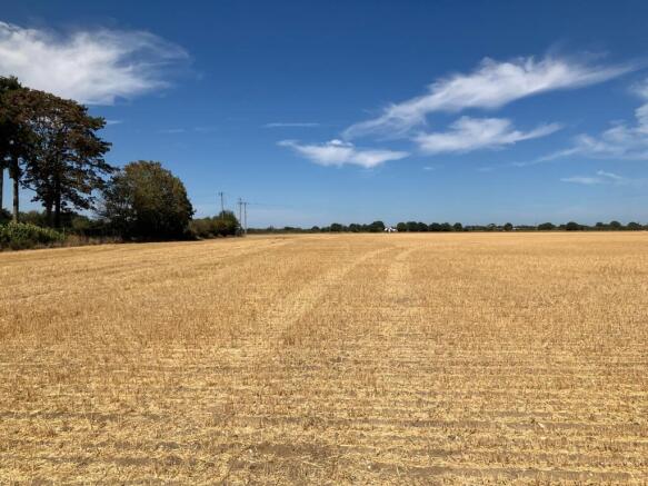
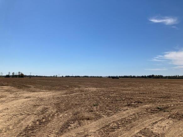
- Prime Grade 1 and 2 arable land
- Water abstraction and pump house with three phase electricity included
- Existing mineral option
- Nissan Hut
Description
Council Tax Band: Exempt (Tendring District Council)
Tenure: Freehold
Description
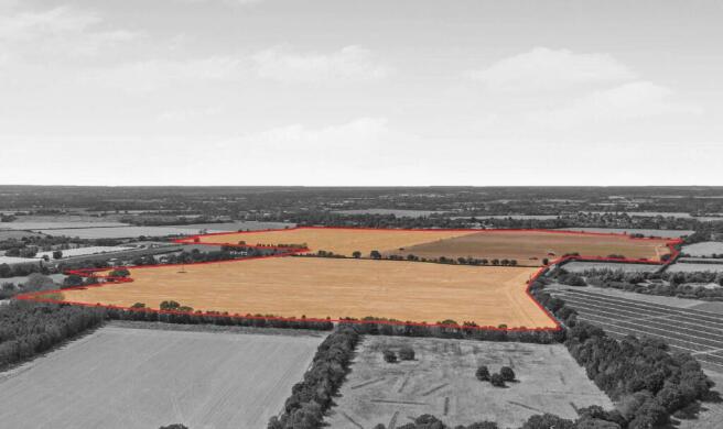
The land is located near Ardleigh, to the north east of Colchester, and comprises approximately 204.89 acres (82.92 hectares) of arable land. Lot 1 totals approximately 95.73 acres (38.74 hectares) and incudes a pump house with three phase electricity and a redundant Nissan Hut constructed of concrete and fibre cement sheeting. Lot 2 totals approximately 48.52 acres (19.63 hectares). Lot 3 totals approximately 60.64 acres (24.54 hectares). Part of Lot 1 and 2 is registered as a Crop Mark Scheduled Monument Site.
The full extent of the property is shown coloured on the attached plan for identification purposes only.
The land is classified as a mixture of Grade 1 and 2 on DEFRA's Land Classification Map. According to the Soil Survey of England and Wales, the land belongs to the Tendring series.
Guide Price
Whole - £2,460,000
Lot 1 - 95.73 acres of Grade 1 and 2 arable land shaded pink on the attached plan for identification purposes. Inclusive of a pump house with three phase electricity, a Nissan Hut and an abstraction licence. Guide Price - £1,200,000.
Lot 2 - 48.52 acres of Grade 1 and 2 arable land shaded green on the attached plan for identification purposes only. Guide Price - £560,000.
Lot 3 - 60.64 acres of Grade 1 arable land shaded blue on the attached plan for identification purposes only. Guide Price - £700,000.
Access
Lots 1 and 3 benefit from access directly off Morrow Lane and Little Bromley Road. Lot 2 benefits from access directly off Frating Road.
Location and Situation
The property is located to the north east of the City of Colchester, on the outskirts of the village of Ardleigh. The land is some 6 miles from the centre of Colchester.
Nearest Postcode: CO7 7NE
What3Words: ///homelands.brands.cage
Method of Sale
The property is offered for sale, as a whole or in 3 lots, by Private Treaty.
Prospective purchasers should register their interest with the selling agent to whom offers should be submitted. Please contact Hugh Wasteney or Emma Chinn at Stanfords on .
Viewings
Should you wish to inspect the land, please register your interest with the agents and inform them of your attendance. Viewing may take place unaccompanied during daylight hours with a set of particulars in hand.
Land Registry
The property is registered with HM Land Registry under title numbers EX847477, EX606337, EX702530.
Tenure, Possession and Holdover
The property is offered for sale with the benefit of vacant possession.
In addition to the purchase price the Purchaser may be required to pay for all growing crops including seeds, fertiliser, sprays applied and cultivations undertaken at the date of completion. Payment must be made at a figure assessed by the Vendor's Agent, based upon CAAV rates, or contractor's rates, where applicable, as well as invoice costs for seed, fertiliser and sprays.
Sporting, Mineral and Timber
To be included in the sale, so far as they are owned. We have been informed by our client that there is a mineral Option Agreement dated 24th March 2009 over Lot 3 and an option for railway sidings over part of Lot 1.
Environmental Schemes
We have been informed that there are no live environmental schemes on the property.
Cropping History
Lot 1 - Winter Wheat (2024), Potatoes (2025), Winter Wheat (2026)
Lot 2 - Winter Wheat (2024), Winter Wheat (2025), Potatoes (2026)
Lot 3 - Potatoes (2024), Winter Wheat (2025), Winter Wheat (2026)
Local Authority
Tendring District Council, Town Hall, Station Road, Clacton-On-Sea, Essex, CO15 1SE
Services
The property does not benefit from any services, and prospective purchasers should make their own enquiries to the availability of services.
Water Abstraction
We are informed that Lot 1 benefits from a water abstraction point. The licence allows for up to 39,000 cubic metres to be abstracted per year.
Planning
All planning enquiries should be directed to Tendring District Council.
Covenants, Rights of Way, Easements and Wayleaves
The land is offered for sale and will be conveyed with the benefit and subject to all covenants, rights of way (whether private or public), water, drainage, sewage, wayleaves and other easements, if any, subject to all outgoings or charges connected with or chargeable upon the land whether mentioned herein or not.
There are several public footpaths running across the land. There are also telegraph poles and overhead wires crossing the land.
There is a possibility that Lot 1 and 3 will be affected by National Grid's proposed Norwich to Tilbury project. The current proposed pylon route runs within the land's northern boundary.
Lots 1 and 3 are subject to intrusive and non-intrusive survey licences between the vendor and National Grid. Both the intrusive and non-intrusive licences run until Spring 2028.
Boundaries, Plans, Areas, Schedule and Disputes
The plans attached to these particulars are based on Ordnance Survey and are for identification purposes only. The purchaser will be deemed to have full knowledge of the boundaries, and any errors or mistakes shall not annul the sale or entitle any party to compensation in respect thereof.
VAT
Any guide price quoted or discussed is exclusive of VAT. In the event that a sale of the property or any party thereof, or any right attached to it under chargeable supply for the purposes of VAT, such tax will be payable in addition.
AML Compliance
In order to comply with current Anti-Money Laundering legislation, once an offer has been accepted (subject to contract) the prospective purchaser(s) will need to provide, as a minimum, proof of identity and residence, together with proof of source of funds for the purchase, before the transaction can proceed.
Sale Particulars Prepared August 2026.
Brochures
BrochureLand North of Frating Road

NEAREST STATIONS
Distances are straight line measurements from the centre of the postcode- Manningtree Station3.2 miles
- Hythe Station3.5 miles
- Colchester Town Station4.2 miles

About Stanfords, Colchester
The Livestock Market Wyncolls Road, Severalls Industrial Park, Colchester, CO4 9HUNotes
Disclaimer - Property reference RS0043. The information displayed about this property comprises a property advertisement. Rightmove.co.uk makes no warranty as to the accuracy or completeness of the advertisement or any linked or associated information, and Rightmove has no control over the content. This property advertisement does not constitute property particulars. The information is provided and maintained by Stanfords, Colchester. Please contact the selling agent or developer directly to obtain any information which may be available under the terms of The Energy Performance of Buildings (Certificates and Inspections) (England and Wales) Regulations 2007 or the Home Report if in relation to a residential property in Scotland.