Nursery Lane, Quadring PE11 4GP
Business rates & charges may apply

- SIZE
Ask agent
- SECTOR
Land for sale
Description
LOCATION
The plots are situated on Nursery Lane, in the village of Quadring, and being therefore being within walking distance of the Shop, Village Hall and playing field. A Primary School is located in the village, and the nearby villages of Gosberton and Donington have more extensive shopping facilities and a Secondary school. Further shopping facilities and Secondary Schools are located in the nearby Market town of Spalding (8 miles). The population for Spalding is approximately 29,000 and the District of South Holland has a population of around 90,000 people (2013 figures from South Holland District Council´s website).
Quadring lies on the A152, and therefore has good access to the A16 and A17. Kings Lynn is 40 miles, and beyond to the north Norfolk coastal resorts. Spalding Train station connects to Peterborough and onwards fast train journeys are then available to London´s Kings Cross (within 50 minutes). Spalding station also connects to Lincoln.
DESCRIPTION
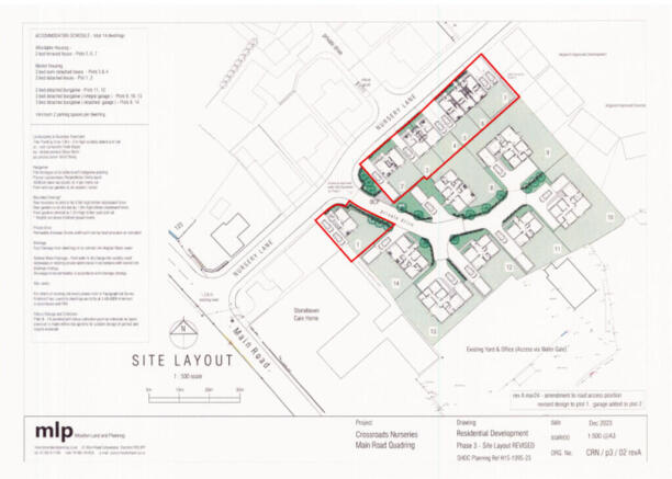
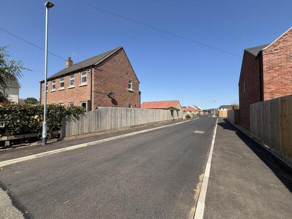
The 7 plots extend along the first part of the Nursery Lane site, as shown edged red on the plans included in these Particulars (for identification purposes only). At the present time the site is part of a Nursery, with glasshouses having been cleared. The site is presently behind Hoarding.
SERVICES
SERVICES
It is understood that mains electricity, gas, water and foul drainage are available in Nursery Road, for easy connection, and there is a manhole in the private road spur, which leads to the land at the rear. However, neither the Vendors nor the Agents make any guarantees as to the availability of services and interested parties must make their own enquiries direct with the service providers concerned as to the availability, practicality and cost of providing all necessary services to the site as required.
PLANNING
Prospective purchasers´ attention is drawn to the various conditions attached to the Planning Consents and the purchaser will be responsible for all costs associated with fulfilling such conditions. A copy of the formal Planning Consent is available from the Council´s website: or from the Agent´s Spalding Office. Included in these Particulars is a copy of the plan determined in the Full planning application. Any queries in respect of planning matters should be addressed direct to the Planning Department at South Holland District Council - CALL: .
PLANNING CONSIDERATIONS
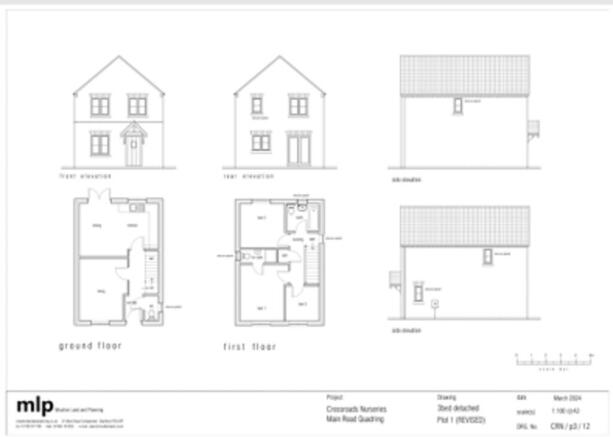
Full Planning Consent was granted by South Holland District Council - Reference No: H15-1095-23 for the development of the 7 frontage plots, along with 7 plots at the rear, and the plans included show the frontage plots as being developed for 2 detached 3 bed houses, a pair of 3 bed semi-detached houses, and a terrace of two bedroom houses, all with car parking spaces. A Condition compliance approval was granted for all conditions, under application H15-0335-24. Dropped kerbs are installed to all plots and a foul drainage manhole is installed, in readiness for connections to plots 1 and 2. Building Regulation approval has been obtained for the 7 frontage plots - ref B15-0482-25, with ASHP systems.
OTHER
Freehold with vacant possession upon completion.
LOCAL AUTHORITIES
District & Planning: South Holland District Council, Council Offices, Priory Road, Spalding, Lincolnshire PE11 2XE
CALL:
Water & Sewerage: Anglian Water Customer Services, PO Box 10642, Harlow, Essex, CM20 9HA
CALL:
County & Highways: Lincolnshire County Council, County Offices, Newland, Lincoln LN1 1YL
CALL:
Electricity: National Grid - New Supplies - Customer Application Team, Tollend Road, Tipton, DY4 0HH
COVENANTS
The Vendor is retaining ownership of the Private Drive running between plots 1 and 2, which will be sold with the rear land. The vendor reserves the rights for drainage and services across the site for the benefit of their retained property.
An electricity cable runs across a part of Plot 1, which will be required to relocated by the purchaser for the development of that plot.
INFORMATION PACK
Details of the following documents are available upon request: CALL - / EMAIL -
- Plans associated with the Planning Applications
- Planning Consents
- Design and Access Statement
- Flood Risk Assessment
VIEWING
By prior appointment, as although the plots are behind hoardings on Nursery Lane, access for viewing the site is from Water Gate.
NB: The site is uneven in part with differing ground levels and parties view the site at their own risk. Neither the Vendors nor the Agents accept any liability for any damage to persons or property by virtue of viewing the site.
Brochures
Nursery Lane, Quadring PE11 4GP

NEAREST STATIONS
Distances are straight line measurements from the centre of the postcode- Swineshead Station6.0 miles
Notes
Disclaimer - Property reference 101505033234. The information displayed about this property comprises a property advertisement. Rightmove.co.uk makes no warranty as to the accuracy or completeness of the advertisement or any linked or associated information, and Rightmove has no control over the content. This property advertisement does not constitute property particulars. The information is provided and maintained by Longstaff Chartered Surveyors, Spalding. Please contact the selling agent or developer directly to obtain any information which may be available under the terms of The Energy Performance of Buildings (Certificates and Inspections) (England and Wales) Regulations 2007 or the Home Report if in relation to a residential property in Scotland.