Land and Stone Building at Sarn Hir

- PROPERTY TYPE
Farm Land
- SIZE
Ask agent
Key features
- Beautiful Countryside Views
- Stone Outbuilding
- Planning Potential subject to planning permission
- Productive Level Pastureland
- Ring Fenced Block of Land
- Direct Road Frontage and Access
Description
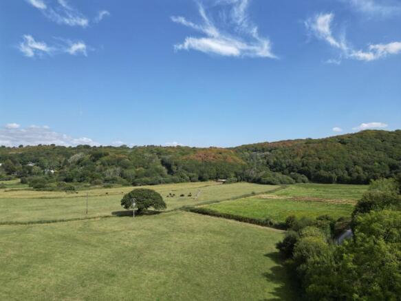
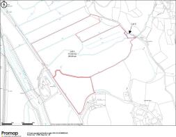
The attractive block of land extends to approximately 27.5 acres (11.12 hectares) of productive pastureland, enclosed by mature hedgerows, tree-lined boundaries and well-maintained drainage ditches. The land is divided into five conveniently sized paddocks, providing flexibility for grazing and agricultural management. The holding is classified as Subgrade 3b Agricultural Land, categorised as moderate quality agricultural land.
The soils comprise loamy and clayey floodplain soils with naturally high groundwater levels. A public footpath crosses two of the northern fields. The land lies within Eryri (Snowdonia) National Park and is identified as being at high risk of fluvial flooding. The holding benefits from direct frontage and access onto the A496, with several field gateways providing convenient access throughout the landholding.
Lot 2
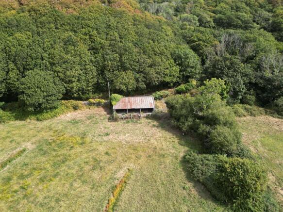
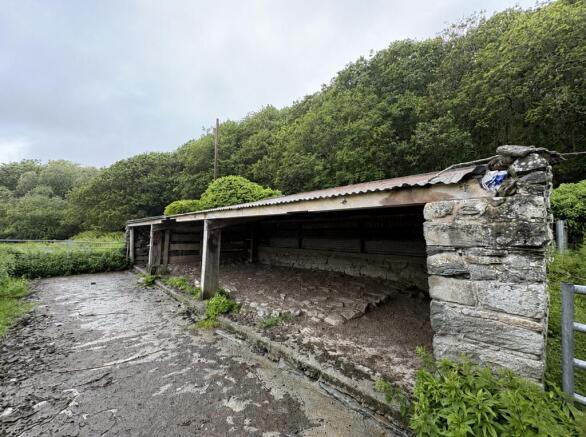
Situated on the western side of the holding is a former cow shippen constructed of traditional stone, timber framed under a roof with corrugated sheet covering, 6m by 20m. The building is fronted by a concrete apron and is enclosed within a fenced curtilage comprising timber posts and stock-proof fencing, together with a grassed area. Access to the building is available directly from the council-maintained highway onto which it fronts. Occupying an attractive rural setting with direct highway access, the traditional stone building presents an excellent opportunity for purchasers seeking a conversion or development project, subject to all necessary planning permissions, statutory consents and purchasers making their own enquiries.
For further information please view the property brochure. To obtain a tender form, please contact the Bala office on: .
Tenure: Freehold
Restrictions: Conservation area
Rights & easements: Public right of way
Brochures
BrochureLand and Stone Building at Sarn Hir

NEAREST STATIONS
Distances are straight line measurements from the centre of the postcode- Llanbedr Station0.4 miles
- Pensarn Station0.5 miles
- Llandanwg Station1.1 miles
Notes
Disclaimer - Property reference RS0250. The information displayed about this property comprises a property advertisement. Rightmove.co.uk makes no warranty as to the accuracy or completeness of the advertisement or any linked or associated information, and Rightmove has no control over the content. This property advertisement does not constitute property particulars. The information is provided and maintained by RG Jones, Bala. Please contact the selling agent or developer directly to obtain any information which may be available under the terms of The Energy Performance of Buildings (Certificates and Inspections) (England and Wales) Regulations 2007 or the Home Report if in relation to a residential property in Scotland.