Land off Northampton Road, Blisworth

- PROPERTY TYPE
Farm
- SIZE
Ask agent
Description
offered as two separate lots.
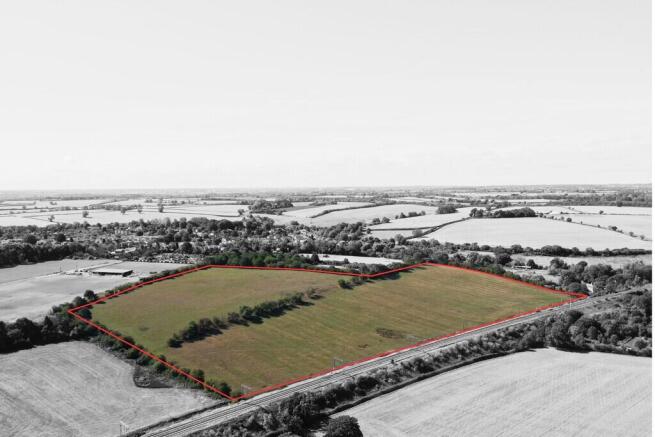
Parcel 1 comprises the northern part of the property and extends to approximately 14.02 acres (5.67 hectares). The land slopes gently eastwards before becoming more level
towards the eastern boundary. The parcel also benefits from a small pond.
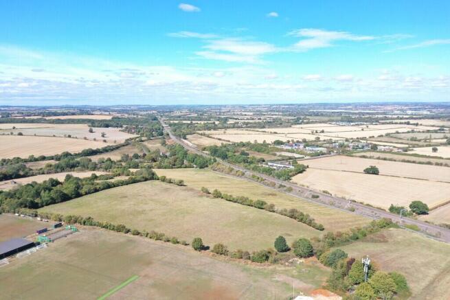
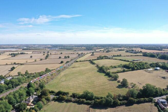
Parcel 2 extends to approximately 8.22 acres (3.33 hectares) and is generally level in topography. The boundaries of the property as a whole are formed by a combination of mature hedgerows, established trees and post-and-wire fencing, with palisade fencing forming the northern boundary.
The land has predominantly been used for sheep grazing in recent years and is well suited to continued livestock use. Given its location and characteristics, the property may also
offer potential for amenity or other non-agricultural uses, subject to the necessary planning and other consents.
The principal access to the property is via an existing agricultural access directly onto Northampton Road. The property also benefits from a right of way from Northampton
Road within the village, the route of which is shown on the plan at the rear of this brochure.
The land is classified as Grade 3 under the Agricultural Land Classification Maps of England and Wales.
The soils are identified as belonging to the Banbury Association in accordance with the Soil Survey of England and Wales. These are generally described as well-drained,
brashy, fine and coarse loamy soils over ironstone, which are suitable for agricultural and livestock uses.
EASEMENTS, WAYLEAVES AND RIGHTS OF WAY
The property is sold subject to and with the benefit of all existing wayleaves, easements and rights of way, whether public or private, light, sport, drainage, water, electricity supplies and any other rights, obligations, easements and quasi-easements, whether specifically mentioned or not.
Parcel one is subject to an oil pipeline running across the north-eastern corner of the land; a plan of this and the lease can be requested from the selling agents.
If the land was disposed of as two lots, a right of access from the agricultural access from Northampton Road would be reserved over Lot 1 to serve Lot 2.
METHOD OF SALE
The property is offered for sale by Private Treaty as a whole or in two lots, and is shown edged red on the attached plan.
TENURE AND POSSESSION
The property is offered for sale freehold with the benefit of vacant possession upon completion.
SERVICES
There are currently no services connected to the property.
PLANNING AND LOCAL AUTHORITY
The property is located within the administrative boundaries of West Northamptonshire Council
SPORTING, TIMBER AND MINERAL RIGHTS
We understand that the mineral and timber rights are included in the freehold sale, insofar as they are owned
ENVIRONMENTAL SCHEMES
We understand that the property is not entered into any agri-environmental schemes.
FLOOD ZONE
The property is located entirely in Flood Zone 1
OVERAGE
The Vendors' preference is to retain 30% of any uplift in value if planning permission is obtained for a development or change of use from agricultural 30 years after completion of the sale. If applied, the overage payment will be triggered upon disposal of land with the benefit of planning permission or implementation of planning permission. The Vendors will consider offers with and without an overage provision.
PLANS, AREAS AND SCHEDULES
Plans included or attached to these particulars are based upon the Ordnance Survey Maps, copyright reserved. All plans are not to scale.
VIEWINGS
Viewings of the property or rights attached must be undertaken in daylight hours, on foot only, with a set of these particulars in hand.
NEAREST POSTCODE
The nearest postcode is NN7 3DN and the property can be found more precisely using the what3words mapping system reference of ///crouches.foggy.quite
HEALTH AND SAFETY
We ask you to be as vigilant as possible when making your inspection, for your own personal safety. It is asked that you observe any specific signage on the property.
MEASUREMENTS AND OTHER INFORMATION
All measurements are approximate. While we endeavour to make our Sales Particulars accurate and reliable, if there is a point which is of particular importance, please do contact Bletsoes, who will be pleased to check the information for you, particularly if you are contemplating travelling some distance to view the property. Particulars prepared and photographs taken in September 2026.
Brochures
BrochureLand off Northampton Road, Blisworth

NEAREST STATIONS
Distances are straight line measurements from the centre of the postcode- Northampton Station4.2 miles
- Wellingborough Station13.9 miles


Notes
Disclaimer - Property reference 100064003500. The information displayed about this property comprises a property advertisement. Rightmove.co.uk makes no warranty as to the accuracy or completeness of the advertisement or any linked or associated information, and Rightmove has no control over the content. This property advertisement does not constitute property particulars. The information is provided and maintained by Bletsoes, Thrapston. Please contact the selling agent or developer directly to obtain any information which may be available under the terms of The Energy Performance of Buildings (Certificates and Inspections) (England and Wales) Regulations 2007 or the Home Report if in relation to a residential property in Scotland.