Watling Street, Lutterworth

- PROPERTY TYPE
Land
- SIZE
Ask agent
Key features
- Two Parcels of Freehold Land
- Approx 1.3 Acres in Total
- Road Frontage Along A5
- One Parcel Embankment with Shrubs and Trees
- Second Parcel Woodland
- Semi-Rural Location with Adjacant Commercial uses
Description
Location
The land occupies a semi-rural position adjoining Watling Street (A5), approximately 0.2 miles north of its junction with Shawell Lane, close to the village of Shawell and to the south-west of Lutterworth.
The immediate surroundings comprise a mixture of uses, including residential properties, commercial and industrial premises with associated yard and storage areas, together with woodland, agricultural land and open countryside. The land is also situated close to the route of the former Great Central Railway, part of which now forms the Great Central Walk.
Watling Street (A5) provides convenient road connections towards Rugby, Lutterworth and the wider regional motorway network.
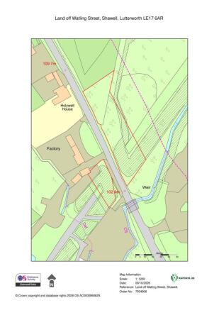
The two areas of land are situated in close proximity to one another and are offered for sale together as a single lot.
Description
The property comprises two areas of freehold land extending in total to approximately 0.53 hectares (1.30 acres), situated adjoining Watling Street (A5) and offered for sale together as a single lot.
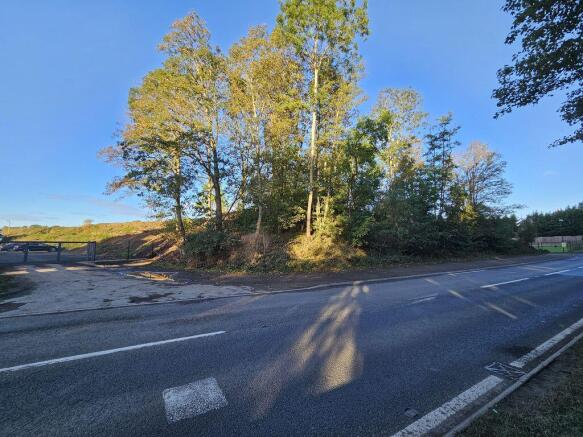
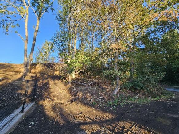
The land is of an irregular configuration and comprises two distinctly different areas. One consists principally of established woodland with mature trees and natural vegetation, whilst the other comprises a former embankment, with sloping and uneven ground supporting established trees, shrubs and undergrowth.
The land occupies a predominantly natural and unmanaged setting, with adjoining uses including commercial premises, associated yard areas and residential properties.
The property is held under two registered freehold titles, WK450041 and WK445468.
The land is offered for sale as seen, and interested parties are advised to satisfy themselves regarding the precise boundaries, rights of access, physical condition and suitability for their intended use.
Planning & Restrictions
The land falls within the administrative area of Rugby Borough Council, which is the relevant local planning authority. We have not been provided with details of any planning permissions relating to the development of the land. Prospective purchasers should make their own enquiries with the local planning authority regarding the planning designation of the land and its suitability for any proposed use or development.
Brochures
Property BrochureFull DetailsWatling Street, Lutterworth

NEAREST STATIONS
Distances are straight line measurements from the centre of the postcode- Rugby Station2.6 miles
About Cottons, Edgbaston
Cavendish House, 359-361 Hagley Road, Edgbaston, Birmingham, B17 8DL

Notes
Disclaimer - Property reference 12918121. The information displayed about this property comprises a property advertisement. Rightmove.co.uk makes no warranty as to the accuracy or completeness of the advertisement or any linked or associated information, and Rightmove has no control over the content. This property advertisement does not constitute property particulars. The information is provided and maintained by Cottons, Edgbaston. Please contact the selling agent or developer directly to obtain any information which may be available under the terms of The Energy Performance of Buildings (Certificates and Inspections) (England and Wales) Regulations 2007 or the Home Report if in relation to a residential property in Scotland.