
Notting Hill Way, Lower Weare, Axbridge, Somerset, BS26

- PROPERTY TYPE
Land
- SIZE
1,147,370 sq ft
106,594 sq m
Description
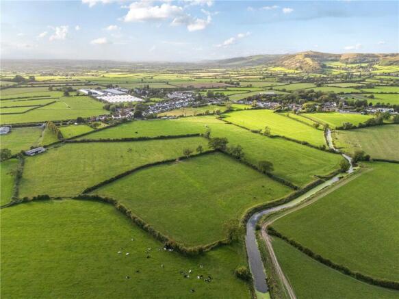
A parcel of 26.34 acres of pastureland together with a modern farm building.
For sale by private treaty as a whole.
Location
The land is located close to the village of Lower Weare within easy reach of the A38 between Axbridge and Cheddar and Junction 22 of the M5 Motorway.
Property
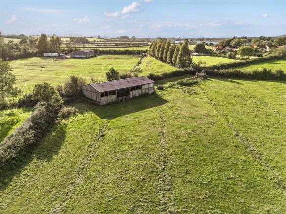
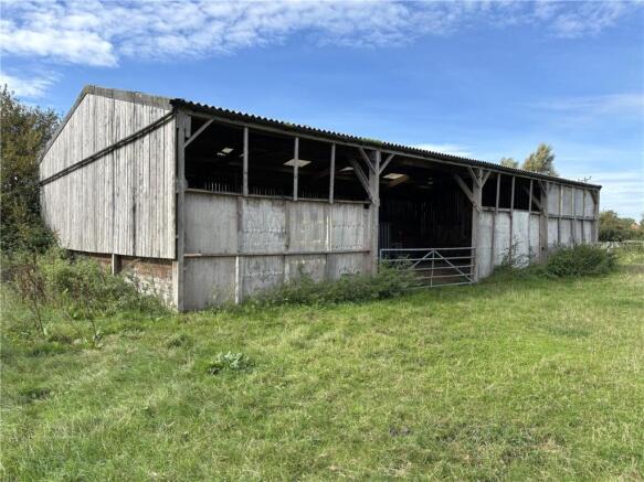
The property comprises a level parcel of pastureland totalling 26.34 acres together with a timber framed farm building and with the benefit of mains water connected.
The land is divided between four main field enclosures. Access is available via a stone track leading from Notting Hill Way, which runs along the western boundary. The eastern boundary of the land comprises the River Axe.
The farm building comprises a four bay timber framed machinery and fodder store with timber clad elevations under a fibre cement roof. The building measures 60’ x 30’.
Method of Sale
The property is offered for sale by private treaty with a guide price of £350,000.
Tenure and Possession
The freehold of the property is offered for sale. Vacant possession is available from 15th March 2027.
Services
The property is serviced by a mains water supply.
Wayleaves Easements & Rights of Way
There is a right of access over the track for the neighbouring property to the south and via the track and along the southern/western boundary of field 9546 to the north/west.
Health and Safety
Potential purchasers should take particular care when inspecting the land, being conscious of sudden movements from livestock which may be present and machinery which may be operating at the time of inspection, as well as uneven, steep and slippery ground conditions. Potential purchasers should also be mindful of the open water along the eastern boundary when inspecting the land and not venture too close to the River Axe.
Local Authorities
Somerset Council (formerly Sedgemoor District Council)
Viewings
Viewings are by appointment only. Please
contact the vendor’s selling agents, Carter
Jonas, on to arrange a time
to view the property.
Directions
From Junction 22 of the M5 motorway, take the A38 exit to Burnham-on-Sea/Highbridge. At the next roundabout, take the third exit onto Bristol Road/the A38. At East Brent Roundabout, take the second exit and stay on Bristol Road/the A38. After about four miles, turn right signed Stone Allerton/Wedmore/Chapel Allerton/Weare/Wedmore Golf Club. Follow Notting Hill Way for about half a mile and the entrance to the land will be found on the left-hand side, between the last of the houses in the village and Weare Academy First School.
What Three Words
Siesta.travel.satellite
Brochures
ParticularsNotting Hill Way, Lower Weare, Axbridge, Somerset, BS26

NEAREST STATIONS
Distances are straight line measurements from the centre of the postcode- Weston Milton Station6.4 miles

Notes
Disclaimer - Property reference TAU260072. The information displayed about this property comprises a property advertisement. Rightmove.co.uk makes no warranty as to the accuracy or completeness of the advertisement or any linked or associated information, and Rightmove has no control over the content. This property advertisement does not constitute property particulars. The information is provided and maintained by Carter Jonas Rural, Taunton. Please contact the selling agent or developer directly to obtain any information which may be available under the terms of The Energy Performance of Buildings (Certificates and Inspections) (England and Wales) Regulations 2007 or the Home Report if in relation to a residential property in Scotland.