
Claypole, Newark, Nottinghamshire, NG23

- PROPERTY TYPE
Land
- SIZE
251,777 sq ft
23,391 sq m
Key features
- Good roadside access
- Fenced boundaries
- Land lies on the outskirts of the sought after village of Claypole
- Potential for a variety of uses
- The land extends to 5.78 acres
- (2.33 hectares)
Description
Description
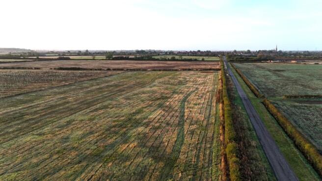
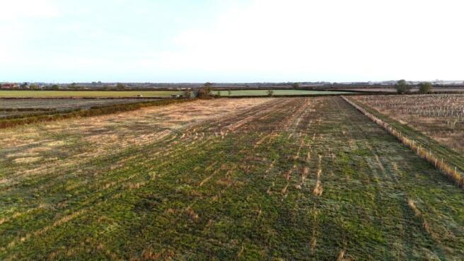
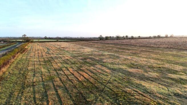
A parcel of amenity land located at Claypole, suitable for a variety of uses. The parcel benefits from good access from the public road. The land is located in a secluded and rural area offering a great degree of privacy for those wanting to enjoy the countryside The land is for sale as a whole by private treaty.
The property extends in total to approximately 5.78 acres(2.33 hectares), the land is classified as grade 3 on the agricultural land classification maps. The Soil Survey of England and Wales identifies the soil as being are part of ‘Evesham 1’ series. Historically the land has been farmed with arable crops.
The land lies flat and is bordered by mature hedgerows and new fencing. The land would suit a variety of uses ranging from equestrian to amenity use, with wildflower mixes being drilled over spring 2025. Native hedges have been planted enhancing the area for wildlife and fauna.
The land has access directly from Barnby Lane.
ALTERNATIVE INCOME STREAM OPPORTUNITIES There are a number of potential alternative income opportunities that purchasers can look to explore.
BIODIVERSITY NET GAIN A BNG survey was undertaken in Feb 2024 and is available on request.
SUSTAINABLE FARMING INCENTIVE A SFI agreement is in place generating an annual income. The land is designated as flower rich grassland and attract a payment of £798/ha/yr. On the sale of the land the current SFI agreement will have to be ended but a new agreement on similar or better terms could potentially applied for subject to meeting specific criteria. A copy of the current agreement is available on request.
Location
The land is located on the outskirts of the sought after village of Claypole which benefits from a public house, village shop, butchers and coffee shop. Newark on Trent is to north west, has a wide range of amenities and lies on the main East Coast Mainline with regular trains to London Kings Cross taking approximately from 1 hour 15 minutes. The A1 lies 4 miles to west and provides access to the wider UK road network.
Disclaimer: All journey times and distances are approximate.
Acreage: 5.78 Acres
Directions
Nearest Postcode NG23 5AS
what3words ///repayment.courtyard.storeroom
Additional Info
Any development requiring planning permission will not be permitted as the land is intended for agricultural, amenity or enhancing biodiversity purpose only.
Services: The selling agents are not aware of any services connected to the land. We understand services run along the public highway.
Local Authority: South Kesteven District Council
Photographs and particulars: October 2026.
Brochures
Web DetailsClaypole, Newark, Nottinghamshire, NG23

NEAREST STATIONS
Distances are straight line measurements from the centre of the postcode- Newark North Gate Station4.2 miles
- Newark Castle Station4.7 miles
- Elton & Orston Station8.2 miles
Notes
Disclaimer - Property reference LIR240090. The information displayed about this property comprises a property advertisement. Rightmove.co.uk makes no warranty as to the accuracy or completeness of the advertisement or any linked or associated information, and Rightmove has no control over the content. This property advertisement does not constitute property particulars. The information is provided and maintained by Savills Rural Sales, Lincoln. Please contact the selling agent or developer directly to obtain any information which may be available under the terms of The Energy Performance of Buildings (Certificates and Inspections) (England and Wales) Regulations 2007 or the Home Report if in relation to a residential property in Scotland.