
Church Lane, Barnham, Bognor Regis, West Sussex, PO22

- PROPERTY TYPE
Land
- SIZE
12,428,975 sq ft
1,154,691 sq m
Key features
- A ring-fenced block of predominantly arable land
- A valuable core of high-quality Grade 1 cropping land
- Commercially sized fields with a good network of internal tracks and access from Church Lane
- Countryside Stewardship features including winter bird food, nesting areas and floral margins
- Approximately 285.33 acres (115.47 hectares) in total
Description
Description
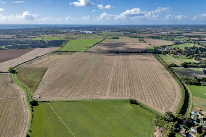
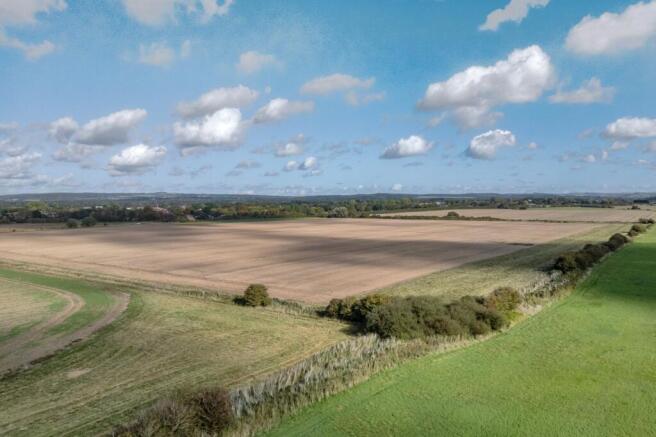
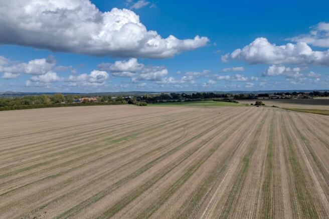
Brook Lane Farm comprises a ring-fenced block of predominantly arable land situated to the south of the village of Barnham, approximately eight miles east of Chichester.
With access from Church Lane, the fields are of a commercial nature and size, with a good network of internal tracks providing excellent connectivity and convenient access throughout the holding.
Extending to around 285.33 acres (115.47 hectares) in all, the farm includes a valuable core of high-quality Grade 1 cropping land, complemented by areas of Grade 2 and Grade 3 land. The latter have mostly been incorporated into Countryside Stewardship, with winter bird food areas, nesting areas and several floral margins providing environmental and biodiversity benefits alongside the productive farming operation. The arable ground is approximately 213.03 acres (86.22 hectares).
The Lidsey Rife runs along parts of the southern and eastern boundaries of the holding, forming a distinctive landscape and watercourse feature within the wider farmland setting, and adding further environmental interest.
These established stewardship features enhance the ecological interest and landscape character of the farm, providing valuable habitats and food sources for farmland wildlife. Brook Lane Farm therefore offers an appealing balance of versatile and productive arable land with meaningful environmental provision, all contained within a single cohesive holding.
Published soil mapping indicates predominantly deep, medium to light silty soils with a sand-to-loam texture, associated with river loam parent material. Parts of the holding are also shown as having clay-to-sandy loam soils, over marine and estuarine sand and silt, corresponding broadly with the areas entered into Countryside Stewardship and providing a varied soil profile across the farm.
The arable land is being farmed under a Contract Farming Agreement, while the remainder has been retained in hand, benefiting from income generated through the Countryside Stewardship scheme.
General Remarks
METHOD OF SALE
The freehold property is offered for sale by private treaty as a whole.
TENURE AND POSSESSION
The tenure of the property is freehold.
The arable land is farmed under a contract farming agreement and, therefore, vacant possession is available subject to the terms of the CFA, details of which are available from the vendor’s agent.
PLANS, AREAS AND SCHEDULES
The plans and associated acreages have been prepared for illustrative purposes, and their accuracy cannot be guaranteed.
LOCAL AUTHORITIES
Arun District Council:
West Sussex County Council:
STATUTORY DESIGNATIONS
A small area at the entrance off Church Lane lies within the Barnham (Church Lane) Conservation Area, designated for its special architectural and historic interest.
MINERALS, SPORTING AND TIMBER RIGHTS
The minerals, sporting and timber rights, so far as they are owned are included in the sale.
EASEMENTS, COVENANTS, RIGHTS OF WAY AND
RESTRICTIONS
The property is sold subject to and with the benefit of all rights, including rights of way, whether public or private, light, support, drainage, water and electricity supplies and other rights and obligations, easements and quasi easements and restrictive covenants and all existing and proposed wayleaves, masts, pylons, stays, cables, drains and water, gas and other pipe whether referred to in the particulars or not.
VAT
In the event that the sale of the property, or part of it or any right attached to it, becomes chargeable for the purposes of VAT, such tax will be payable.
Acreage: 285.33 Acres
Directions
POSTCODE
PO22 0BP
WHAT3WORDS (BEST FOR DIRECTIONS)
///supply.test.storms
Brochures
Web DetailsChurch Lane, Barnham, Bognor Regis, West Sussex, PO22

NEAREST STATIONS
Distances are straight line measurements from the centre of the postcode- Barnham Station0.9 miles
- Bognor Regis Station2.6 miles
- Ford Station3.1 miles
Notes
Disclaimer - Property reference MRU260037. The information displayed about this property comprises a property advertisement. Rightmove.co.uk makes no warranty as to the accuracy or completeness of the advertisement or any linked or associated information, and Rightmove has no control over the content. This property advertisement does not constitute property particulars. The information is provided and maintained by Savills Rural Sales, Sevenoaks. Please contact the selling agent or developer directly to obtain any information which may be available under the terms of The Energy Performance of Buildings (Certificates and Inspections) (England and Wales) Regulations 2007 or the Home Report if in relation to a residential property in Scotland.