Warren Road

- PROPERTY TYPE
Land
- SIZE
231,304 sq ft
21,489 sq m
Key features
- Approximately 5.31 acres (2.14 hectares)
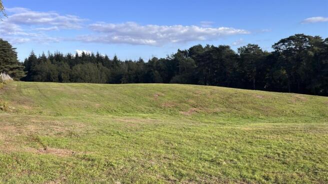
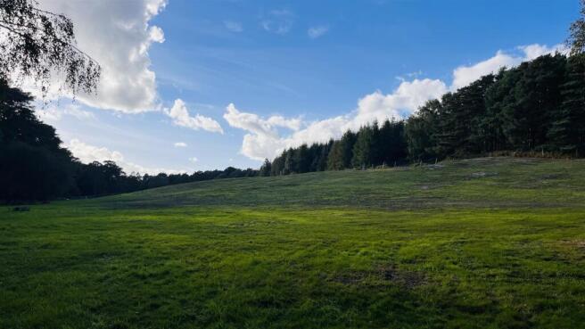
- Pasture land within the South Downs National Park
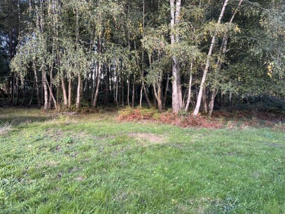
- Small area of woodland along eastern boundary
Description
Description - The land is gently undulating across a south facing slope and it is currently used for, and ideally suited to, equestrian purposes – with superb riding opportunities across Longmoor which adjoins the property and beyond. However, subject to obtaining the necessary consents the land would also suit a range of other alternative uses.
The Land at Warren Road is located immediately to the east of Liss Forest, a hamlet of Liss which is 1.4 miles to the south and the town of Petersfield, offering a wide range of services, is 6.7 miles to the south.
Transport connections are excellent with the A3 trunk road providing access to London and the South Coast just 1.8 miles to the east. The area benefits from close proximity to several highly regarded state and private schools including Bedales, Churcher’s, Highfield and The Alton School.
Access - There is vehicular access from Warren Road.
What3words: ///dishing.firming.skidding
Services - There is a metered water connection and pipe from the road that is currently not connected.
Boundaries - Purchasers will be responsible for all boundary fences.
Tenure With Possession - Freehold with vacant possession will be given upon completion.
Rights And Easements - The Property is sold with benefits of and subject to all Rights of Way and other easements and rights of a similar nature which exist, whether mentioned in these particulars or not.
Overage - The land is offered for sale subject to an Overage Provision of 30% of the uplift in value as a result of any purchaser, or their successors in title, obtaining planning permission for change of use of the land at anytime in the next 30 years
Designations - The land is situated in the South Downs National Park. Part of the land is designated as a SINC (Site of Importance for Nature Conservation).
Local Authority - Hampshire County Council (
South Downs National Park (
Viewings - Viewings strictly by appointment only with a copy of particulars in hand.
Contact - Shannon Wateridge, BCM Wilson Hill, Winchester Office.
t e
NB: These Particulars are as at October 2026.
Directions - From Petersfield follow the A3 north and just beyond Liss, at the Ham Barn roundabout take the first exit onto Farnham Road. Follow the road for 3/4 of a mile then turn right off Farnham Road on to Forest Road (at Greatham Old Church) towards Liss Forest. Follow Forest Road for approximately 1 mile then turn left onto Warren Road. Proceed along Warren Road and the land is on your left hand side as you leave the hamlet of Liss Forest.
Brochures
Land at Warren Road - revised 2026.pdfWarren Road

NEAREST STATIONS
Distances are straight line measurements from the centre of the postcode- Liss Station1.0 miles
- Liphook Station3.6 miles
- Petersfield Station4.3 miles
About BCM Wilson Hill, Winchester
The Old Dairy, Winchester Hill, Sutton Scotney, Winchester, Hampshire, SO21 3NZ


Notes
Disclaimer - Property reference 34994475. The information displayed about this property comprises a property advertisement. Rightmove.co.uk makes no warranty as to the accuracy or completeness of the advertisement or any linked or associated information, and Rightmove has no control over the content. This property advertisement does not constitute property particulars. The information is provided and maintained by BCM Wilson Hill, Winchester. Please contact the selling agent or developer directly to obtain any information which may be available under the terms of The Energy Performance of Buildings (Certificates and Inspections) (England and Wales) Regulations 2007 or the Home Report if in relation to a residential property in Scotland.