Wadebridge

- PROPERTY TYPE
Land
- SIZE
Ask agent
Key features
- 3.09 acres of agricultrual land
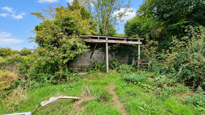
- Derelict agricultural building
Description
The Land
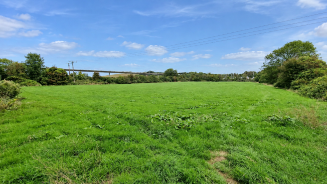
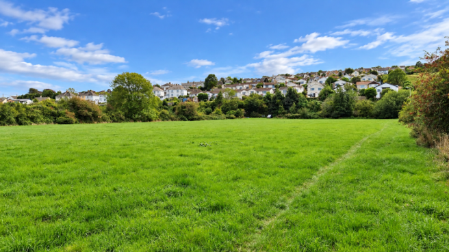
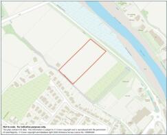
Situated approximately ¼ mile west of Wadebridge town centre and is accessed off Piggy Lane via a set of galvanised gates and borders the Camel Trail.
The land is laid to pasture, bounded in the main with traditional Cornish hedge banks with mature hedges, providing shelter and shade. The land has been more recently been used to produce forage crops but could be used for agricultural purposes, horse grazing or horticultural purposes.
Within the corner of the field lies an open-fronted barn (6.7m x 4.5m) with stone walls on three sides, in a poor state of repair.
Property Information
Services
No Services are connected to the land. Interested parties are advised to make their own enquiries to the relevant service providers.
Wayleaves, Easements & Rights of Way
The sale will be subject to and with the benefit of all wayleaves, easements and rights of way as may exist.
Particulars & Plan
Whilst every care is taken in the preparation of these particulars, their accuracy is not guaranteed and they do not constitute any part of an offer or contract. Any intending purchaser/s must satisfy themselves by inspection or otherwise as to the correctness of these particulars.
Location
The land lies on the edge of the old market town of Wadebridge, at the head of the Camel Estuary. Once an important town associated with the maritime trade, it is still a busy town to this day. Its vibrant community is centred on the many and varied shops and businesses within the heart of this town which include well supported businesses and an industrial park. The town straddles the River Camel and the A39 so the villages and towns of Rock, Polzeath, Port Isaac and Bude are nearby. From Wadebridge, one can enjoy easy access onto the former Padstow to Bodmin railway line, now a hugely popular cycle and footpath known as the Camel Trail.
Viewing & Directions
Viewers may access the land for viewing purposes with sale particulars in hand, during daylight hours adhering to the Countryside Code. Please notify the agents Lodge & Thomas of your intended visit. Tel: Email:
Directions: From Goldsworthy Way, follow signs to Piggy Lane Car Park. Before the car park entrance, keep straight ahead and the field gate is located 200m on the right.
what3words///film.slap.requiring
Brochures
Brochure 1Wadebridge

NEAREST STATIONS
Distances are straight line measurements from the centre of the postcode- Taynuilt Station409.2 miles


Notes
Disclaimer - Property reference LAT221725. The information displayed about this property comprises a property advertisement. Rightmove.co.uk makes no warranty as to the accuracy or completeness of the advertisement or any linked or associated information, and Rightmove has no control over the content. This property advertisement does not constitute property particulars. The information is provided and maintained by Lodge & Thomas, Truro. Please contact the selling agent or developer directly to obtain any information which may be available under the terms of The Energy Performance of Buildings (Certificates and Inspections) (England and Wales) Regulations 2007 or the Home Report if in relation to a residential property in Scotland.