
Off Charley Road, Charley, Loughborough
- PROPERTY TYPE
Land
- SIZE
690,862 sq ft
64,183 sq m
Key features
- 69.61 acres (28.17 hectares) of Productive Arable Land
- Set in the picturesque Charnwood Forest
- Classified Grade III
- Freehold, and subject to an implied Farm Business Tenancy Agreement
- Ideal for Agricultural, Equestrian or Amenity Use
- Available as a Whole or in Five Lots
- Lot 1 – £450,000.00 SSTC
- Lot 2 – £185,000.00
- Lot 3 - £130,000.00 SSTC
- Lot 4 – £80,000.00 SSTC
Description
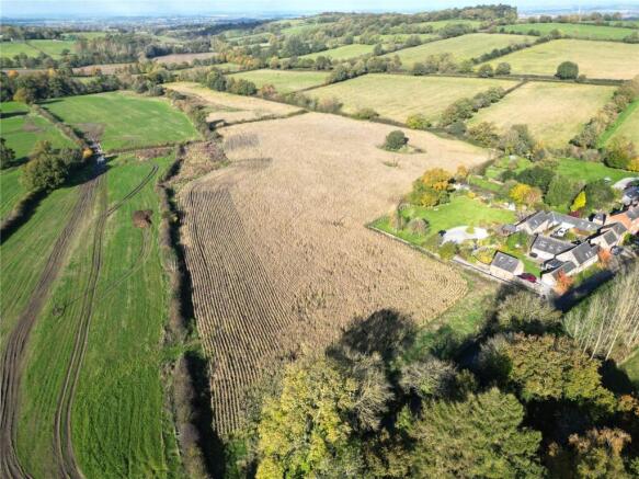
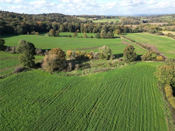
An exceptional opportunity to purchase a ring-fenced block of arable land (subject to a tenancy), available as a whole or in five lots, set in the picturesque Charnwood Forest extending to approximately 69.61 acres (28.17 hectares).
Location
Charley is situated amongst open countryside in the Heart of Charnwood Forest. Bordering Ulverscroft, the area is particularly well placed for fast access to the M1 at Markfield with excellent local schooling available at nearby Endowed Schools at Loughborough. Nearby Oaks in Charnwood is well know for Mount St Bernards Monastery.
Postcode – LE67 4UE
What3Words –The what3Words location for the access to each lot is detailed below:
Lot 1 – ///incomes.gestures.household
Lot 2 – ///origins.sinkhole.beak
Lot 3 - ///reserves.footballers.clutter
Lot 4 – ///adverbs.less.supplied
Lot 5 – ///learning.fishery.infringe
Description
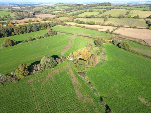
The 69.61 acres (28.17 hectares) of arable land is classified Grade III according to the Agricultural Land Classification Plans of England and Wales. The soil type is of the Claverley soil association which is described as fine reddish coarse and fine loamy soils. The productive land which is currently subject to a Tenancy has previously been used for agricultural grazing and arable cropping but being set within the picturesque Charnwood Forest and with lots Three and Four having direct access onto Charley Road, the Land lends itself to a range of agricultural and non-agricultural amenity uses, subject to the relevant permissions. The land is available as a whole or in five lots. Lot 1 (shaded red on the enclosed plan) – Approximately 38.60 acres (15.62 hectares) of arable land, currently cropped with temporary grassland, divided into six field parcels and bordered by internal and boundary dry stone walls, with Cat Hill Wood of Charley Woods Nature Reserve as a scenic (truncated)
Method of Sale
The Land is for sale by Private Treaty with the following guide price: Lot 1 – £450,000.00 Lot 2 – £185,000.00 Lot 3 - £130,000.00 Lot 4 – £80,000.00 Lot 5 – £15,000.00 Guide Price as a whole £860,000
Services
The Land does not benefit from any mains services however, a mains water and electricity connection would be available within the vicinity.
Land Registry Title Number
The Land is registered under title number LT280844.
De-Linked Payments & Environmental Stewardship
No de-linked payments will be made available to a successful purchaser. The Land is entered into a Mid-Tier Countryside Stewardship Agreement which commenced on the 1st of January 2024 and includes maize and hedgerow management options.
Wayleaves, Easements & Rights of Way
The Land is sold subject to and with the benefit of all rights, including rights of way whether public or private and all Easements and Wayleaves whether specifically mentioned or not. Lots One and Two are accessed via a Right of Access down the main driveway off Charley Road.
Tenure & Possession
The Land is sold Freehold, and subject to an implied Farm Business Tenancy Agreement where a Notice to Quit has been served to provide vacant possession in March 2026. Further information on the Tenancy is available from the Vendors Agents upon request.
Sporting, Timber & Mineral Rights
All Sporting and Timber, Mines and Mineral rights are included in the Freehold sale so far as they are owned.
Viewing
At any reasonable time with these Sales Particulars in hand via prior appointment and permission to be given by the selling Agent. Please contact Lucy Morgan on or email .
Local Authority
Lots One and Two are within North West Leicestershire District Council PO Box 11051 Coalville LE67 0FW Tel: Email: customer. Lots Three, Four and Five are within Charnwood Borough Council Southfield Road Loughborough LE11 2TX Tel:
Brochures
ParticularsOff Charley Road, Charley, Loughborough

NEAREST STATIONS
Distances are straight line measurements from the centre of the postcode- Loughborough Station4.8 miles

About Bentons, Melton Mowbray
47 Nottingham Street Melton Mowbray Leicestershire, LE13 1NN
Notes
Disclaimer - Property reference BNT241057. The information displayed about this property comprises a property advertisement. Rightmove.co.uk makes no warranty as to the accuracy or completeness of the advertisement or any linked or associated information, and Rightmove has no control over the content. This property advertisement does not constitute property particulars. The information is provided and maintained by Bentons, Melton Mowbray. Please contact the selling agent or developer directly to obtain any information which may be available under the terms of The Energy Performance of Buildings (Certificates and Inspections) (England and Wales) Regulations 2007 or the Home Report if in relation to a residential property in Scotland.
Map data ©OpenStreetMap contributors.