Land For Sale in South East, England
Paid partnerships can play a role in listing order
 1/7
1/7


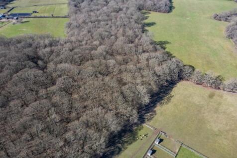
1.297-acre freehold land in Warlingham, Surrey. Strategic investment with wide-ranging potential. Guide price £30,000. Auction sale.

- Prime 1.297-acre (5,252 sqm) freehold land parcel in Warlingham, Surrey, with clear title and defined boundaries.
- Attractive guide price of £30,000, offering accessible entry for investors and land bankers.
- Located within the Metropolitan Green Belt, preserving long-term hope value for future planning changes.
 1/8
1/8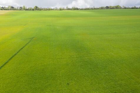
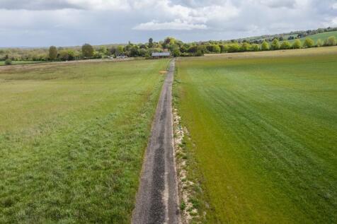
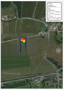
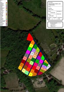
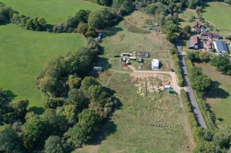
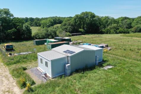
Greenbelt agricultural land. Available for agricultural use or a variety of other uses subject to the necessary consent.£5000 for 100 m2£7,000 for 200 m2£9,000 for 300 m2£10,000 for 400 m2Suitable for a variety of uses subject to the necessary consents.


 1/5
1/5


AN OPPORTUNITY TO ACQUIRE A RESIDENTIAL DEVELOPMENT SITE WITH OUTLINE PLANNING PERMISSION FOR UP TO 65 DWELLINGS ON THE EDGE OF THE POPULAR VILLAGE OF STOKENCHURCH, BUCKINGHAMSHIRE LOCATION The property is located to the south-eastern built edge of the settlement of Stokenchurch, a village and civil parish within the unitary authority of Buckinghamshire Council. Stokenchurch is strategically positioned adjacent to the M40, joining Oxford to London and located approximately 7-miles west of High Wycombe and approximately 17-miles southeast of Oxford. Oxford is a regional city hub providing an extensive range of services and facilities including shops, restaurants, banks, sports centre, retail parks and supermarkets. Facilities in Stokenchurch include a Tesco Express store, a primary school, a community centre with sporting facilities, public house, coffee shop and post office. PROPERTY The property extends to approximately 9.09 acres (3.68 hectares) of arable farmland, largely enclosed by mature hedgerows and scattered boundary trees. It adjoins residential garden boundaries to the north-west, with existing barns at Mill House, to the north projecting into the field. A wooded bank separates the property from the M40 to the north. A connection from the development scheme will provide access to the National Highways' footpath and cycle path via the existing footbridge over the M40, providing pedestrian access into the village. To the south, beyond an established hedgerow,...









 1/12
1/12


The site is of irregular shape and relatively flat. It is bound to the perimeter by fencing and vegetation. Historically, The Hollies was occupied as an outpatient facility by the Southern Health NHS Foundation Trust as a part of the adjacent Parklands Hospital. It was acquired by Homes England in 2018 which has subsequently demolished buildings and associated foundations to a depth of 3m with excavations backfilled and a small area of hard standing also remaining. Services are understood to have been isolated to the boundary of the site. Currently access to the site is from Aldermaston Road to the east.
1/12


An exceptional opportunity to acquire a prominent and strategically positioned development parcel fronting Lower Chase Road, offering significant potential for residential-led development (STPP). The site benefits from direct frontage and the ability to reinstate a secondary access from Lower Chase Road, with an established track running alongside the boundary providing vehicular access into the rear fields. The front 3.69 acre section of the site benefits from extant planning permission for a care home, demonstrating the site's suitability for development. The surrounding area is experiencing continued residential growth. Land immediately adjoining the western boundary is currently under consultation for a proposed scheme of 77 new dwellings. This further reinforces the site's position within an expanding residential setting.
 1/5
1/5


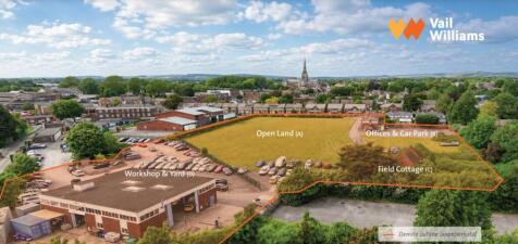
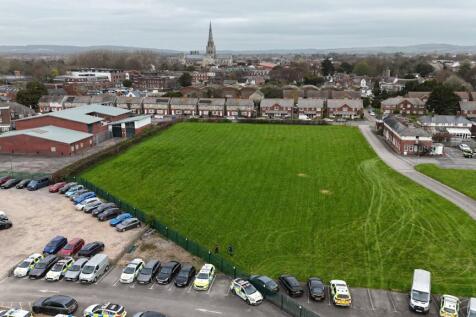
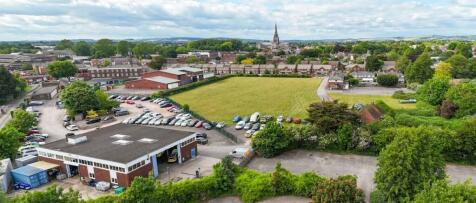
PROPERTY HIGHLIGHTS The Property forms Phase 1 of the Didcot Gateway Regeneration project and comprises three development parcels totalling approximately 0.85 hectares (2.1 acres) Prominent location addressing entrance to Didcot Parkway railway station and transport hub. Subject to an Outline Planning Application (ref: P22/S0491/O) for up to 144 Dwellings. Flexibility for a variation of the building heights and mix within the application parameter plans. The Property is offered for sale Freehold with vacant possession. The existing Licence with UKPC to operate part of the Property for car parking will be terminated ahead of Contract Completion. Homes England are seeking offers on a Conditional (Subject to Planning) basis. Communications are excellent with the A34(T) linking the M4 and M40 motorways 6 miles away, and Didcot Parkway railway station with regular main line services to London Paddington and Bristol 8 miles away. SITE LOCATION Didcot is located approximately 15 miles south of Oxford and 15 miles northwest of Reading. It is well connected to the national highway network with the A4130 connecting the town with Milton interchange of the A34 to the west (3 miles) and Henley on Thames to the east (19 miles). In turn the A34 links to M4 Junction 13 to the south and M40 Junction 9 in the north. Didcot Parkway railway station provides high frequency rail links to London, Reading, Bristol and Oxford. London Paddington is within 1hr travel time. In...


 1/2
1/2

The subject site forms part of a regeneration plan for a mixed-use development, with the majority of the consented 1,260 dwellings (out of a potential 1,460 dwelling masterplan) built and occupied with works continuing on site, up to 13,000 sqm of B1 employment floorspace (including- 3,000 sqm Enterprise Centre), up to 3,500 sqm of Class A local facilities, a 100 bed hotel, 60 bed care home, a new 2 Form Entry primary school, community centre, youth and leisure facilities and more.


 1/1
1/1
Land and/or ready to occupy completed units (Not yet built) suitable for a range of commercial uses within the south east section of a larger mixed use site currently being developed mostly for housing. Potential uses include retail, office, light industrial and Children's Nursery.


 1/7
1/7

Land benefitting from allocation for development for 15 residential units in Borough of Spelthorne. In total the relatively flat site extends to approximately 1.86 acres. Predominantly, it is set as open grassland with trees with vegetation to the northeast perimeter and to the west towards Coppermill Road along with a small grouping in the centre of the site. Presently, the site is occupied under licence for grazing.


 1/2
1/2

The subject site forms part of a regeneration plan for a mixed-use development, with the majority of the consented 1,260 dwellings (out of a potential 1,460 dwelling masterplan) built and occupied with works continuing on site, up to 13,000 sqm of B1 employment floorspace (including- 3,000 sqm Enterprise Centre), up to 3,500 sqm of Class A local facilities, a 100 bed hotel, 60 bed care home, a new 2 Form Entry primary school, community centre, youth and leisure facilities and more.
 |1/6
|1/6


Warwick Crescent is a residential area, just 8 mins walk from the heart of Portsmouth University, and 10 mins from the main student hub on Cambridge Rd. The proposed new development will present an attractive 4 storey building. Portsmouth is home to over 28,000 students with an additional 10,000 forecast by 2030. The City has a severe shortage of PBSA and the council has stated a desire for more to relieve pressure on the residential housing market, with the student to bed ratio currently 3:1, one of the 10 highest in the country.