Land For Sale in West Midlands
Paid partnerships can play a role in listing order

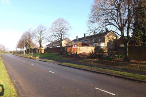

Building Plot with Full Planning Permission for a Detached Property We are pleased to offer this exciting opportunity to acquire a building plot with planning permission for the construction of a detached property. This is an ideal prospect for those looking to create a bespoke home in...
 1/3
1/3


Description: The property comprises a broadly rectangular shaped site of predominantly tarmac surface. The site is fully secure with gated access off Willenhall Lane. We understand all mains services are connected to the site. There is approximately 17,072 sq.ft. of accommodation on site which comprises a 2-storey office. There are also a number of external outbuildings/garages. Location: The property is located on the southern side of Willenhall Lane in Bloxwich. Bloxwich is situated approximately 2 miles west of Walsall. Willenhall Lane runs in an east to west direction from Green Lane (A34) the main arterial route leading northwards from Walsall Town Centre. Junction 10 of the M6 Motorway is approximately 2 miles south of the property.

- Includes ancillary offices and storage facility extending to approximately 17,072 sqft (1,586 sqm)
- Approx. 2 miles from Junction 10 of the M6 Motorway
- Anticipated vacant possession date End of March 2027
 |1/2
|1/2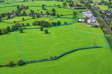

The land benefits from Outline Planning Consent under Planning Reference Number 24/02661/OUT for a hybrid planning application for outline permission for Class E (commercial, business and service).

- A development site with a Total Gross Site Area of approximately 5.54 hectares (13.69 acres)
- Suitable for commercial development or development for owner occupation
- Located on the edge of the town of Wem
1/4


COMMERCIAL/RESIDENTIAL DEVELOPMENT SITE IN HIGHLY PROMINENT LOCATION

- Freehold commercial/residential development site.
- Currently comprising 2 single-storey garages and forecourt parking.
- Attractive development opportunity having previously had planning granted for a 4-bed dwelling (Ref: 22/03073/FUL).
1/12


Freehold Residential Development Opportunity in West Bromwich.

- Freehold residential development site with planning permission.
- 0.587 acre site (0.237 hectares) with full planning permission.
- Consent for development of 32 apartments all conditions discharged.


 |1/4
|1/4


Planning permission has been obtained for the redevelopment of the existing site which extends for approximately 0.08 hectares with a four and five storey building to contain a retail unit on part of the ground floor with two flats also on the ground floor, together with a further 12 flats above. The decision document and associated plans / information are available via the Data Room on our website (subject to registration) or can be found on Dudley MBC planning website ( - planning application P18/0186).


 1/4
1/4


A rare opportunity to acquire a strategically located development site extending to approximately 0.8 hectares (2.00 acres), situated within the established Churnet Park commercial and retail area in Leek, Staffordshire. The site comprises predominantly vacant grassland with areas of mature vegetation and benefits from direct access via Abbey Green Road. Positioned adjacent to the existing McDonald's drive-thru and close to Sainsbury's and other commercial occupiers, the site occupies an accessible location within the Leek Development Boundary. The property benefits from a strong planning history, including previous outline consent and reserved matters approval for residential development, together with policy support for a range of potential future uses. The site may be suitable for: Residential development (subject to planning) Employment uses Commercial / business uses Light industrial or trade counter development The site is considered brownfield in nature and is located in an area identified for growth within the Staffordshire Moorlands Local Plan. Its proximity to existing employment uses, retail provision and residential neighbourhoods makes it an attractive opportunity for developers, investors and owner occupiers alike. Leek town centre lies within approximately 20 minutes' walking distance, with excellent road connections via the A523 to Stoke-on-Trent, Macclesfield and the wider region.



 1/3
1/3


The land comprises a greenfield site adjacent to the existing Esso petrol filling station, which includes a Spar as well as Greggs and Subway kiosks / concessions. Access to the subject site is currently though the existing PFS, off the main A road (A449). The site also benefits from a prominent roadside frontage of 250ft (76m).
 1/8
1/8
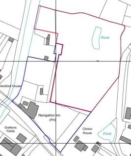
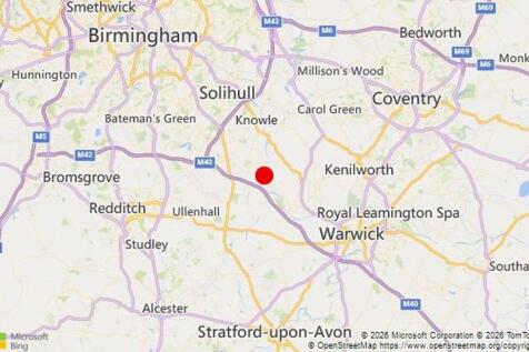
The site edged red on the above aerial photo, occupies a plot of circa 2.17 acres, with access reserved over the pub car park from the Old Warwick Road, B4439. For the avoidance of doubt, the Navigation Inn public house, car park and beer garden are not for sale. This area is outlined in blue on the site plan below.


 1/7
1/7


The total site comprises approximately 16.7 acres. The area currently in use is approximately 10.8 acres. The surfaced areas are a mix of concrete and compacted hardstanding. The remainder of the site is natural vegetation covered along the bank of the River Avon to the north and east sides of the boundary. The site is bounded mainly by steel palisade fencing.


 |1/27
|1/27


Land at Hemmingford House consists of 3 properties, known as The Annexe, Coach House and Wardens Dwelling, with wider amenity land. Offers a great opportunity to create new residential dwellings within the grounds of Hemmingford House. The Annexe - A two-storey property arranged as a 6-bed house-share with communal kitchen and bathroom. The Coach House - A two-storey property arranged as a 6-bed house-share with communal kitchen and bathroom The Wardens Dwelling - A two-storey property currently used as a 3-bed single-dwelling.
 1/1
1/1
The land forms part of a new urban extension currently under construction by Bloor Homes and Bovis Homes, which comprises approximately 800 new homes together with a new local centre, primary school and country park. The development also includes a new arterial relief road, Shottery West Relief Road, which has been constructed and work to connect the final section of road to the A46 has commenced and the Relief Road will be open to traffic in Summer 2026. The development is progressing well, with construction of the school set to begin in summer 2026. The land provides a level and serviced development site of approximately 0.508 hectares (1.25 acres) with consent for a single storey medical centre and pharmacy together with dedicated parking for up to 33 cars.
 1/5
1/5


Location: The site is located a short walk south from Evesham town centre. It is well placed for bus links from the surrounding areas and is only a few minutes away from the A46. The site is surrounded by established retail and residential properties. Evesham is located roughly equidistant between Worcester, Cheltenham and Stratford upon-Avon. It lies within the Vale of Evesham, an area comprising the flood plain of the River Avon, which has been renowned for market gardening. The town centre, situated within a meander of the river, has numerous amenities including shops, schools, sports clubs, leisure centres and restaurants. Description: The site comprises the Evesham College Campus, made up of the entire car parking provision for the college along with the entirety of the college buildings. The site is circa 8.09 acres (3.27 hectares). A scheme was previously designed to utilise a 4.15-acre site for 57 No 2 and 3 bed houses- see planning below for more information. We envisage a scheme between 75-90 units could be achieved on the larger site, however it is the developer's responsibility to undertake their own design and planning due diligence.
1/3


Location: The site is circa 1.3 acres and forms part of the land belonging to The Trustees of The Congregation of Priests of The Sacred Heart of Jesus of Betharram. It is located on the west side of the Worcester Road, Droitwich Spa in a predominantly residential area. The site is situated to the south of Droitwich town centre, approximately 1 mile from Droitwich Spa railway station, which provides regular services to Birmingham (under 1 hour to New Street Station) and Worcester (within 15 minutes). Local to numerous shops and supermarkets, the site is well placed to take advantage of local amenities. Within 0.6 miles of the site is The BMI Droitwich Spa Hospital and there are local amenities such as a Sainsbury's Local approximately 0.2 miles away. Near to the site are Chawson First School and Witton Middle School with the latter's playing fields immediately adjoining the site. Description: The development proposal shows a residential housing scheme for 9 units across circa 0.9 acres. The remainder of the site comprises a car park facility of up to 66 car parking spaces, totalling around 0.4 acres, which is to be delivered as part of the planning consent W/10/02571/PN. The car park is retained in the ownership of The Trustees of the Congregation of the Sacred Heart of Jesus of Betharram. The schedule of accommodation comprises 2 No. 3-bed semi-detached properties, 4 No. 4-bed link detached properties, 1 No 4-bed detached property (all with additional room in the...


 |1/1
|1/1
Future Development Potential (Subject To Planning) The site occupies a strategic location at the Weeford Interchange, which connects the A38 with the A5 and M6 approximately 4.7 miles (7.6 km) to the south of Lichfield and 3.4 miles (5.5km) east of Shenstone. The A5 is one of the Midlands’ most important east-west transport corridor linking Lichfield with the West Midlands, North Wales and London.






 |1/24
|1/24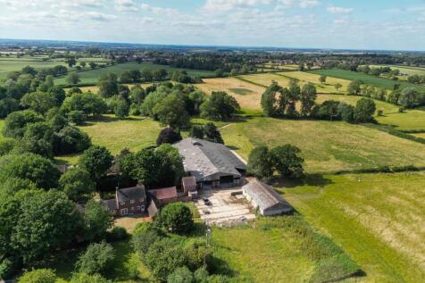
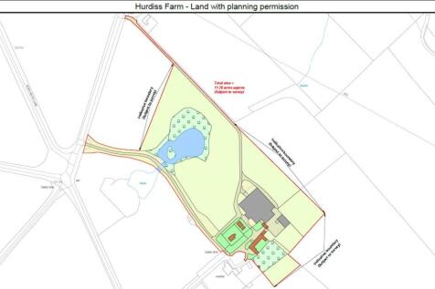
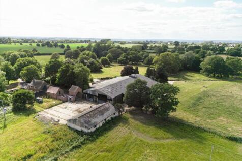
Lot 2 - Planning consent for extension of existing cottages and conversion of farm buildings to provide 15 dwellings (1979.89 sq m/21312 sq ft) on rural estate, paddocks and woodland. About 12 acres. Being sold in conjunction with Lot 1, a detached farmhouse in mature parkland with garden, paddo...
|1/27


A Unique Opportunity to Acquire Four Blocks of Arable Land Extending to Approximately 238 Acres (96 Ha) plus a Courtyard of Agricultural Buildings Set in 3.30 Acres (1.33Ha) in a Sought-After Location in The Worcestershire Countryside. Available as a Whole or in Five Lots.