Commercial Properties For Sale in Worcestershire
Paid partnerships can play a role in listing order

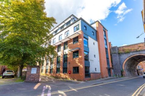
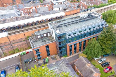
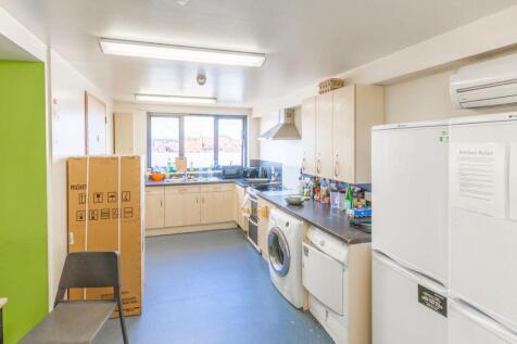
Freehold city centre student investment opportunity currently producing an annual rental income of £318,360 per annum ( with potential to increase to £510,300 per annum).The property comprises 83 spacious en-suite bed spaces, a 1-bedroom ex warden flat and shared open plan kitchen an...

 1/6
1/6


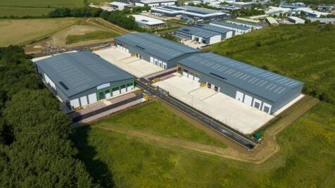
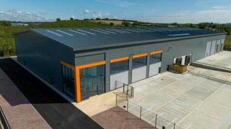
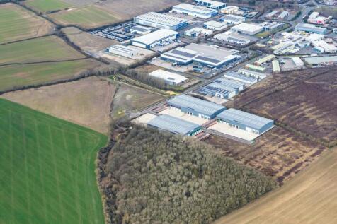
Location: The property is situated on the Berry Hill Industrial Estate, with a frontage to the A442 Droitwich to Kidderminster Road. Droitwich Town Centre is approximately 1 ½ miles to the South of the property. Communication links are good with Junction 5 of the M5 Motorway being approximately 3 miles distant via the A38 Bromsgrove to Worcester Road. Description: Unit 1: The property is newly refurbished with a two-bay steel portal frame warehouse featuring part brick/ clad elevations, a 4.3m eaves height, and a new profile clad roof with LED lighting. Access is via a side roller shutter door and a rear dock level loading door. The front office block, partially single and two-storey, includes a canteen, WCs, meeting rooms, and open-plan offices, all with suspended ceilings, CAT II lighting, central heating, and carpeting. The site also offers two vehicular access points and surfaced car parking and yard areas. Potential to combine with: Unit 2A: The property features a two-bay steel portal frame warehouse with part brick and part clad elevations, a 5m eaves height, and heating via suspended gas-fired blowers. Access is provided by a level access roller shutter door. The site includes a secure, surfaced car parking and yard area with two vehicular access points. The front office block, partly single and two-storey, offers a canteen, WCs, meeting rooms, and open-plan offices with suspended ceilings, CAT II lighting, central heating, and carpeting.

- G7208
- 59,135 sqft (5,493 sqm) GIA approx. with potential to combine with Unit 2A (11,611 sqft) totalling 70,746 sqft
- New profile clad roof


 1/5
1/5


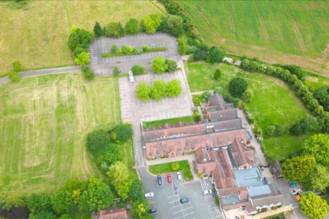
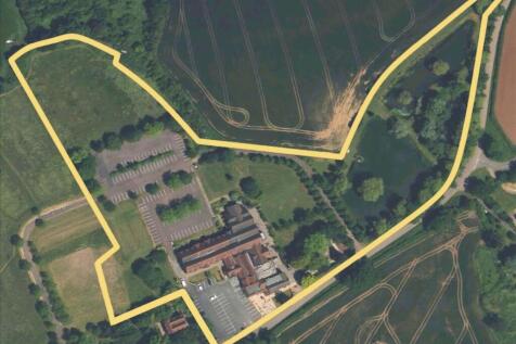
Description: The property comprises a brick-built three-storey office with car parking to the front. The main ground floor access is from the car park. An entrance area is provided, leading to a mainly open plan office. A staircase is also provided from the entrance area leading to the first and second floors. The first floor provides further open plan accommodation, and the second floor provides cellular accommodation. The property has suspended ceilings with recessed lighting to the ground and first floor with strip lighting to the second floor. Carpet tiles and electric heat pumps are provided throughout. Kitchenette and W.C facilities are provided on each floor. Externally, a block paved private car park is provided directly to the front and side of the property. 7 car parking spaces are provided. Location: The property forms part of the Sugarbrook Court office development on Aston Road, Bromsgrove, and is surrounded by other office developments, industrial estates, and local amenities. Bromsgrove Town Centre is approximately 2 miles North and benefits from both a train and bus station. Birmingham City Centre is approximately 16 miles North-East and Worcester City Centre is approximately 15 miles South-West both via the A38 and M5 Motorway. The A38 is accessed a short distant from Aston Road; M5 access is provided nearby at both Junctions 4 and 5.
- Well Established Business Area
- Self-Contained
- Car Parking




 1/4
1/4


Overview A rare opportunity to acquire a long-established specialist bridal boutique in Worcestershire, with approximately 25 years of continuous trading behind it. The business has built a strong local reputation for delivering a personal, appointment-led service to brides, and benefits from an established customer base, recognised goodwill and a straightforward owner-operated structure that keeps overheads manageable and operations simple. The business is particularly well suited to a hands-
 1/10
1/10


Large plot of land in stunning and affluent location offering potential for multiple uses and for immediate use. FREEHOLD land. Peaceful location in rural Worcestershire offering amazing views of the countryside and an excellent base to explore the region. Amenity land in an extremely high demand location near Cothridge and Broadwas only miles from the historic city of Worcester. Perfect for lifestyle and recreation use. Good location and benefits from two entrance ,fenced main gates , from the main public road. Nearby runs river Teme offering excellent fishing- subject to permit. The land is offered without planning permission and any future development is subject to gaining necessary consents from the local authority. Braveheart Auctions can offer no advice and no guarantees on planning. Amazing location with views across the Malvern Hills. The Malvern Hills are a dramatic 10-mile ridge rising above the Severn Plain on the Herefordshire-Worcestershire border. Designated as a National Landscape, this Area of Outstanding Natural Beauty is famous for its panoramic views, pure spring water, rich literary history, and extensive trail network managed by the Malvern Hills Trust. Worcester is a city in central England's West Midlands region. By the River Severn, medieval Worcester Cathedral houses royal tombs, a crypt and cloisters. At The Commandery, a museum traces the building's evolution from the Middle Ages through England's Civil War to the 1950s. The timber-framed...





 1/3
1/3


The application site extends to approximately 16.62 acres (6.73 ha) and comprises a single, broadly rectangular parcel of arable farmland. The site is bounded by the B4082 to the south, a small number of residential properties to the west, and established native hedgerows, interspersed with mature trees, along the northern and eastern boundaries. To the southeast, the site is bounded by a drainage ditch and an area of Severn Trent Water hardstanding. Vehicular access is provided via an established agricultural entrance onto the B4082. There are no public rights of way crossing the site






 1/5
1/5


Worcester Six North Point has been designed with flexibility in mind. Ranging from a stand alone unit of 34,401 sqft to the smallest unit of 5,532 sqft in a terrace style layout, with the ability to combine two units to achieve 16,372 sqft for E(g)(iii), B2 & B8 uses. Set in a secure, managed and landscaped setting the site has excellent environmental credentials with ancient woodland and traditional floodplain meadows providing an excellent environment for the health and wellbeing of our occupiers workforce. Each unit will be designed and built to reflect sustainability and energy efficiency targeting an EPC 'A' rating. Unit 5A: 10m haunch height 2 Level access doors 2 dock doors 180kVA power load Security fenced service yard Tea-point/kitchenette facilities 50kN floor slab 6 EV charging spaces 34 car parking spaces 35m yard depth Air source heat recovery heat pumps Raised access floors 150mm void Units 5B-E: 8.5 - 9.4m haunch height 1 Level Access Door 30 - 45kVA Power Load Concrete floor mezzanine with edge barrier protection Security fenced service yard (Unit 5F) 30kN floor slab 3 EV charging spaces Designated car parking spaces to each unit plus 10 shared spaces Electric heaters to core areas 35m Yard depth (Unit 5F)
1/31


LOCATED IN WORCESTERSHIRE YE25 turnover in excess of £532,000 Family-run farm and gift shop, providing a range of goods including fresh produce, baked goods, dairy items, homeware, and local beers, wines, and spirits. Established relationships with local suppliers. Ideally positioned next ...



 1/6
1/6Location: The property is situated on the Berry Hill Industrial Estate, with a frontage to the A442 Droitwich to Kidderminster Road. Droitwich Town Centre is approximately 1 ½ miles to the South of the property. Communication links are good with Junction 5 of the M5 Motorway being approximately 3 miles distant via the A38 Bromsgrove to Worcester Road. Description: Unit 1: The property is newly refurbished with a two-bay steel portal frame warehouse featuring part brick/ clad elevations, a 4.3m eaves height, and a new profile clad roof with LED lighting. Access is via a side roller shutter door and a rear dock level loading door. The front office block, partially single and two-storey, includes a canteen, WCs, meeting rooms, and open-plan offices, all with suspended ceilings, CAT II lighting, central heating, and carpeting. The site also offers two vehicular access points and surfaced car parking and yard areas. Potential to combine with: Unit 2A: The property features a two-bay steel portal frame warehouse with part brick and part clad elevations, a 5m eaves height, and heating via suspended gas-fired blowers. Access is provided by a level access roller shutter door. The site includes a secure, surfaced car parking and yard area with two vehicular access points. The front office block, partly single and two-storey, offers a canteen, WCs, meeting rooms, and open-plan offices with suspended ceilings, CAT II lighting, central heating, and carpeting.
1/5


Specification: Planning consent has been granted for Plot 8B which enables the Developer to provide certainty on delivery. A building could be delivered within 9 months. The unit has been designed to a high specification, including 10% roof lights, fitted offices with raised floors and suspended ceilings. The unit will be sustainable with a target EPC rating of 'B' and the scheme has achieved a BREEAM communities rating. Location: Worcester Six provides an unrivalled opportunity across the West Midlands for new, sustainable buildings that will enable businesses to thrive in a world class location. When complete Worcester Six will provide 2.0m sqft of employment floor space in a unique business environment.
1/8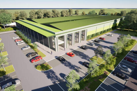
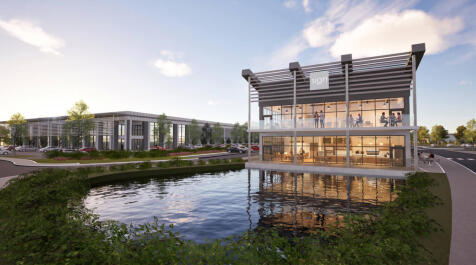
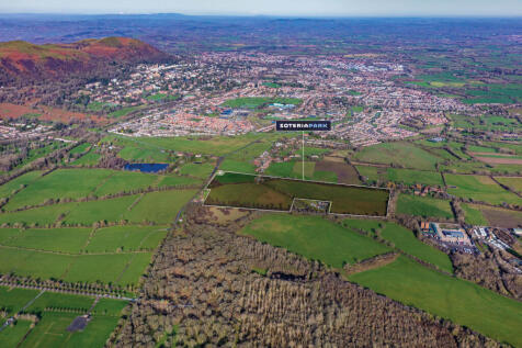
35 ACRE PRIME DEVELOPMENT FOR HIGH SPEC SECURE CAMPUS STYLE BUILDINGS Soteria Park, Malvern is destined to become one of the UK’s most innovative new build campus developments providing much needed facilities for high-tech manufacturing, R&D, cyber, industrial and logistics uses in the central de...


 1/2
1/2

The Land is generally flat and comprises approximately 17.5 acres of arable land bound by mature trees and hedgerows. It is currently accessed from the northwest corner through a single gate off Upper Wick Lane. The Land is included within the Adopted South Worcestershire Development Plan Review (South Worcestershire Development Plan Review 2021 - 2041 - South Worcestershire Development Plan) as a strategic allocation forming part of an 83.29-hectare site at Rushwick (SWDPR 56): Land within the strategic allocation at Rushwick will be developed to deliver approximately 1,000 new dwellings within the Plan period, provide at least 5 hectares of employment land, a new railway station, a new primary school, retail and supporting services and other community facilities. See page 188 of the South Worcestershire Development Plan Review for an indictive concept plan. The Vendor supported the proposed allocation throughout the development of the SWDPR, entering into a Statement of Common Ground on 12 February 2025 stating that it will work with the South Worcestershire Councils and the other landowners on delivering the proposed expansion of Rushwick. Any future landowner is expected to comply with the stated objectives of RES and work with the South Worcestershire Councils and third-party landowners.


 1/5
1/5


Build to suit units are available, tailored to your business needs, in a secure, managed and landscaped setting. Outline planning consent has been granted for over 2 million sqft of employment accommodation. Detailed planning consent has been granted for a 37,975 sqft standalone office building providing a flagship opportunity at the entrance to the scheme. Phase 1A and 1B access roads are now complete, with two secure entrances in to the development. Indicative building sizes are shown in green on the masterplan accommodation schedule, with bespoke development available on either a leasehold or freehold basis to suit.
1/7


Description: Covering an area of circa 1.1 acres, the site is generally level and set in open countryside. It is bounded immediately to the west and north by Stanford Court and the converted coach houses, to the east by the first phase of development and to the south by mature woodland and a lake. To the north, beyond the coach houses, there are open fields leading down to the B4023. Planning: "Plot 15" of the extant planning permission shows a detached property at over 8,000 sqft across two floors with five bedrooms, multiple reception rooms, an orangery, swimming pool, along with a large garage block. It is part of a wider scheme with implemented full planning permission for 15 dwellings. The remaining 14 properties have been constructed and are occupied. Details can be found with application number 13/01623/FUL on the Malvern Hills District Council planning pages. The planning history of the site and the extant planning permission would indicate that there is potential for redeveloping the vacant plot for an alternative form of development to increase the number of dwellings. An alternative feasibility layout has been produced on "Plot 15" to show three smaller properties at circa 3,000 sqft. The three properties would give an overall square footage similar to the plot currently having the benefit of permission. This coupled with an established principle of development would enable a case to be constructed. It would be up to the purchaser to have their own...
1/3


Greenfield land in an edge of settlement location, on the south side of Birmingham. The Land is relatively flat and is currently used for grazing. There is a public right of way which crosses in an easterly/westerly direction. Boundaries are well defined, with a mixture of trees and mature hedgerows. The Land extends to approximately 7.539 acres (3.05 hectares) as defined approximately by the red line boundary on these particulars for identification purposes only.