Building Plot adj Mirfield , Browns Drove, Swineshead, Boston, PE20

- PROPERTY TYPE
Land
- BEDROOMS
1
- BATHROOMS
1
- SIZE
Ask agent
Key features
- Self Build Building Plot
- Road Frontage and Field Views
- Edge Of Swineshead Village
- Semi-Rural Location
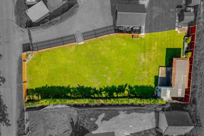
- 0.18 Acres (sts)
- Planning Ref - B/25/0062. Local Authority Boston Borough Council
Description
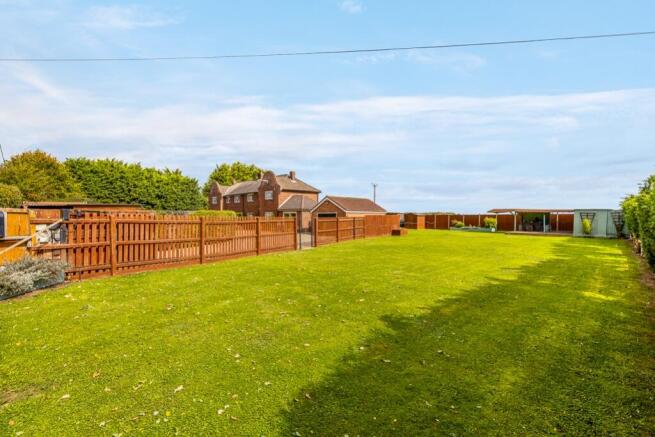
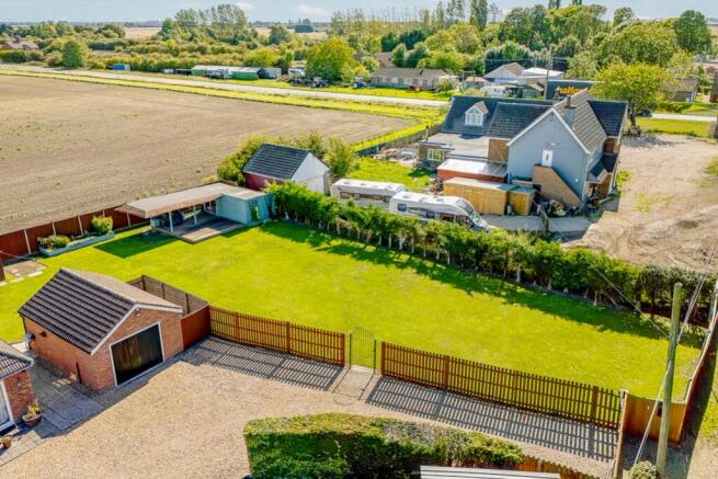
An individual self build plot located within a semi rural area with road frontage, generous grounds and a beautiful field views to the rear.
Outline planning has been granted for a detached self build dwelling in a fantastic location.
For more information regarding the planning conditions please visit the planning website - Reference - B/25/0062.
The total plot size is approximately 0.18 Acres (sts).
Agents Note:- Under the Community Infrastructure Levy regulations a custom and self build scheme is exempt from CIL where it is chargeable, and as such the CIL regulations expect the builder to occupy their home for three years after completion.
For more information, please contact the office on .
Building Plot adj Mirfield , Browns Drove, Swineshead, Boston, PE20

NEAREST STATIONS
Distances are straight line measurements from the centre of the postcode- Swineshead Station0.5 miles
- Hubberts Bridge Station3.2 miles
- Heckington Station4.5 miles
Notes
Disclaimer - Property reference 10357730. The information displayed about this property comprises a property advertisement. Rightmove.co.uk makes no warranty as to the accuracy or completeness of the advertisement or any linked or associated information, and Rightmove has no control over the content. This property advertisement does not constitute property particulars. The information is provided and maintained by Pygott & Crone, Boston. Please contact the selling agent or developer directly to obtain any information which may be available under the terms of The Energy Performance of Buildings (Certificates and Inspections) (England and Wales) Regulations 2007 or the Home Report if in relation to a residential property in Scotland.
Map data ©OpenStreetMap contributors.